Map of Bedford, Texas
Explore Bedford in the Dallas-Fort Worth area. Our map shows its highways, roads and parks. It’s part of the Mid-Cities region.
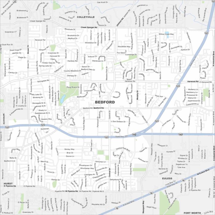
Explore Bedford in the Dallas-Fort Worth area. Our map shows its highways, roads and parks. It’s part of the Mid-Cities region.
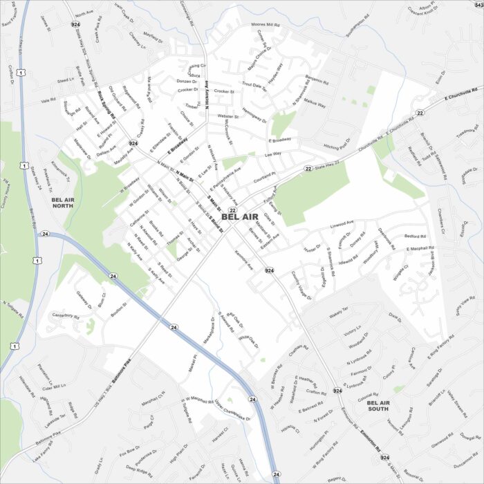
We’ve mapped out every major road in Bel Air. See the heart of Harford County with its historic downtown and nearby parks.
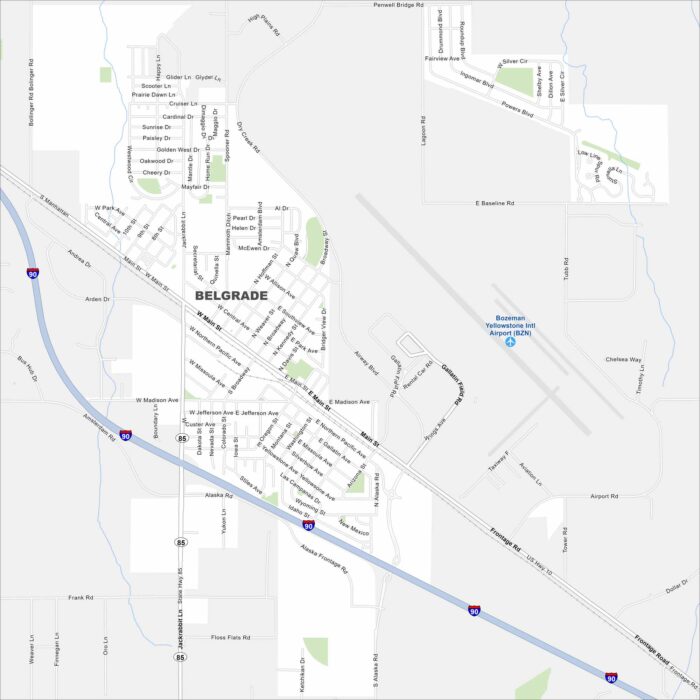
Belgrade is in southwest Montana near Bozeman. Our map highlights its roads, rivers, and parks. It’s part of the Gallatin Valley.
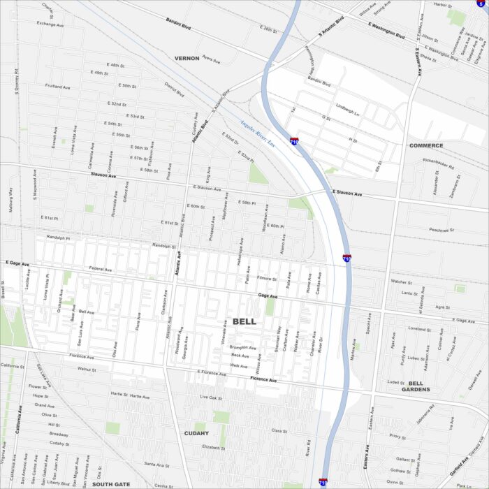
Bell is in southeast Los Angeles County along the Los Angeles River. Our map shows streets, local parks, and nearby freeways.
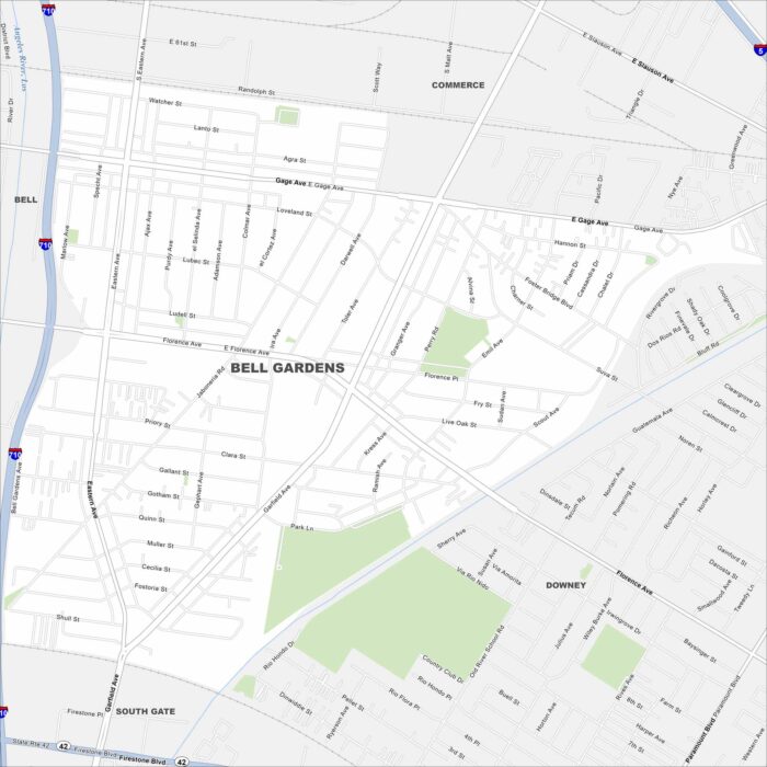
Explore Bell Gardens with our map. It’s located in the southeast of LA County. The city is compact, with a network of local streets.
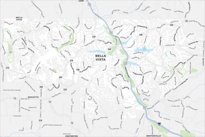
Our map of Bella Vista highlights winding roads, lakes, and wooded hills. The city sits in the Ozark region of northwest Arkansas.
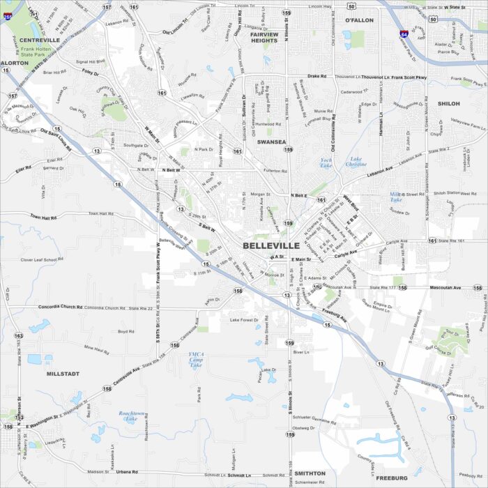
Our map of Belleville highlights the highways, streets, and park spaces. Roads link into the St. Louis area but the city stands on its own.
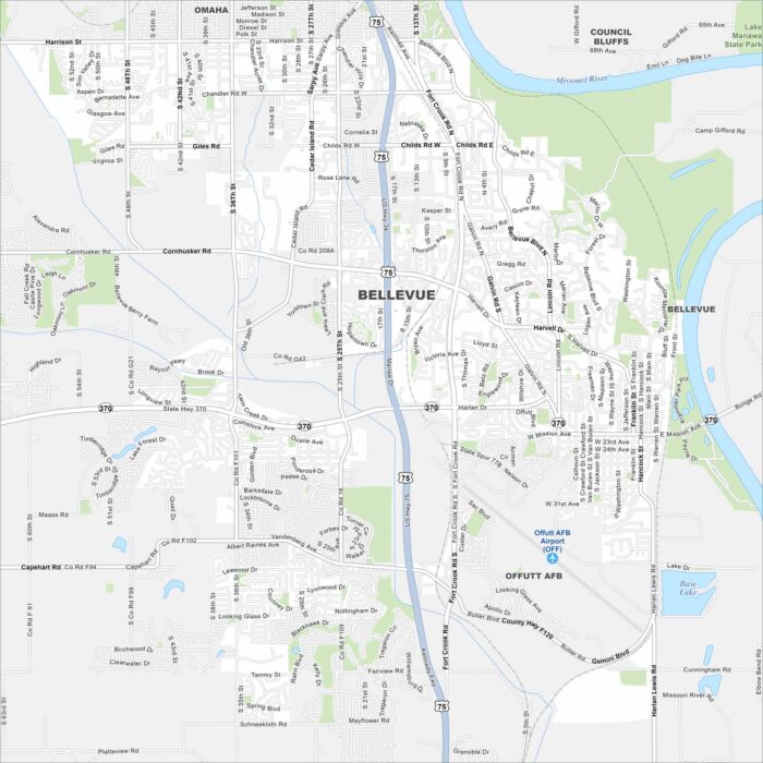
Our Bellevue map lays out roads, lakes, railways, and riverfront areas. Bellevue is just south of Omaha along the Missouri River.
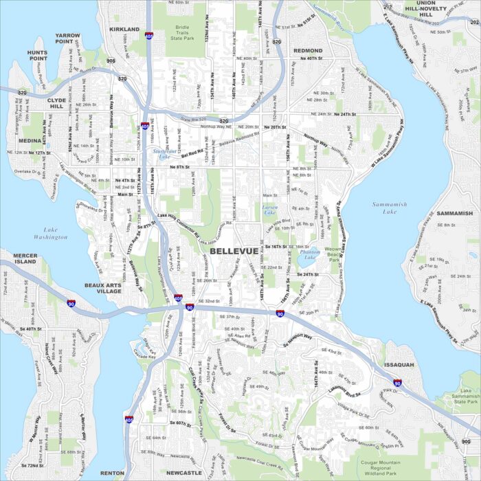
Our map of Bellevue shows highways, lakeshores, and urban streets. It sits east of Seattle, between Lake Washington and Lake Sammamish.
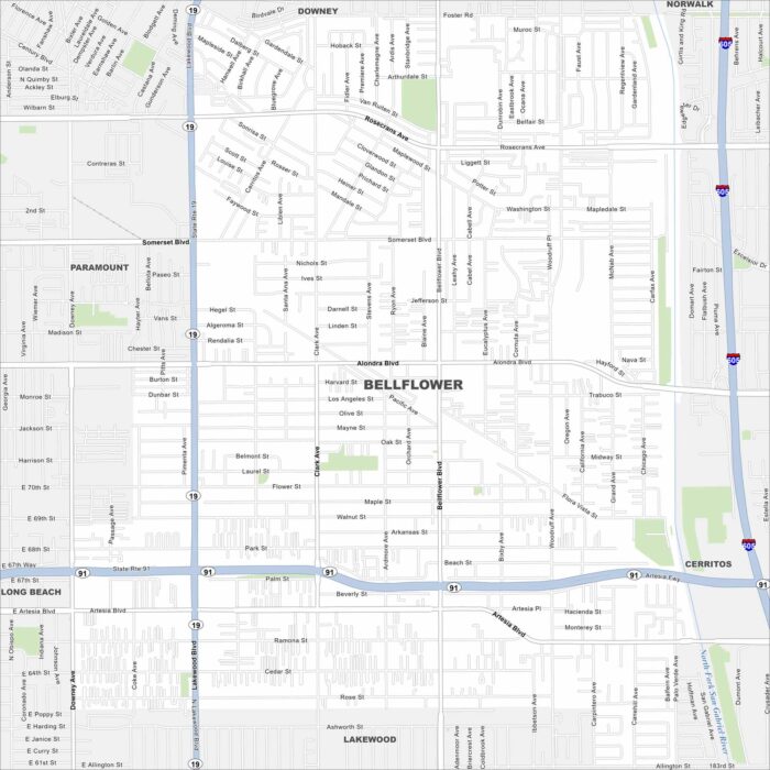
Looking for a map of Bellingham? This map features highways, roadways, and scattered parks. It’s a classic Southern California suburb.
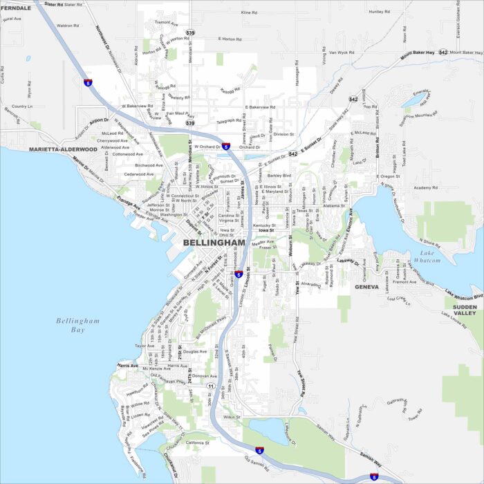
Explore Bellingham on our map at the edge of Bellingham Bay. The city spreads from the waterfront into the surrounding hills.
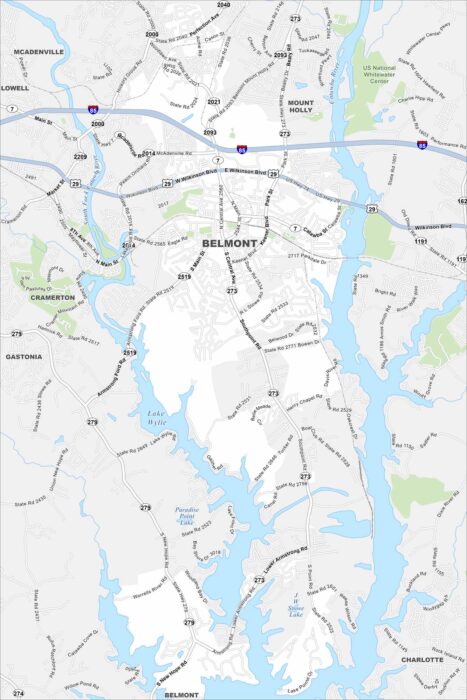
Our map of Belmont shows the Catawba River, local streets, and park areas. The city sits just west of Charlotte.
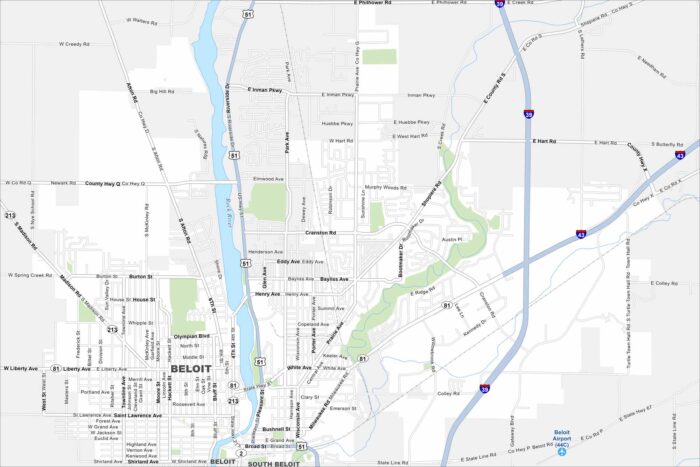
Here’s how to get around Bemidji with our city map. Beloit is on the southern border of Wisconsin along the Rock River.
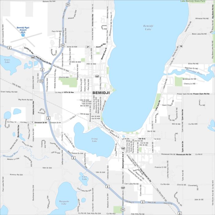
Bemidji is surrounded by lakes in northern Minnesota. Our map shows its roads, water bodies, and nearby forests.
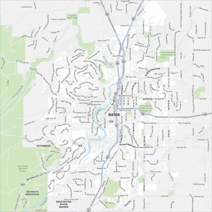
Check out Bend with our map in central Oregon. The Deschutes River, parks, and nearby mountains shape the layout.