Map of Owatonna, Minnesota
Check out Owatonna, situated along the Straight River. This map shows its downtown, parks, and surrounding farmland.
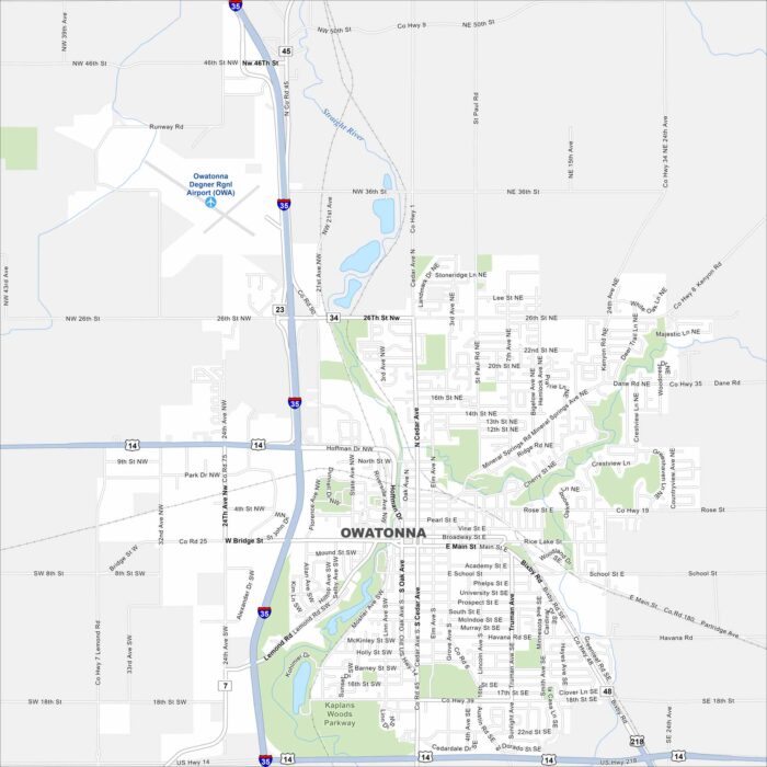
Check out Owatonna, situated along the Straight River. This map shows its downtown, parks, and surrounding farmland.
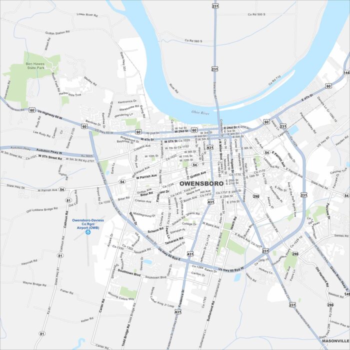
Owensboro sits on the Ohio River with a waterfront downtown. Our map highlights bridges, parks, and neighborhood streets.
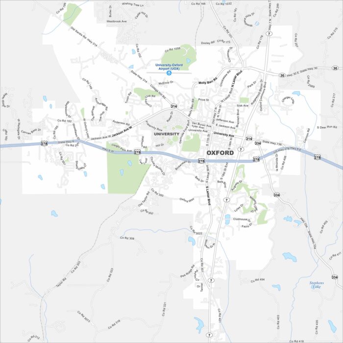
Oxford is home to the University of Mississippi. Take a look at the map to spot the central Square, neighborhoods and campus streets.
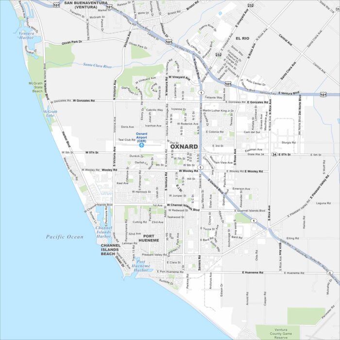
Our map of Oxnard shows a coastal city on the Pacific, west of Los Angeles. Beaches, marinas, and farmland shape its layout.
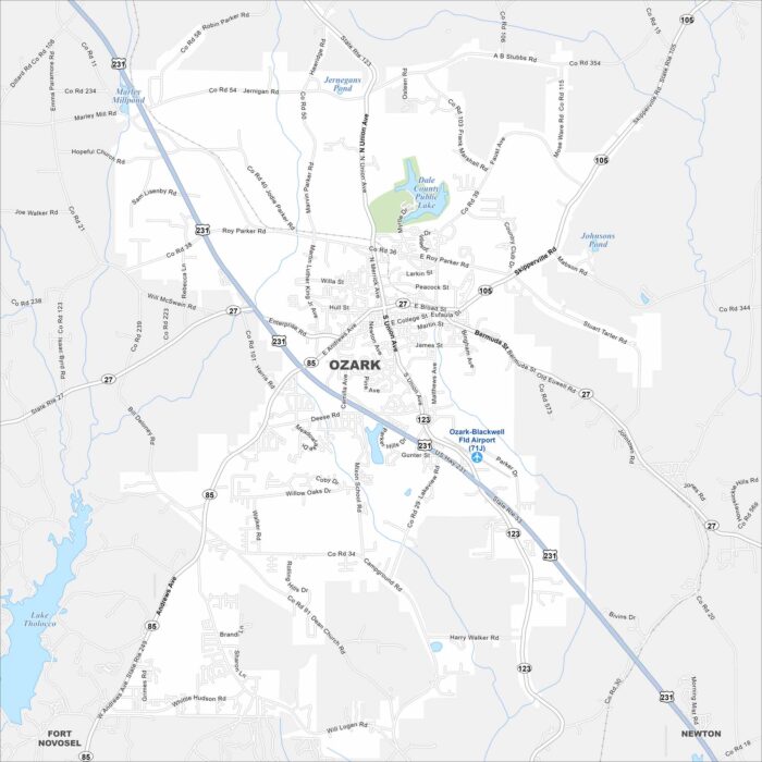
Our map of Ozark shows this city in southeastern Alabama near Fort Novosel. It serves as a gateway to the Wiregrass region.
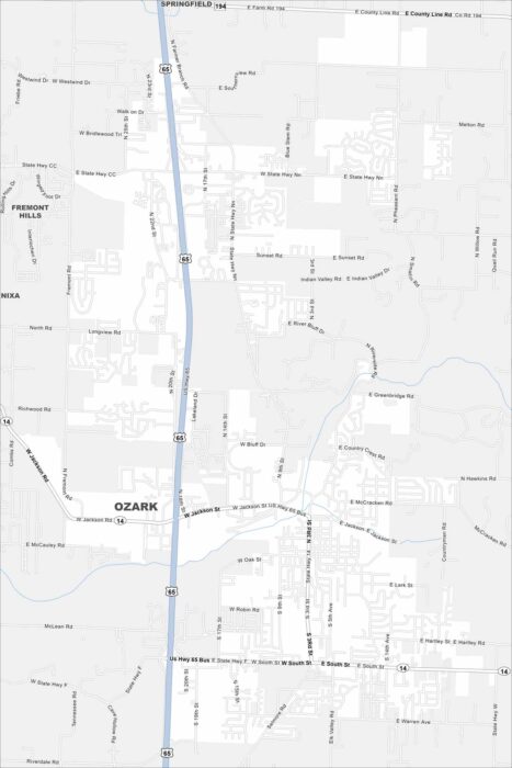
Our map of Ozark shows this city, located between Springfield and Branson. Suburban neighborhoods spread across rolling hills.
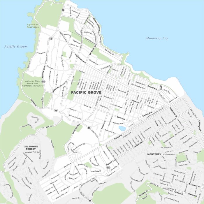
Check out our map of Pacific Grove. Pacific Grove sits on the Monterey Peninsula beside the Pacific Ocean.
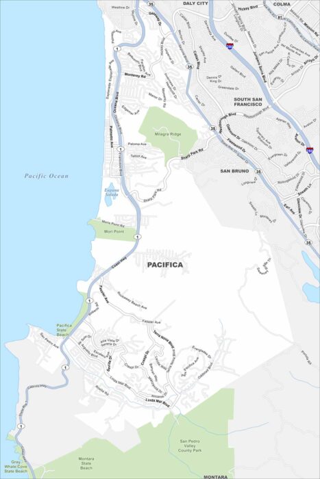
Take a look at Pacifica stretched along the cliffs and beaches south of San Francisco. The map highlights coastal neighborhoods.
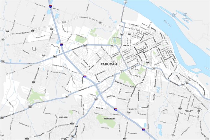
Paducah lies at the confluence of the Ohio and Tennessee Rivers. Our map shows its historic downtown, riverfront, and surrounding area.
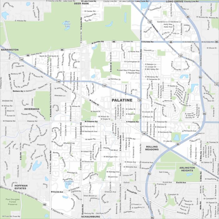
Get to know Palatine, northwest of Chicago. This map highlights its suburban grid, parks, lakes and waterways.
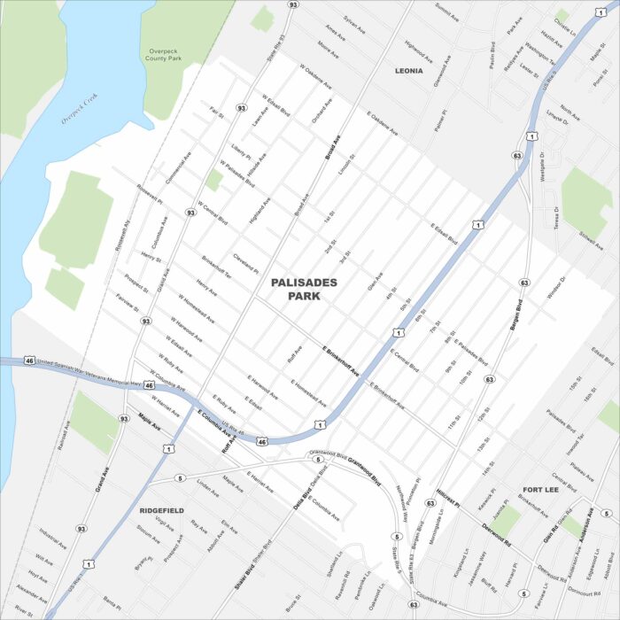
Our map of Palisades Park shows a compact borough just across the Hudson from Manhattan. Dense neighborhoods fill the grid of streets.
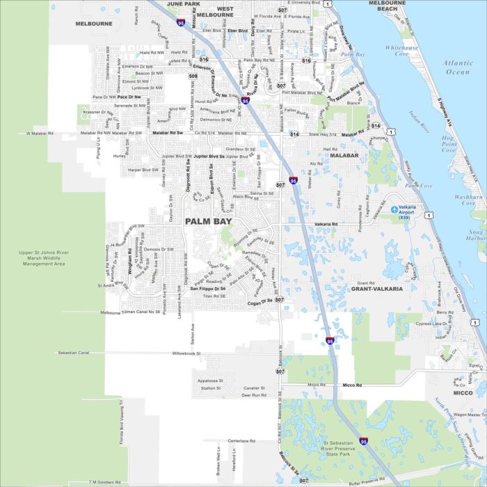
Palm Bay stretches along the Indian River Lagoon. Check out our map to see its wide suburban layout and nearby nature preserves.
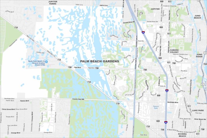
Our map of Palm Beach Gardens highlights its lakes and planned communities. The city sits just inland from the Atlantic coast.
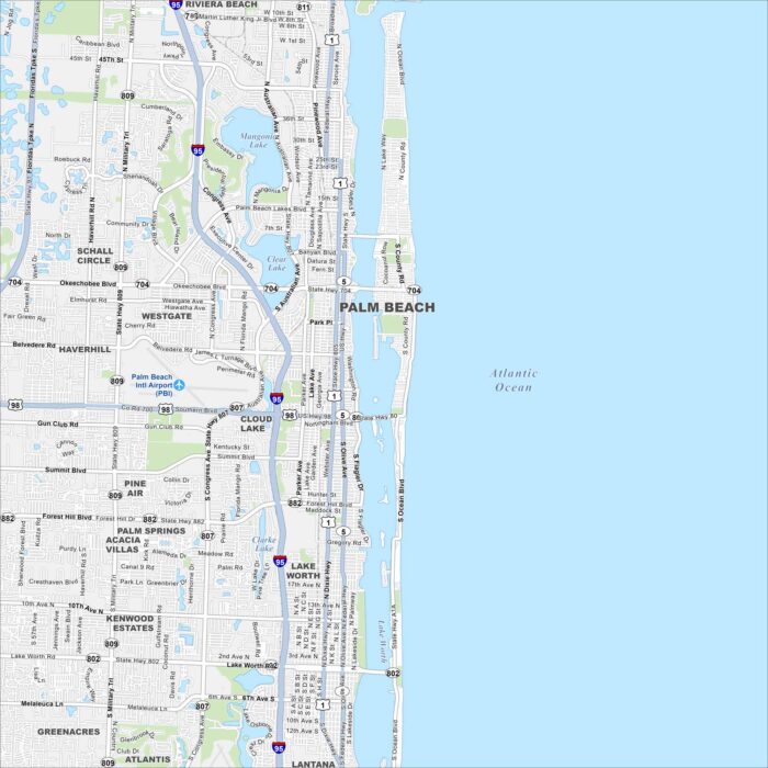
Palm Beach sits on a barrier island between the Intracoastal Waterway and the Atlantic. Use this map to see Worth Avenue and more.
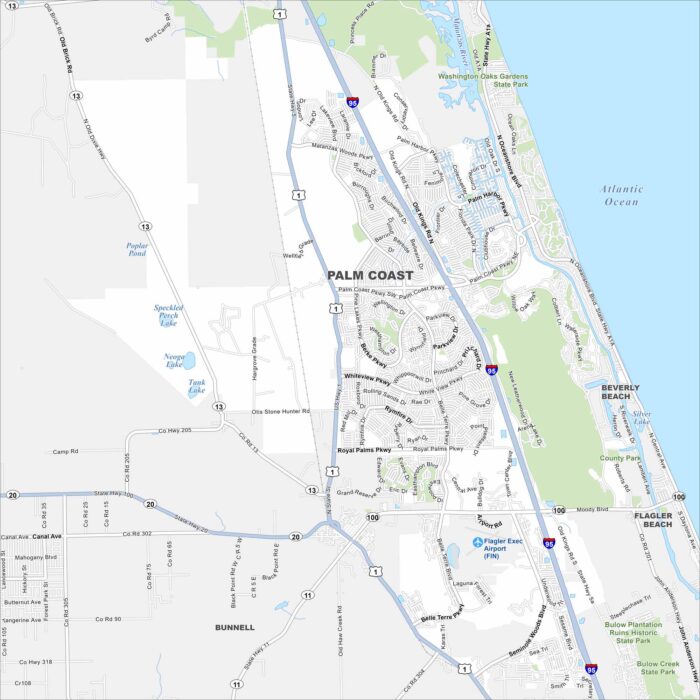
Palm Coast stretches between St. Augustine and Daytona Beach. Our map shows suburban neighborhoods set among canals and nature preserves.