Map of Liberty, Missouri
Liberty lies just northeast of Kansas City. The map shows its streets at the center. Surrounding it, neighborhoods fan outward.
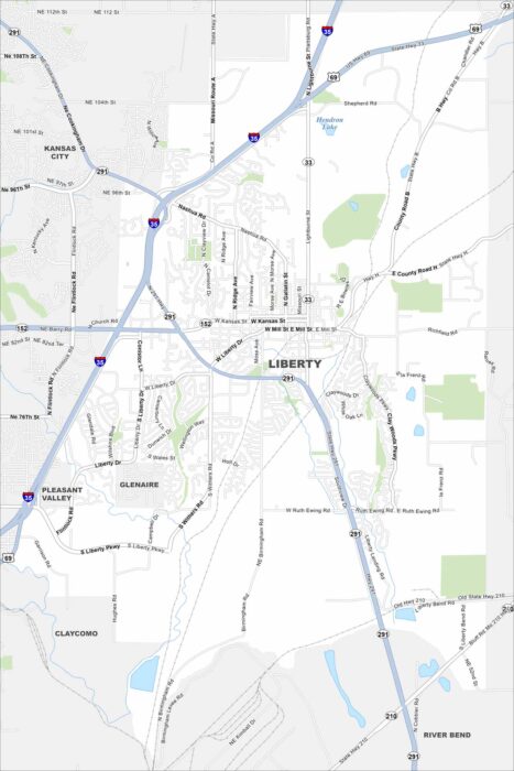
Liberty lies just northeast of Kansas City. The map shows its streets at the center. Surrounding it, neighborhoods fan outward.
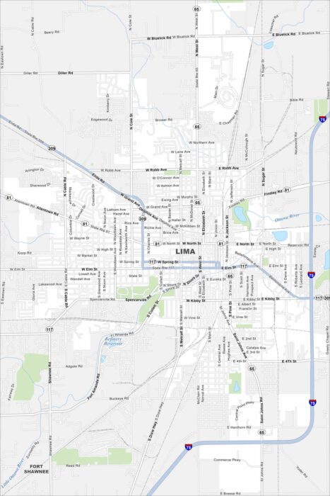
Our map of Lima places the city amid flat farmland in northwest Ohio. Highways and rail lines slice through the center.
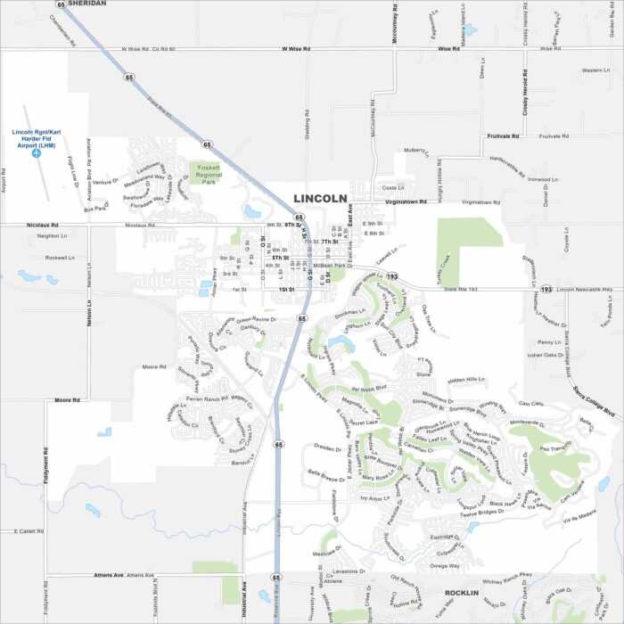
Lincoln shows up on the map at the edge of the Sierra Nevada foothills. The city blends new neighborhoods with older streets.
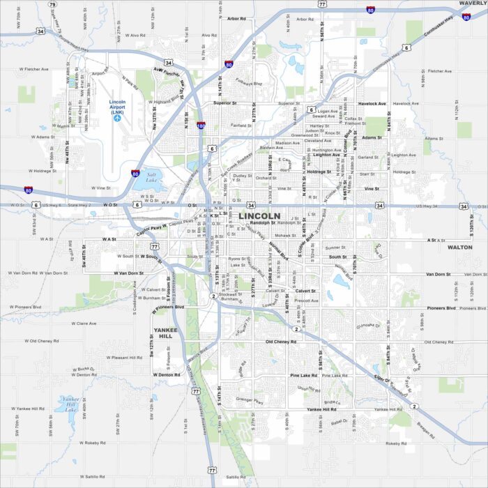
Here’s our map of Lincoln rising from the plains of eastern Nebraska. The state capitol dome anchors the downtown region.
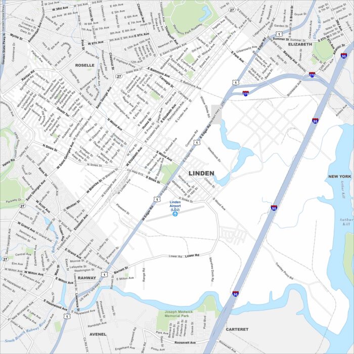
Our map of Linden highlights its mix of industry and neighborhoods. The city sits near Newark Bay with rail lines cutting across it.
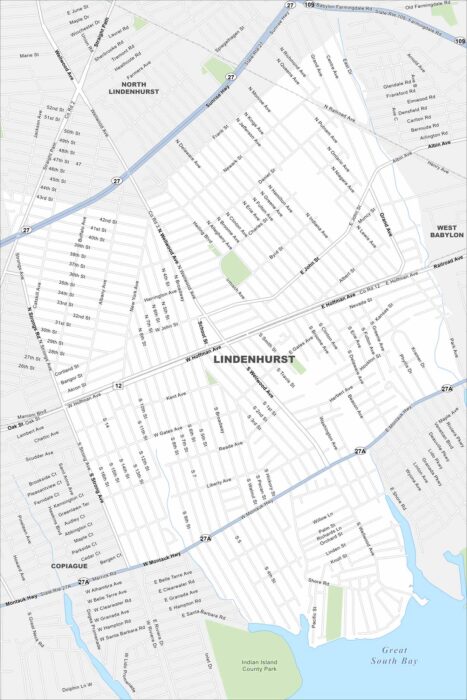
Our map of Lindenhurst places it on Long Island’s South Shore. Canals and waterways run through the village with parks scattered throughout.
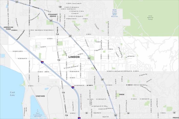
Lindon sits between Orem and Pleasant Grove in Utah Valley. Our map shows its highways and roads stretching toward Utah Lake.
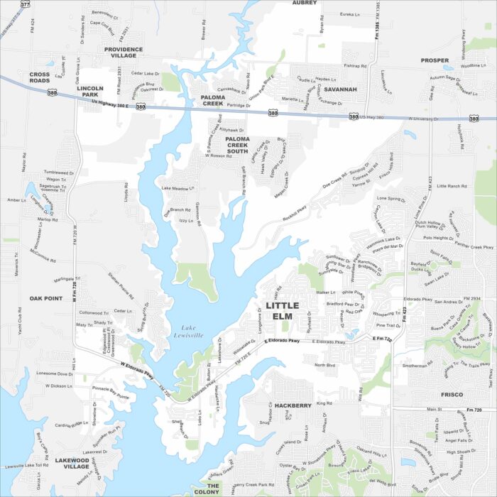
Check out Little Elm on the shores of Lewisville Lake. Our map highlights its growing neighborhoods along the water.
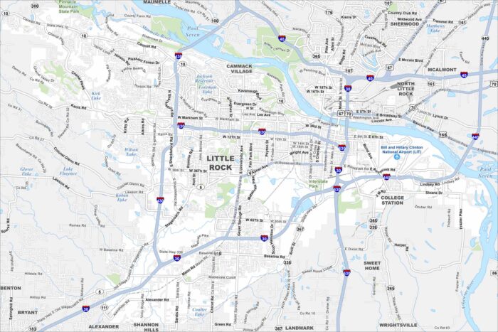
Our map of Little Rock shows the Arkansas River running through downtown. Interstates 30 and 40 cross near the city.
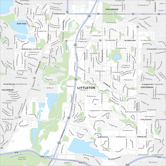
Littleton lies south of Denver along the South Platte River. Our map shows highways, railways, lakes and rivers.
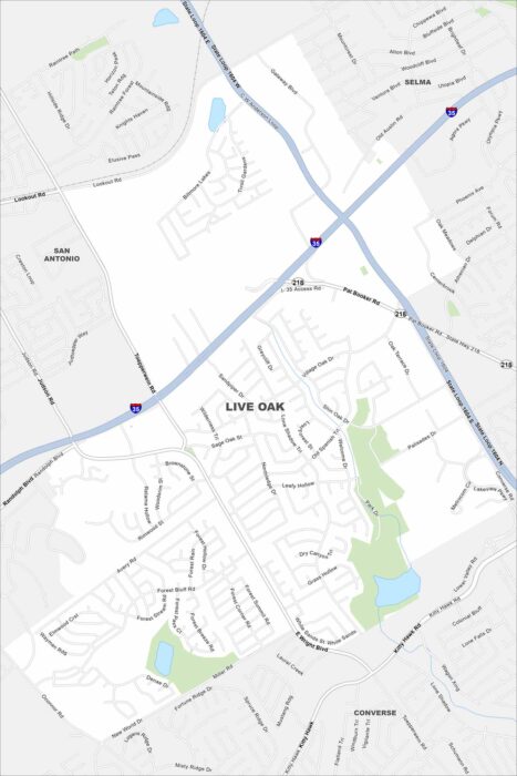
Explore Live Oak northeast of San Antonio in Texas. Our map shows I-35 and Loop 1604 meeting near the city.
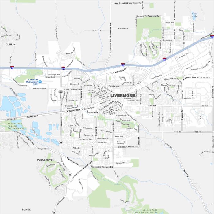
Our map of Livermore highlights its major routes and parks. Highways 580 and 84 connect it to the Bay Area.
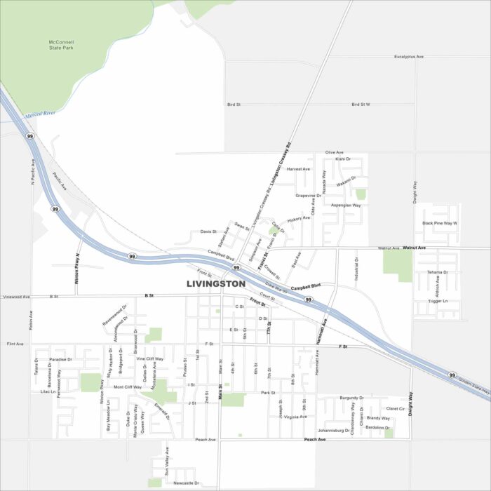
Livingston is set in the San Joaquin Valley in California. Our map shows Highway 99 cutting through town in a diagonal direction.
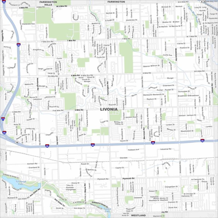
Our map of Livonia places it west of Detroit. Interstate 96 runs through the city. Neighborhoods and commercial areas fill its broad grid.
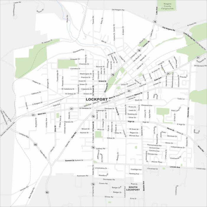
See Lockport, New York on our map along the man-made Erie Canal. Highways connect it to Buffalo and Niagara Falls.