Map of Laconia, New Hampshire
Laconia is located between Lake Winnipesaukee and Lake Winnisquam. Downtown streets cluster near the water.
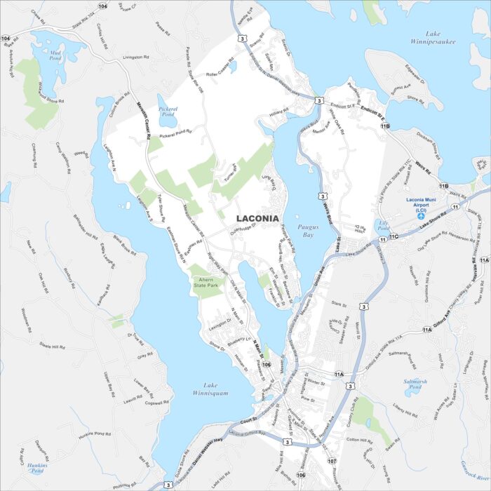
Laconia is located between Lake Winnipesaukee and Lake Winnisquam. Downtown streets cluster near the water.
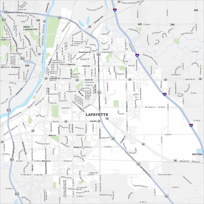
Our map of Lafayette shows the Wabash River cutting through downtown. Streets form a neat grid around the city.
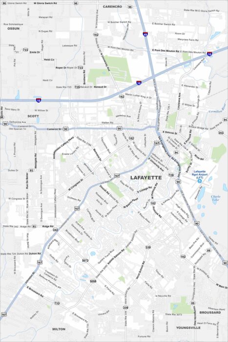
See Lafayette along the Vermilion River. Historic neighborhoods pop out on the map. Interstates connect the city to Baton Rouge.
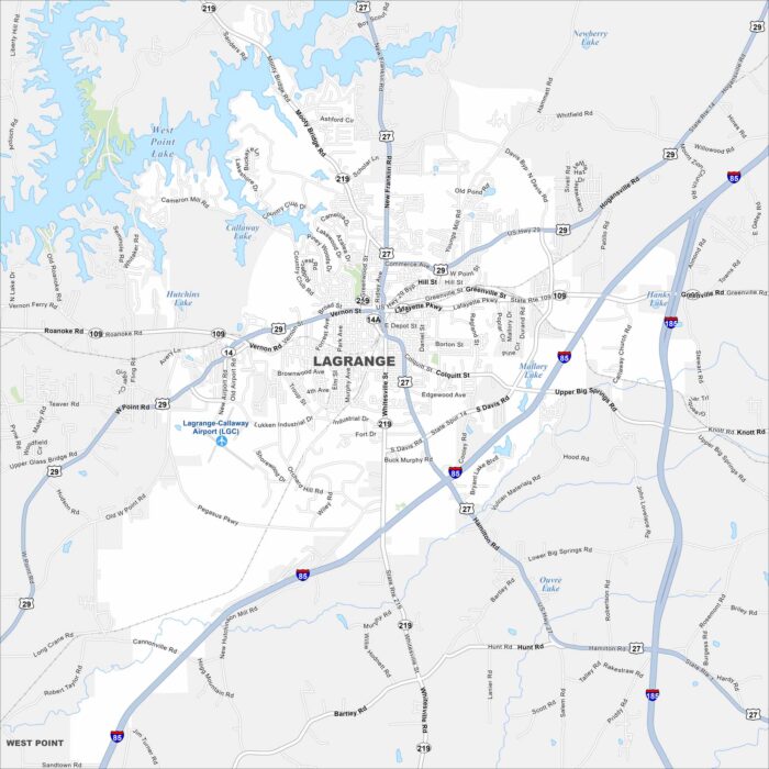
LaGrange is west of Atlanta, Georgia. West Point Lake spreads along the city’s western edge. The downtown square stands out at the center.
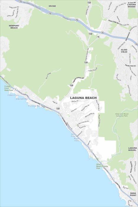
Our map of Laguna Beach follows the coastline of the Pacific Ocean. Canyons carve through the city and beaches line the oceanfront.
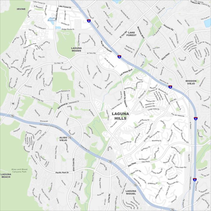
Our Laguna Hills map shows rolling hills combined with neighborhoods. Freeways frame the edges, linking it to Irvine and Mission Viejo.
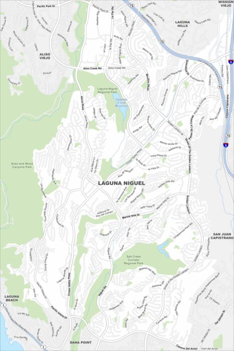
Laguna Niguel spreads out along curving canyon roads. This map highlights its open space reserves and trails.
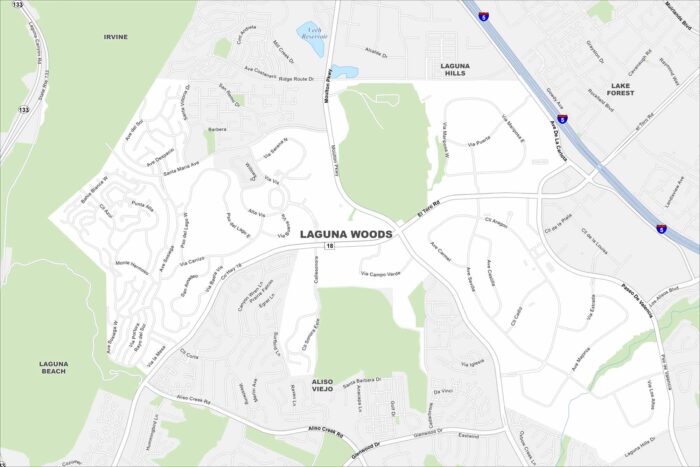
The city of Laguna Woods, California appears compact on the map. Highways surround it on nearly every side.
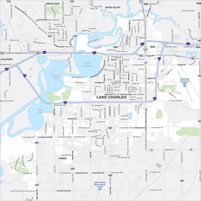
Our map of Lake Charles with highways, rivers and parks. Lake Charles dominates the map’s center. The Calcasieu River runs into the lake.
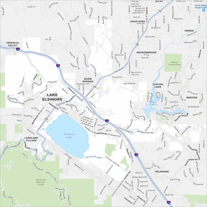
Our map highlights the massive natural lake at the heart of the city. While freeways skirt its western edge, hills rise just beyond town.
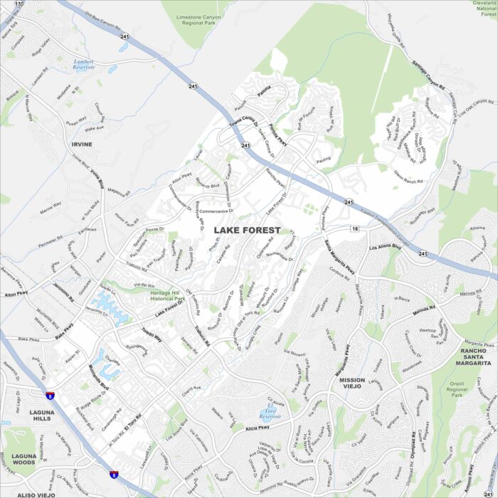
Our map of Lake Forest shows its highways and roads connecting everything. Neighborhoods wind around forested parks and man-made lakes.
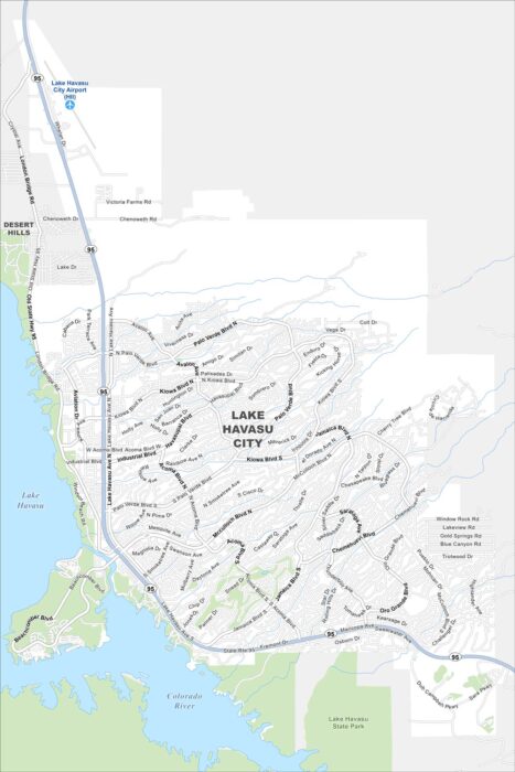
Lake Havasu spreads blue across the map on the western side of our map. The London Bridge marks the city’s centerpiece.

This map shows a curving street layout designed like a “tree”. While waterways flow through town, highways connect it to the Gulf Coast.
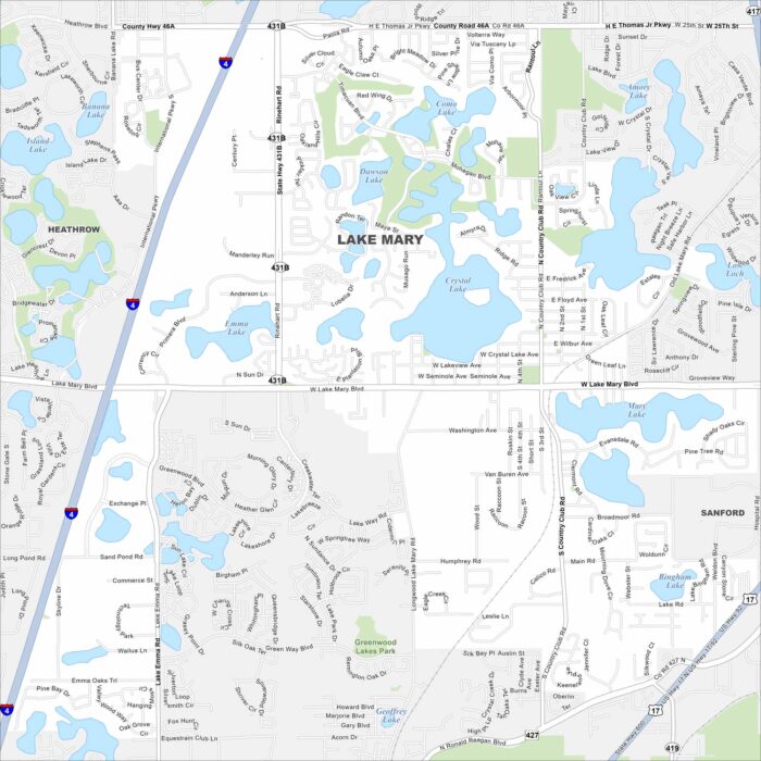
Lake Mary’s map reveals clusters of lakes scattered everywhere. Residential neighborhoods fill a lot of the spaces between.
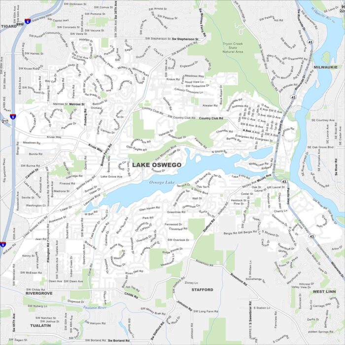
The city of Lake Oswego curves around Oswego Lake. This map highlights the lakes, rivers and winding roads. Portland lies just to the north.