Map of Gulf Shores, Alabama
Explore our map of Gulf Shores on Alabama’s Gulf Coast. You’ll see beaches stretching along the shoreline.
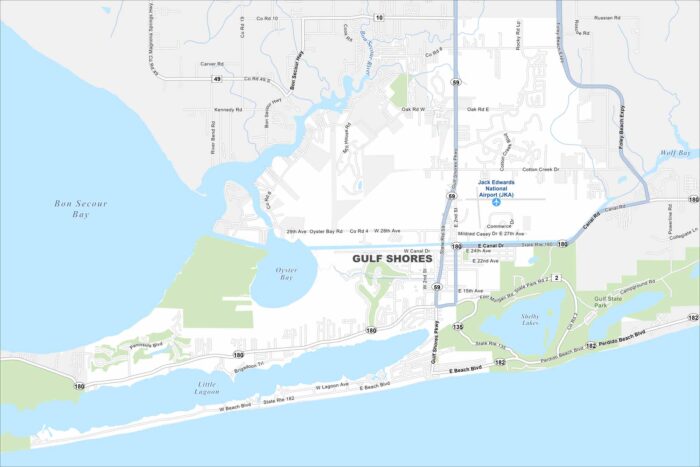
Explore our map of Gulf Shores on Alabama’s Gulf Coast. You’ll see beaches stretching along the shoreline.
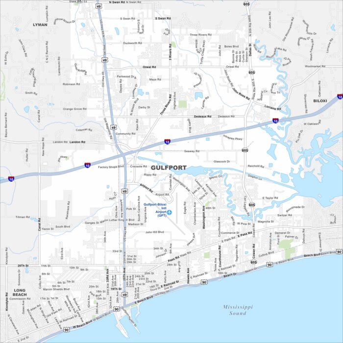
Our map of Gulfport highlights its long stretch along the Gulf Coast. The port and beaches stand out clearly.
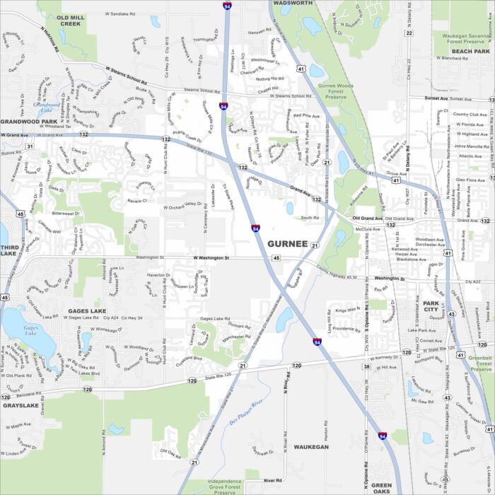
Gurnee, Illinois is in northern Illinois between Chicago and Milwaukee. Our map shows its location along I-94 and State Route 132.
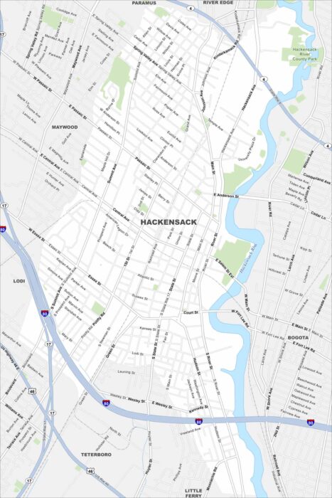
Check out our map of Hackensack in northern New Jersey. The Hackensack River runs right through the city. It’s in close proximity to NYC.
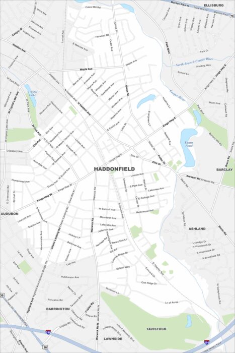
Haddonfield is just across the Delaware River from Philadelphia. This map shows a small, tight street grid with green spaces and ponds.
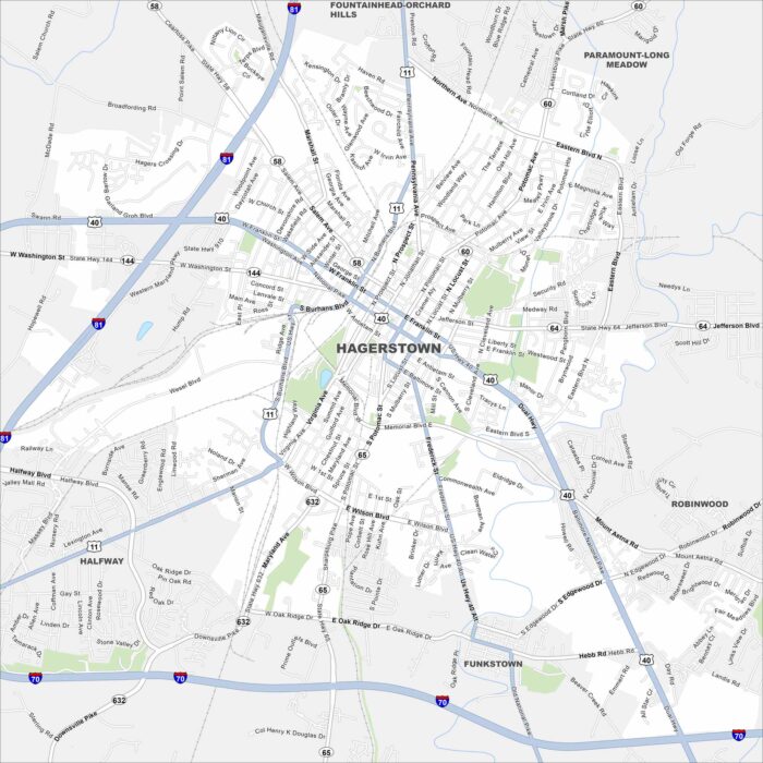
Our map of Hagerstown shows the city in western Maryland’s Cumberland Valley. Interstates 70 and 81 meet close here.
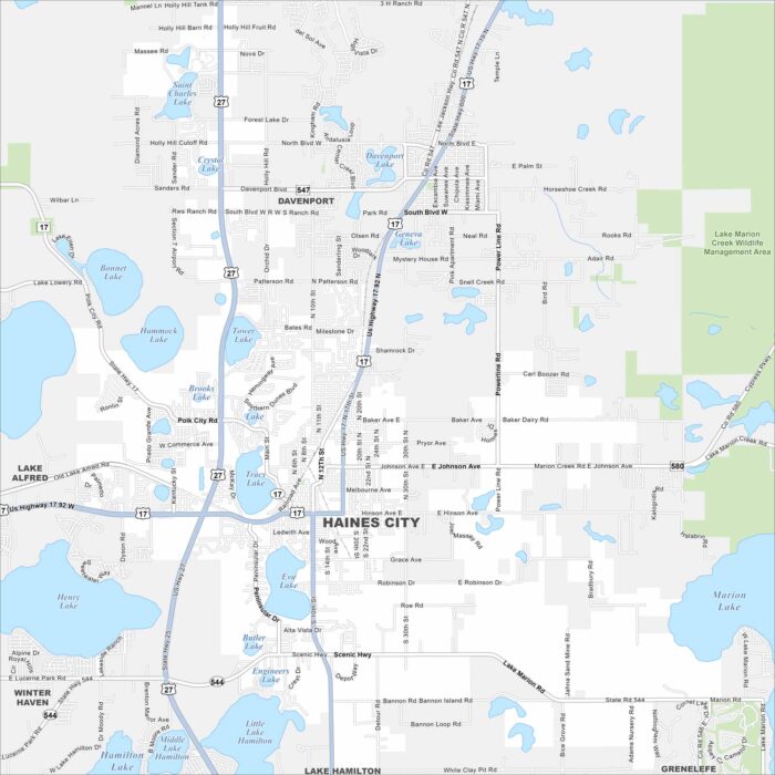
Take a look at our map of Haines City in central Florida. Lakes are scattered throughout the area. Highways link it to Orlando and Lakeland.
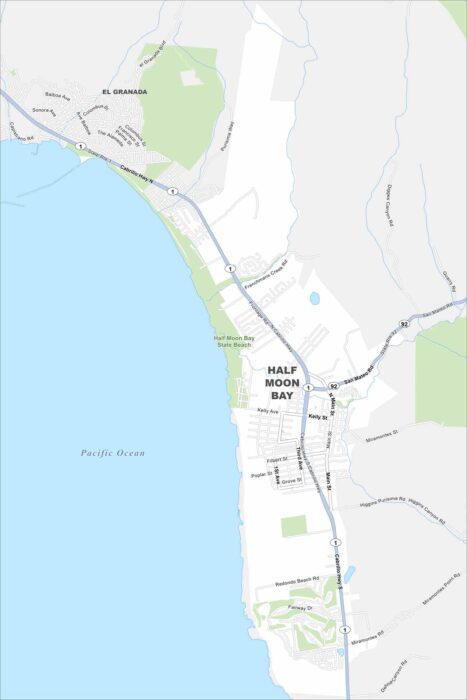
Half Moon Bay is a coastal city south of San Francisco. This map highlights its long stretch of beaches. Hills and farmland are in the east.
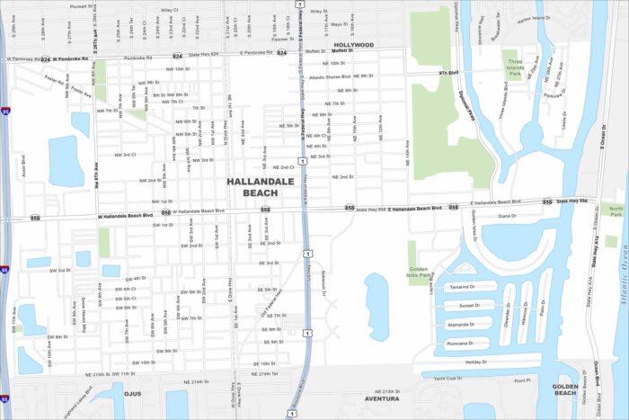
Our map of Hallandale Beach shows its strip along the Atlantic coast. Canals and waterways flow through the city.
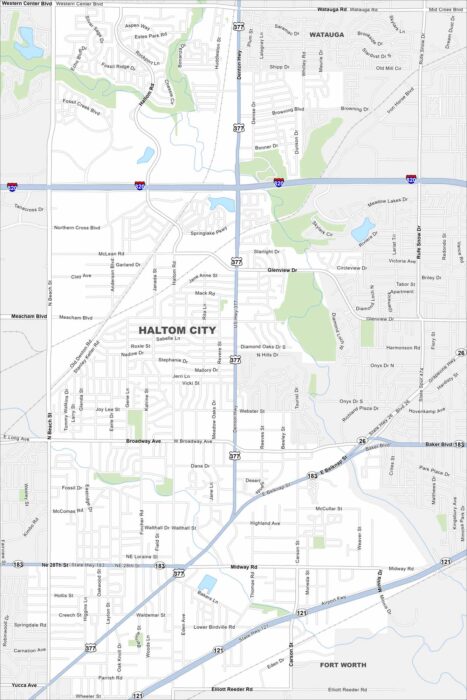
Haltom City is part of the Fort Worth area in north Texas. This map shows dense neighborhoods tied together by major roads.
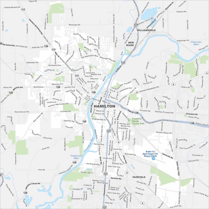
Hamilton sits along the Great Miami River in southwestern Ohio. Our map shows the river bending right through downtown.
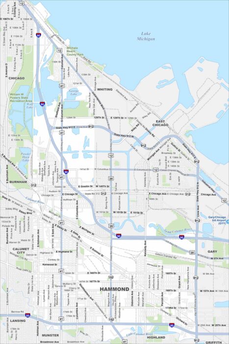
Hammond lies in northwest Indiana along Lake Michigan’s southern edge. You’ll see the lakefront, rail lines, and industry on our map.
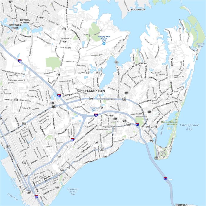
Our map shows Hampton, which is on the Virginia Peninsula. It’s surrounded by the Chesapeake Bay and Hampton Roads.
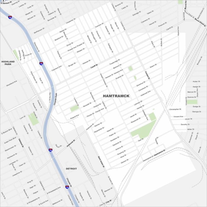
Hamtramck is a small city enclosed entirely by Detroit. On our map, it’s easy to see how tightly packed its streets are.
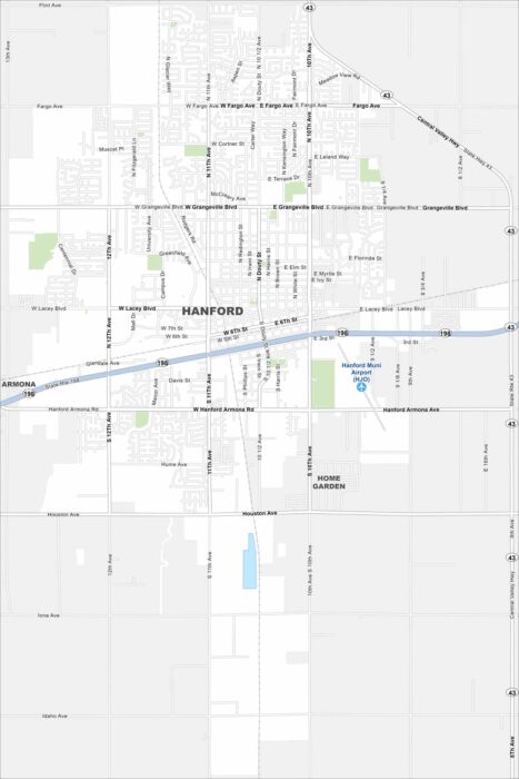
Hanford sits in California’s Central Valley between Fresno and Visalia. Our map shows the roads, railways and green spaces in the city.