Map of Eden Prairie, Minnesota
Our map of Eden Prairie, Minnesota shows lakes scattered throughout the city, including Staring and Red Rock Lake.
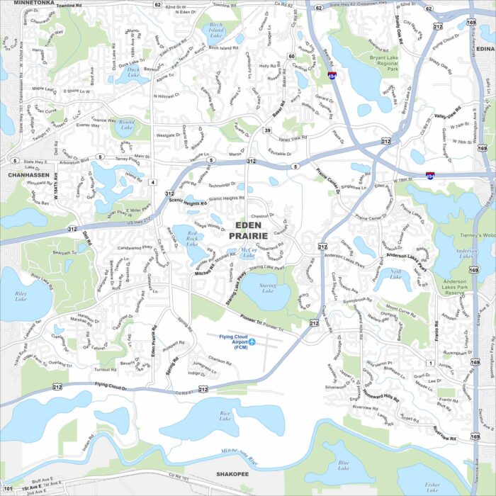
Our map of Eden Prairie, Minnesota shows lakes scattered throughout the city, including Staring and Red Rock Lake.
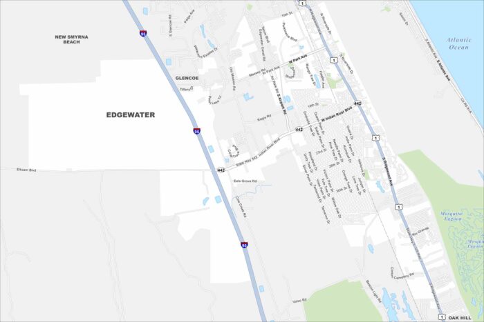
Edgewater sits along the Indian River, just south of New Smyrna Beach. On the map, you’ll see long stretches of waterfront and nearby canals.
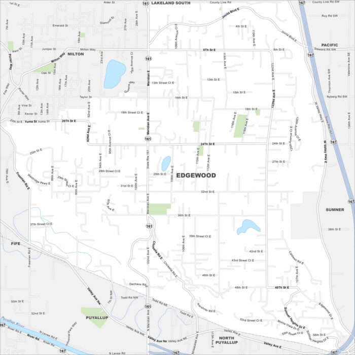
Check out Edgewood just north of Puyallup. Our map reveals this community bordered by rolling hills and open green spaces.
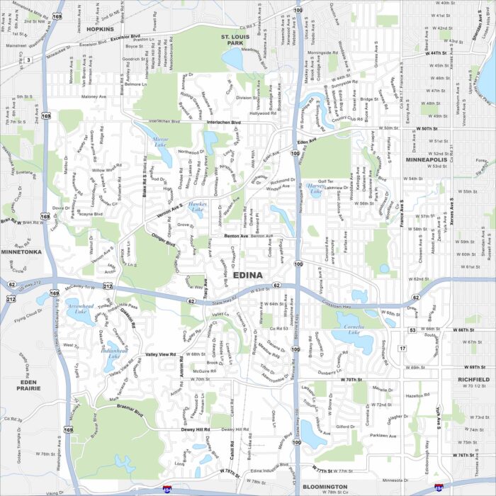
Edina is located southwest of Minneapolis. Our map highlights several lakes, including Arrowhead and Lake Cornelia.
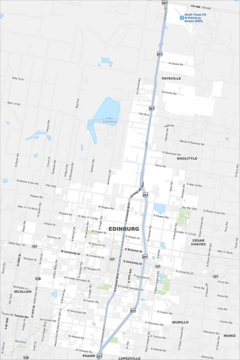
Edinburg spreads across the Rio Grande Valley. Our map shows highways leading toward McAllen and the Mexican border.
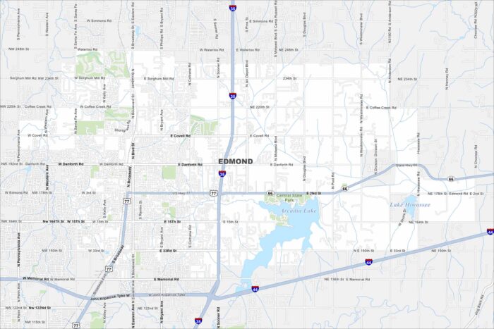
Our map of Edmond marks a large suburban area north of Oklahoma City. Arcadia Lake sits on the east side, great for outdoor activity.

Edmonds rests on Puget Sound with ferry routes stretching across the water. The map shows a downtown leading straight to the shoreline.
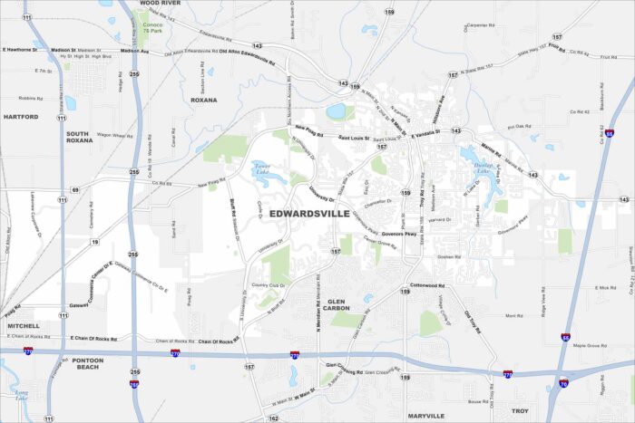
You can find Edwardsville northeast of St. Louis. It has wide open farmland with lots of parks. It’s ones of the oldest cities in Illinois.
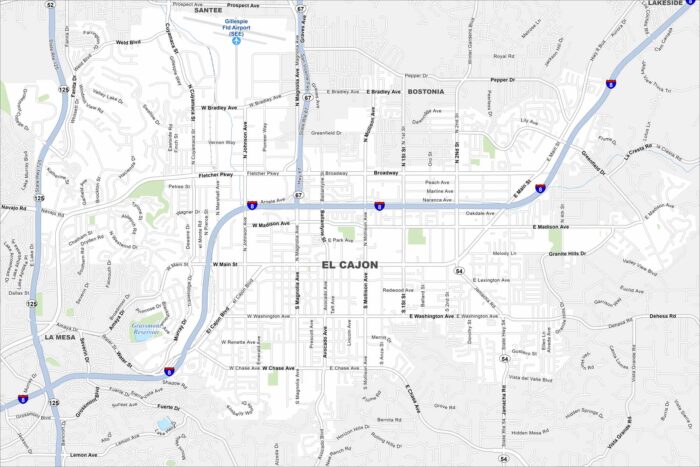
Explore El Cajon in a valley east of San Diego. This map highlights this city surrounded by mountains on nearly all sides.
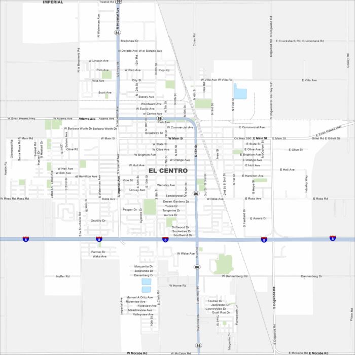
Our map of El Centro shows a city in the heart of the Imperial Valley. Canals and farmland cover the landscape around it.
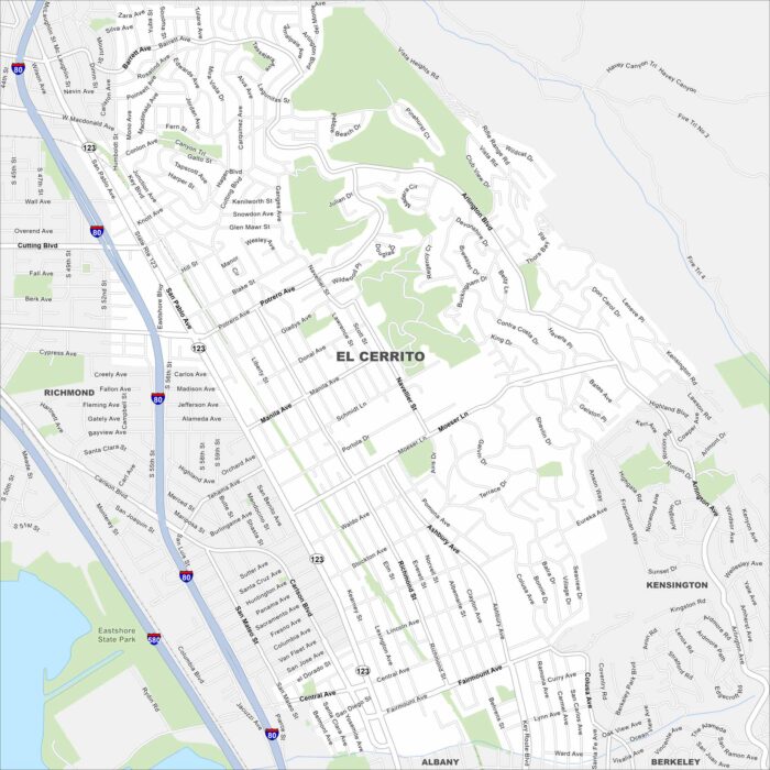
Our map of El Cerrito shows this hillside community overlooking San Francisco Bay. Streets climb toward the Berkeley Hills.
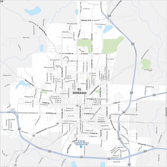
El Dorado is in southern Arkansas near the Ouachita River. Our map reveals its downtown surrounded by wooded countryside.
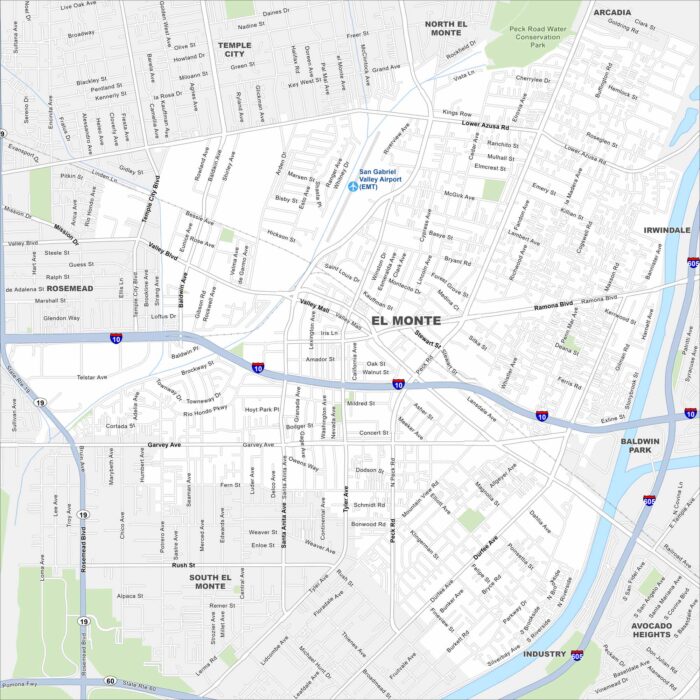
Explore El Monte, California in the San Gabriel Valley. The San Gabriel River runs along the edge of the city.
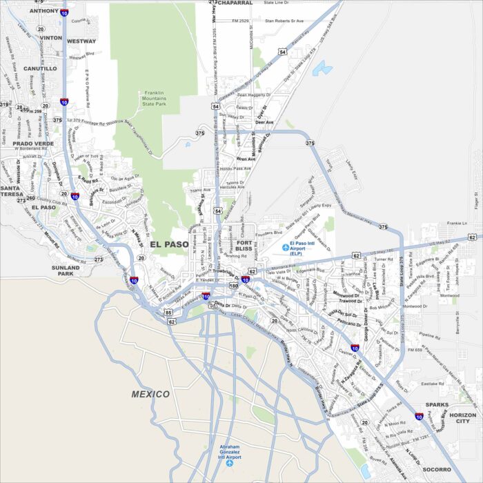
Our map of El Paso shows the Rio Grande carving a boundary with Mexico. The Franklin Mountains rise to the north.
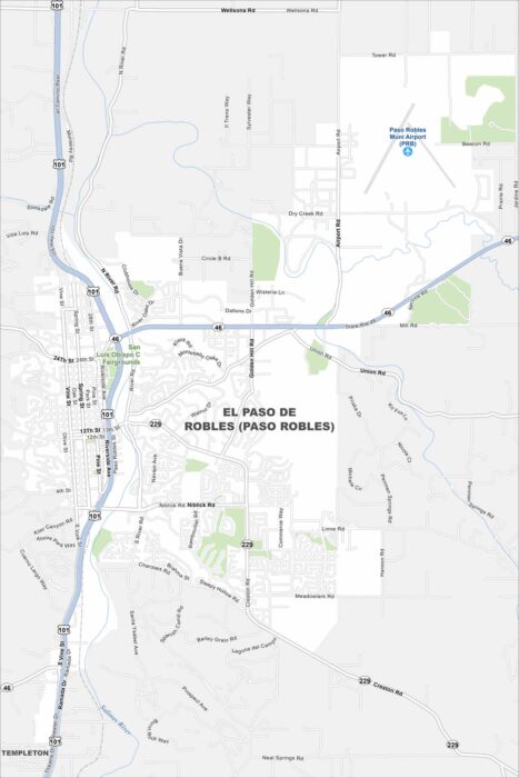
Paso Robles spreads across a rolling valley surrounded by vineyards. The Salinas River winds quietly through the region.