Map of Durham, North Carolina
Check out our map of Durham in the state’s Piedmont region. Rolling terrain, creeks, and a growing downtown stand out.
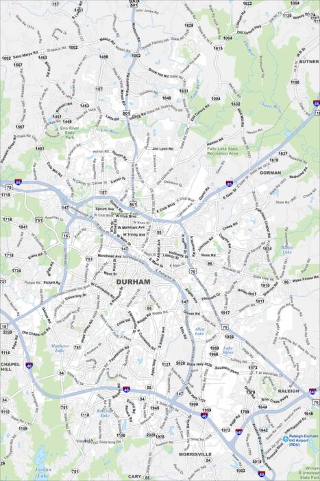
Check out our map of Durham in the state’s Piedmont region. Rolling terrain, creeks, and a growing downtown stand out.
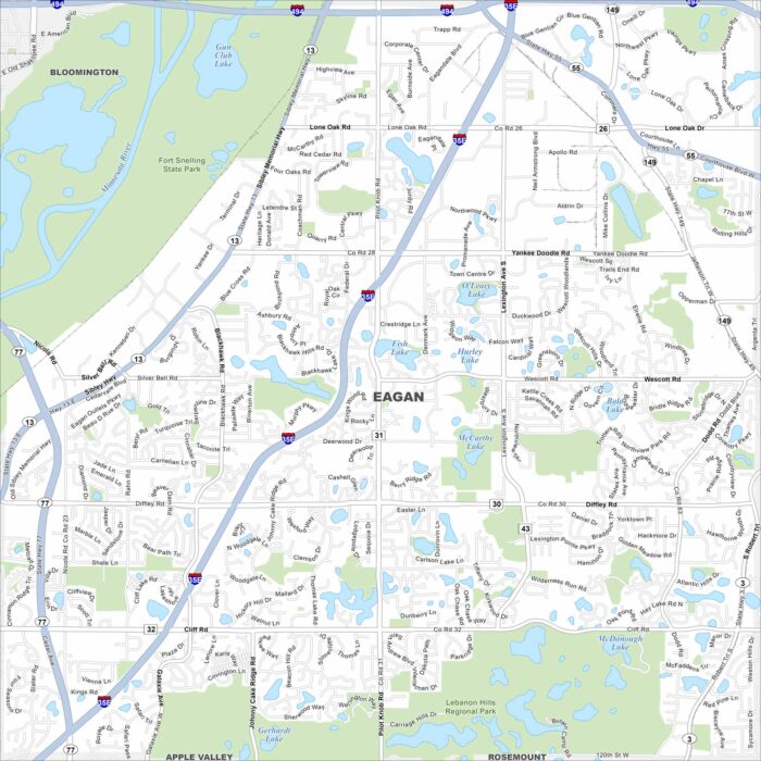
Eagan stretches along the Minnesota River, just south of St. Paul. This map shows its lakes, parks and major freeways.
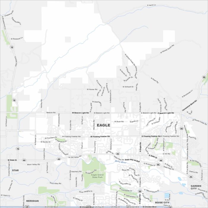
Eagle is just west of Boise along the Boise River. This area has winding neighborhoods, greenbelt trails, and farmland beyond.
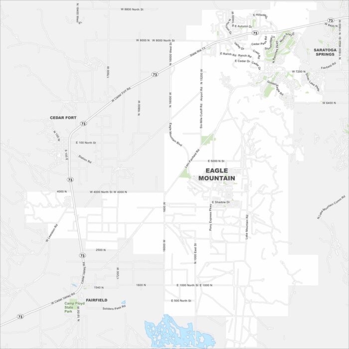
Explore Eagle Mountain on the edge of Utah County. This region has open desert, foothills, and fast-growing housing communities.
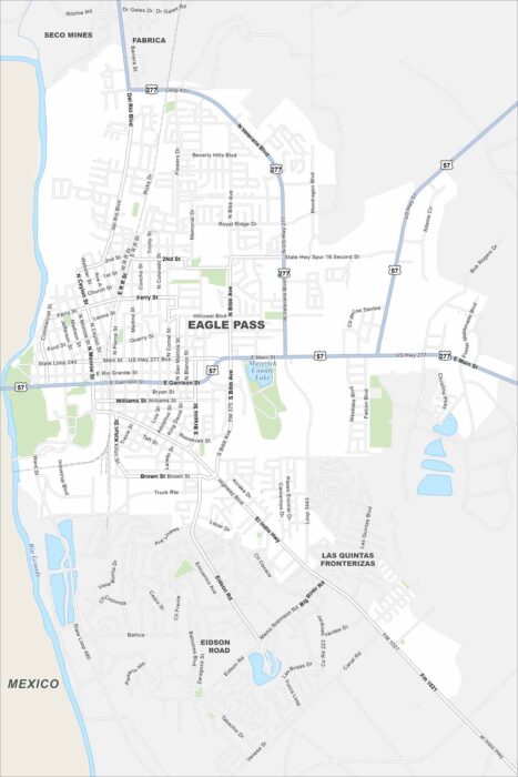
Eagle Pass sits right on the Rio Grande, across from Mexico. The river forms its southern boundary on the map.
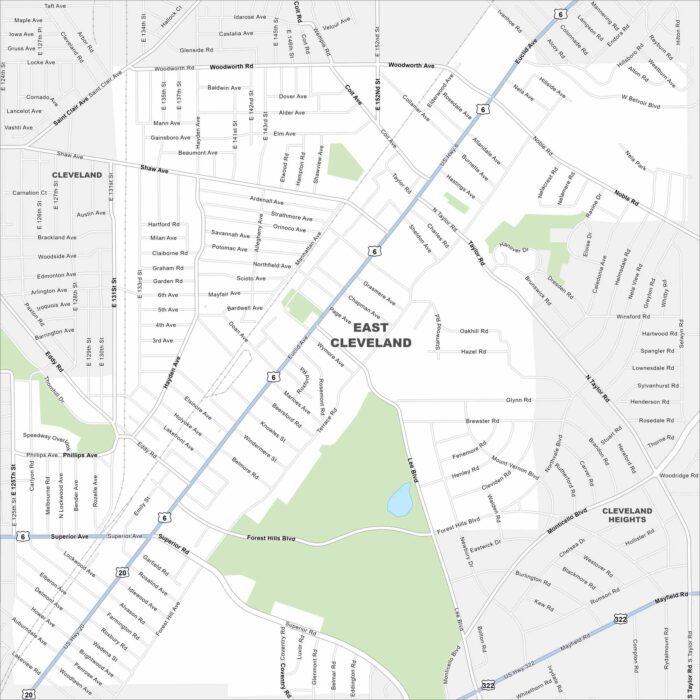
East Cleveland sits close to Lake Erie. On the map, you’ll see it bordered by Cleveland’s east side and major roadways.
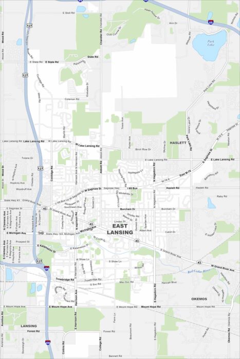
Our map of East Lansing shows the Red Cedar River running through the city. Green spaces and parks stretch along its banks.
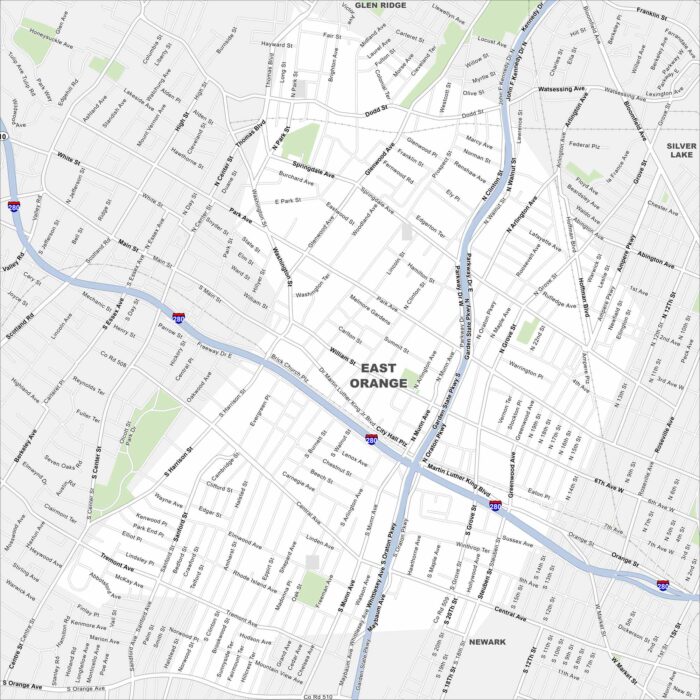
Explore East Orange in northern New Jersey, just west of Newark. The grid of streets links quickly into the Garden State Parkway.
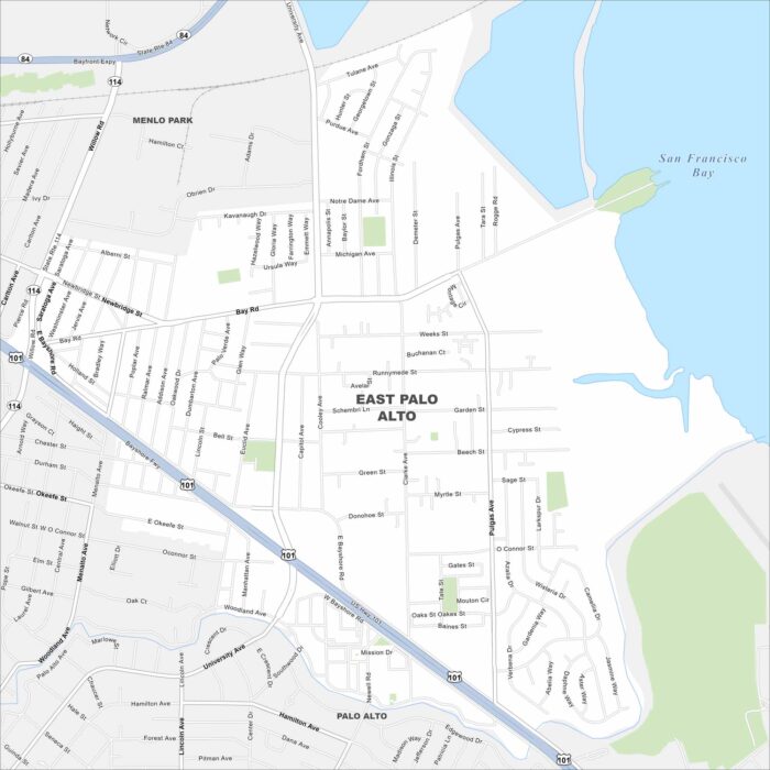
East Palo Alto is on the edge of the San Francisco Bay. This map highlights wetlands and open shoreline areas nearby.
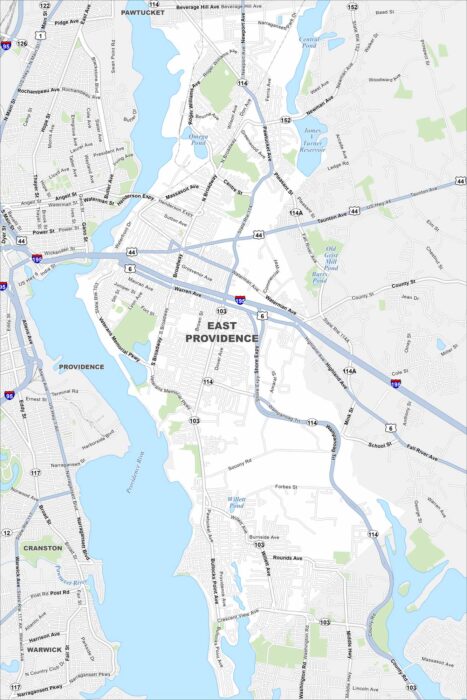
Our map of East Providence shows the Providence River cutting along the west side. Bridges connect it directly to Providence.
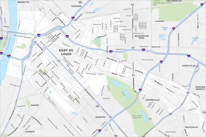
East St. Louis lies right across the Mississippi River from St. Louis. The river dominates the western edge of the map.
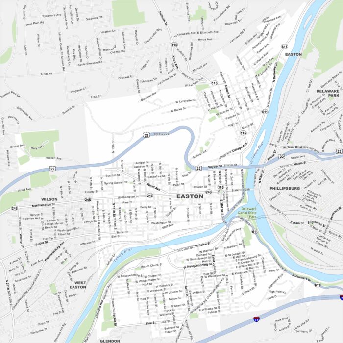
Easton is where the Delaware and Lehigh Rivers meet. On the map, you’ll notice the rivers shaping the city’s borders.
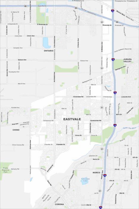
Check out Eastvale in the Inland Empire. Our map shows its neighborhoods spread out between the Santa Ana River and nearby freeways.
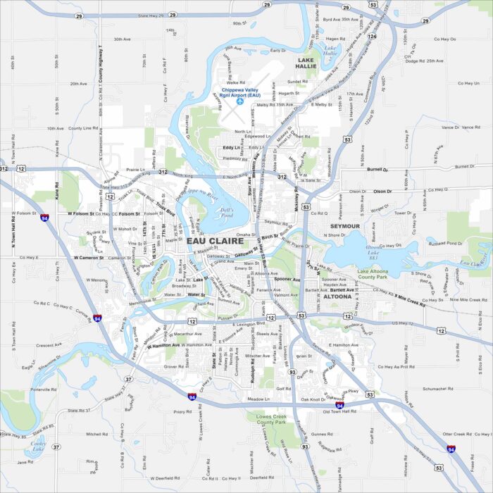
Our map of Eau Claire highlights the Chippewa and Eau Claire Rivers flowing together downtown. Trails and parks follow both waterways.
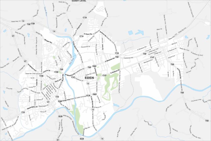
Eden sits near the Virginia border where the Dan and Smith Rivers meet. This map outlines these two waterways and roadways.