Map of Dover, Delaware
Explore our map of Dover in the heart of Delaware. You’ll see the St. Jones River flowing by and roadways linking it across the state.
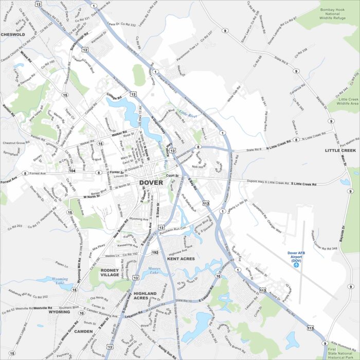
Explore our map of Dover in the heart of Delaware. You’ll see the St. Jones River flowing by and roadways linking it across the state.
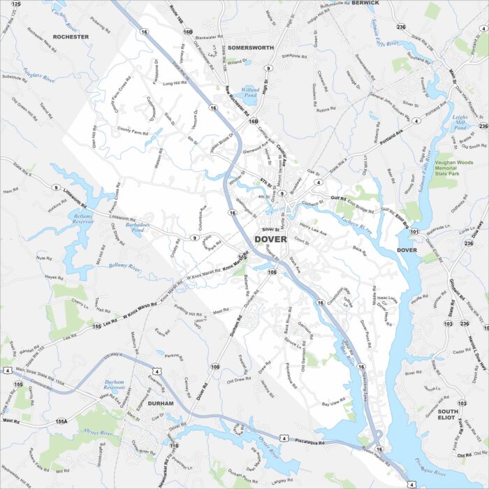
Dover is set in southeastern New Hampshire. It’s positioned between Piscataqua and Bellamy Rivers. This map shows its streets and waterways.
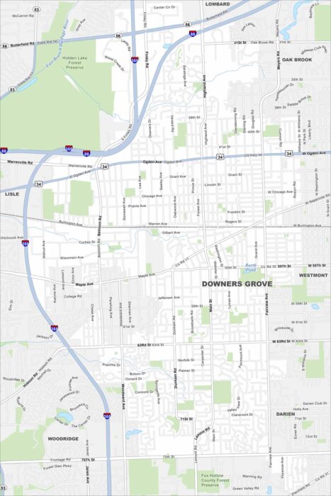
Our map of Downers Grove highlights suburban streets west of Chicago. Highways cut through tree-lined neighborhoods, with parks and creeks.
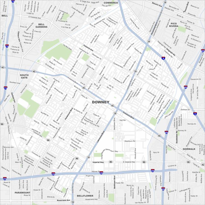
Check out our map of Downey in Los Angeles County. Streets extend between freeways, and you’ll notice the Los Angeles River nearby.
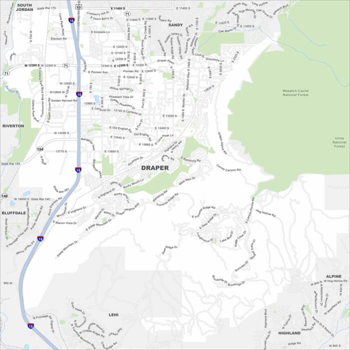
Draper lies at the south end of Salt Lake Valley. Our map shows the Wasatch Mountains rising to the east and open desert to the west.
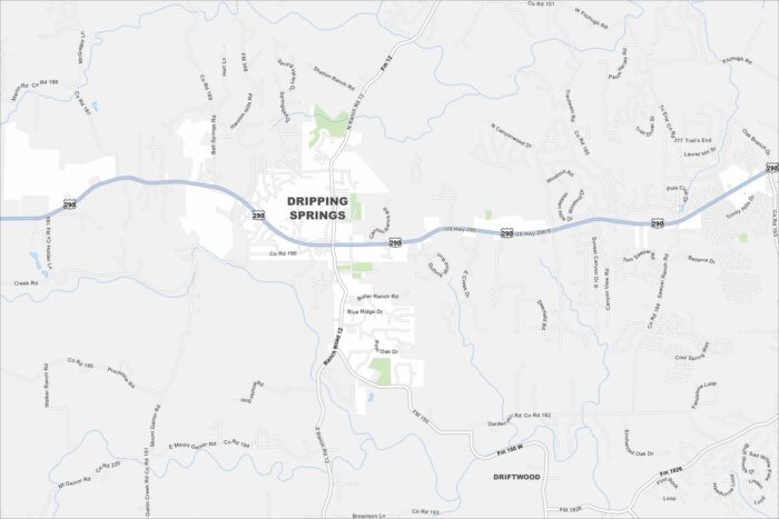
Our map of Dripping Springs shows a Hill Country town just west of Austin. Rolling terrain, creeks, and open ranchland stand out.
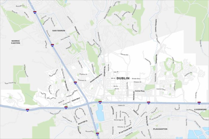
Explore Dublin on our map, situated in the East Bay region. Major highways meet here, surrounded by hills and new neighborhoods.
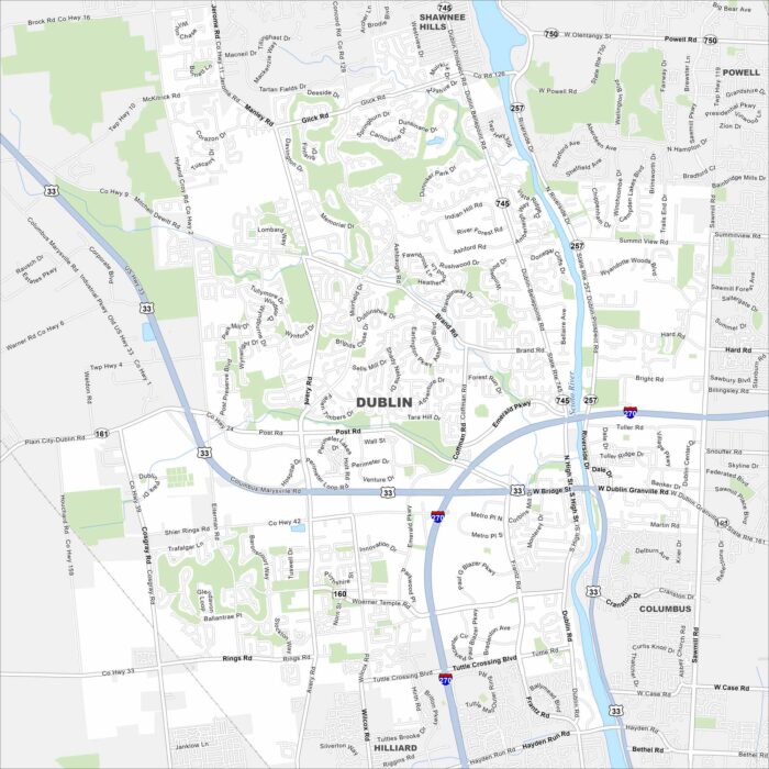
Dublin sits along the Scioto River northwest of Columbus. This map shows residential streets, greenbelt parks, and a riverfront district.
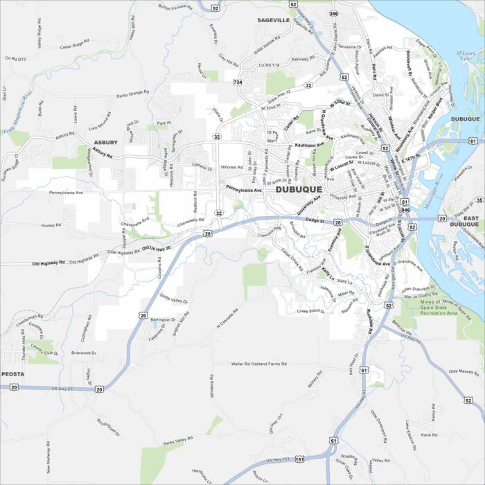
Our map of Dubuque highlights the city along the Mississippi River. Bluffs rise sharply above the downtown and waterfront.
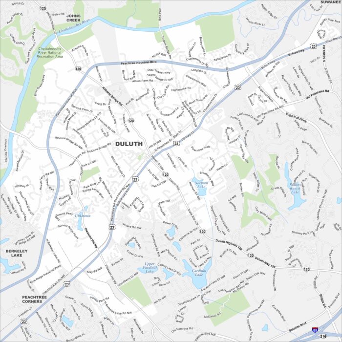
Duluth is in Gwinnett County, northeast of Atlanta. Our map shows neighborhoods, parks, and key roadways tying it to the metro area.
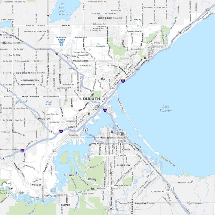
Duluth sits on the western tip of Lake Superior. Our map of the city shows the harbor, lift bridge, and hillside streets.
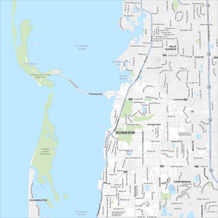
Explore our map of Dunedin along Florida’s Gulf Coast. You’ll spot sandy beaches, offshore islands, and green coastal parks.
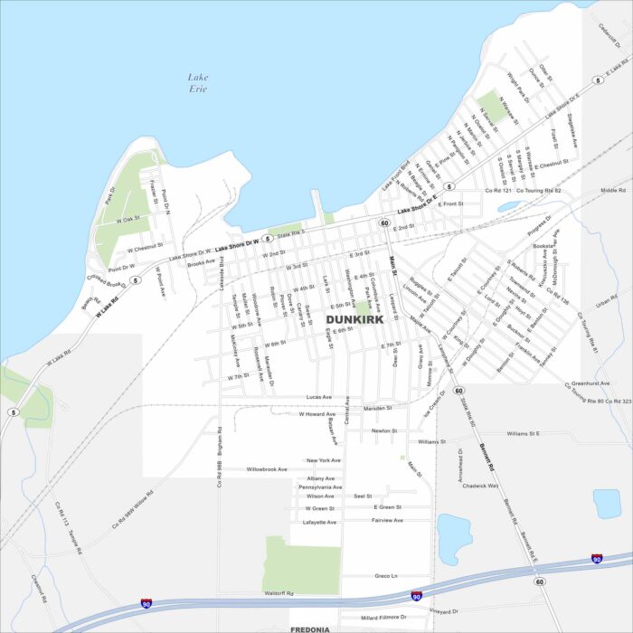
Dunkirk lies on the shores of Lake Erie in western New York. Our map shows Lake Shore Drive and Lake Front Blvd that stretches on waterfront.
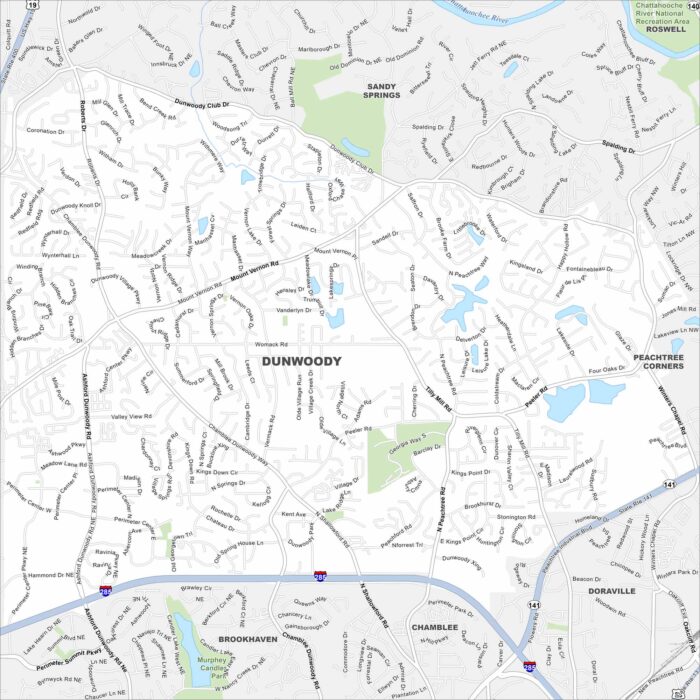
Dunwoody is just north of Atlanta. On the map you’ll notice major highways cutting across neighborhoods and wooded greenbelts.
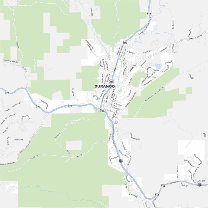
Our map of Durango highlights the Animas River winding along US-160. Mountains surround it on nearly all sides.