Map of Decatur, Alabama
Our map of Decatur shows highways, streets, and the Tennessee River. Often called “The River City”, it grew along Wheeler Lake.
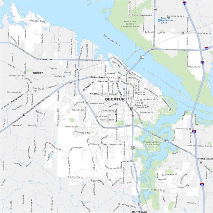
Our map of Decatur shows highways, streets, and the Tennessee River. Often called “The River City”, it grew along Wheeler Lake.
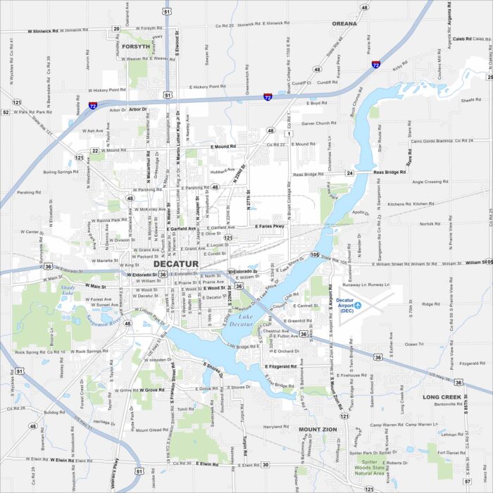
See the roads, highways, and open areas of Decatur on our map. It’s also known as the “Soybean Capital of the World”.
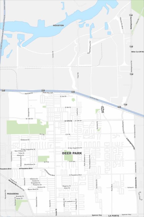
Deer Park is mapped with its major roads, highways, and nearby bayous. The city is part of the region’s industrial core.
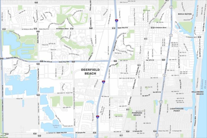
Take a look at this map of Deerfield Beach with its streets, waterways, and coastal parks. It’s located north of Fort Lauderdale.
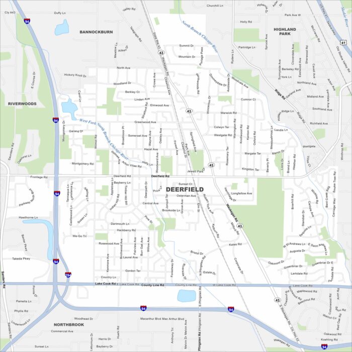
North of Chicago, this community is set near the Des Plaines River. It has quiet neighborhoods with quick access to the city.
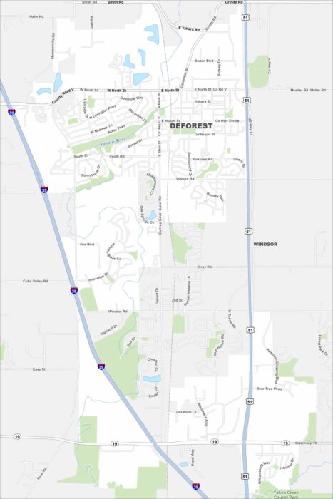
Our map of DeForest shows its highways, smaller roads, and nearby rivers. Just north of Madison, the village is surrounded by farmland.
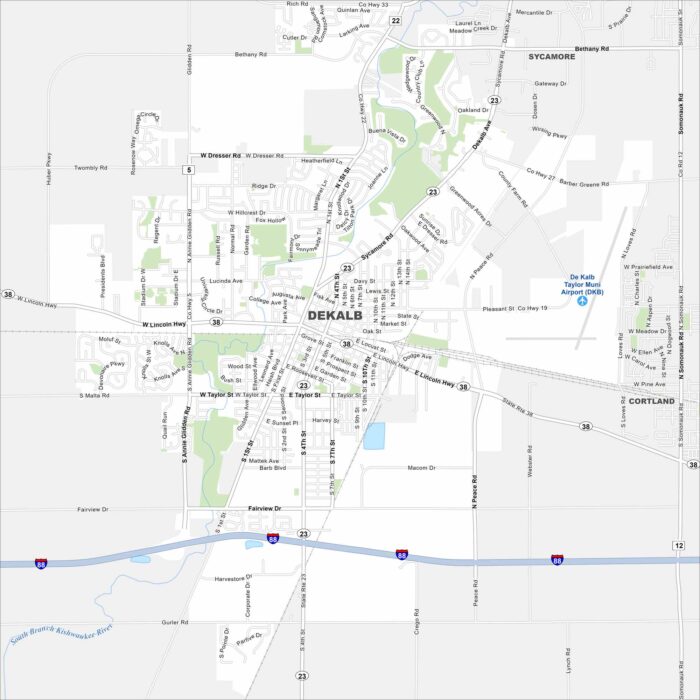
See DeKalb’s streets, highways, and wide-open spaces on our map. The city sits west of Chicago in northern Illinois.
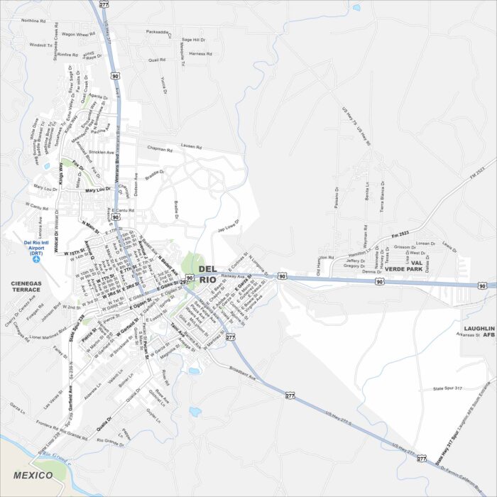
Our map of Del Rio shows the main roads, highways, and its position on the border. Amistad Reservoir spreads just north of the city.
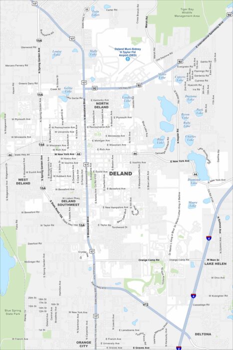
DeLand is mapped with its streets, highways, and surrounding lakes. It’s located between Orlando and Daytona Beach with a historic downtown.
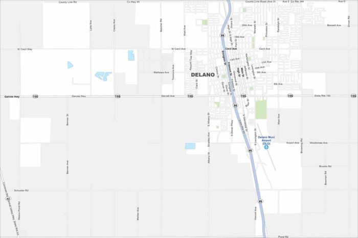
Look over Delano with its roads, highways, and farmland stretching in every direction. Fresno sits a short drive north.
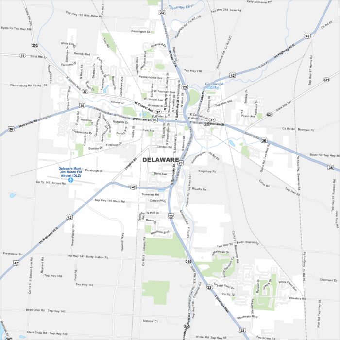
Our map of Delaware shows the Olentangy River as the main waterway. Streets travel out from a historic downtown square.
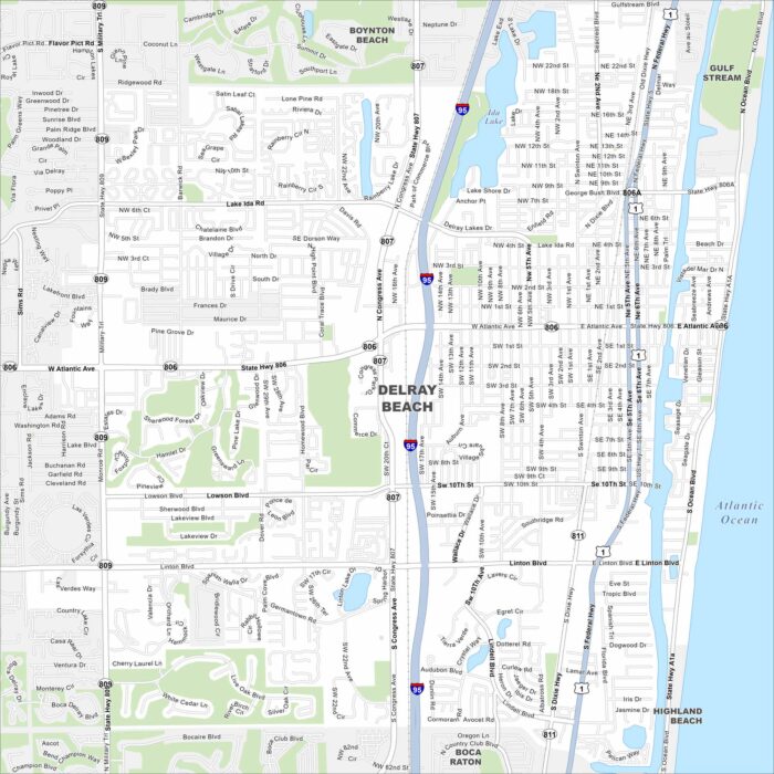
Explore our map of Delray Beach on Florida’s Atlantic coast. This map highlights sandy beaches, the Intracoastal Waterway, and neighborhoods.
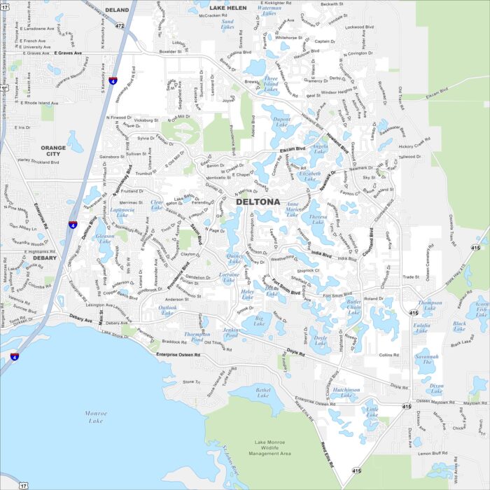
Deltona is set between Orlando and Daytona Beach. On the map, you’ll notice it’s covered with small lakes and spread-out suburban streets.
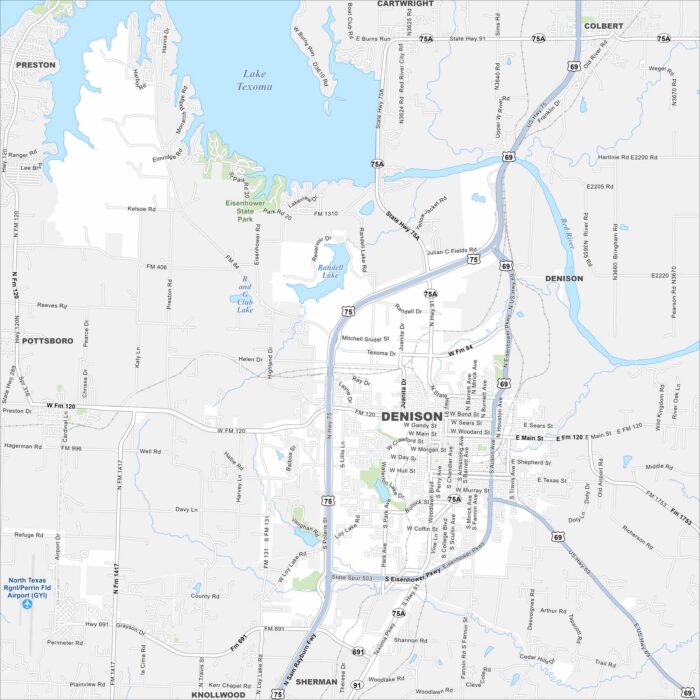
Our map of Denison shows this city located along the Red River near the Oklahoma border. Lake Texoma stands out just north.
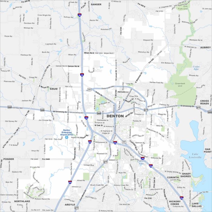
Check out our map of Denton at the north edge of the Dallas-Fort Worth metro. Roads circle its downtown square.