Map of Coral Gables, Florida
Coral Gables appears with its streets, waterways, and boulevards. Nicknamed “The City Beautiful”, it sits just southwest of Miami.
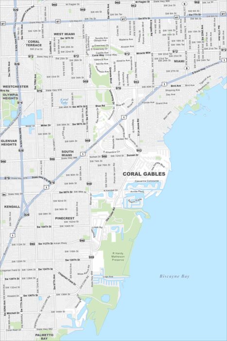
Coral Gables appears with its streets, waterways, and boulevards. Nicknamed “The City Beautiful”, it sits just southwest of Miami.
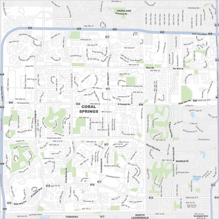
Our map of Coral Springs shows its roads, highways, and canals. Planned with wide boulevards and parks, the city is part of Broward County.
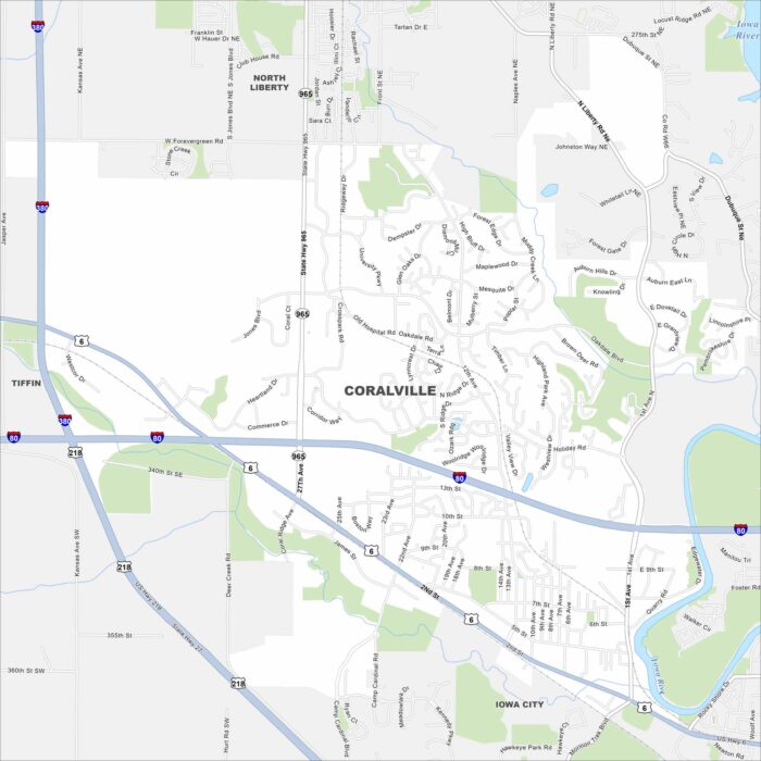
See Coralville with its mapped streets, highways, and Iowa River. Next to Iowa City, it’s known for retail centers and family-friendly parks.
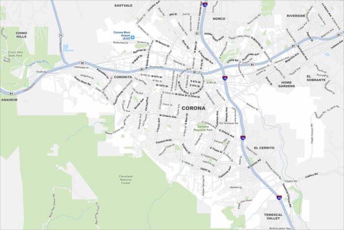
We’ve mapped Corona with its roads, highways, and foothill neighborhoods. The city sits at the base of the Santa Ana Mountains.
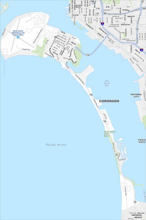
Our map of Coronado shows its streets, coastal access, and scenic bayfront. The city sits on a peninsula linked by the Coronado Bridge.
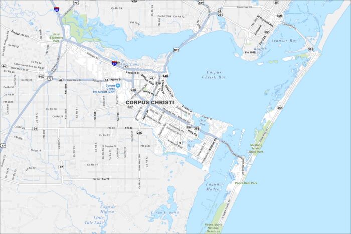
Our map of Corpus Christi highlights the city’s roads, highways, and shoreline. It’s known as the “Sparkling City by the Sea”.
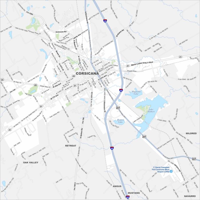
Here’s Corsicana mapped with its streets, highways, and nearby lakes. It’s not too far from Dallas. The city was once an early oil boomtown.
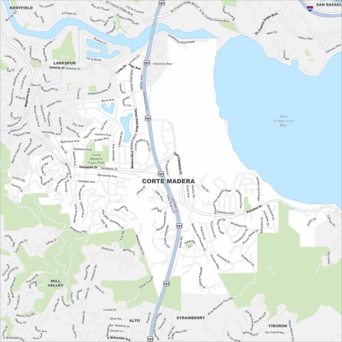
See Corte Madera with its streets, highways, and open marshlands. You can find it north of San Francisco. The bayfront lies just to the east.
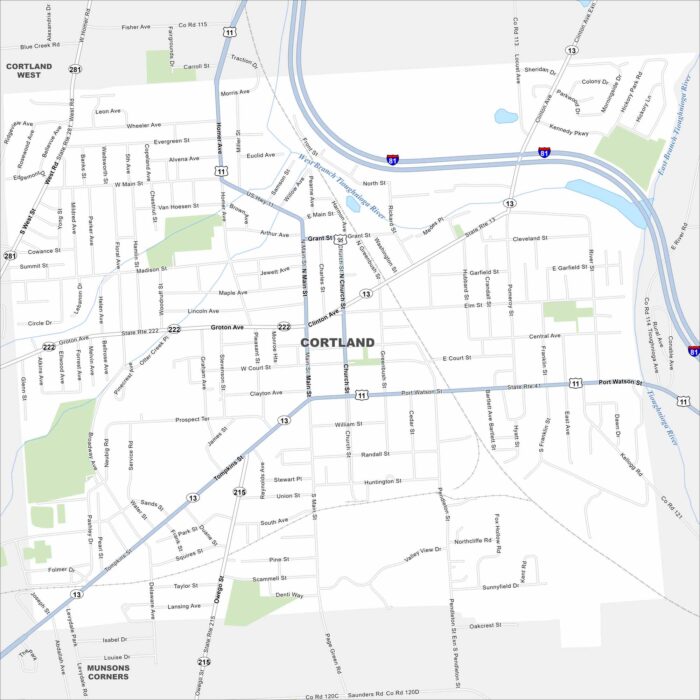
Cortland is sandwiched between Syracuse and Binghamton in New York state. It’s nicknamed the “Crown City” because it sits on a plateau.
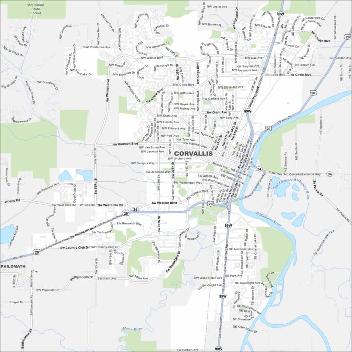
Our map of Corvallis outlines the streets, highways, and the Willamette River. It’s home to Oregon State University with college life.
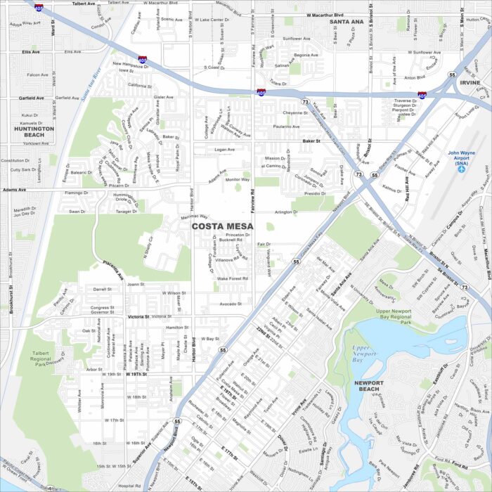
Here’s our map of Costa Mesa, located in the heart of Orange County. It’s a hub for arts and entertainment close to the Pacific Ocean.
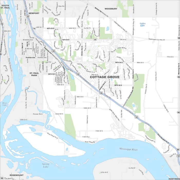
Cottage Grove shows up here with roads, highways, and rivers. You can find it along the Mississippi. It’s also situated south of St. Paul.
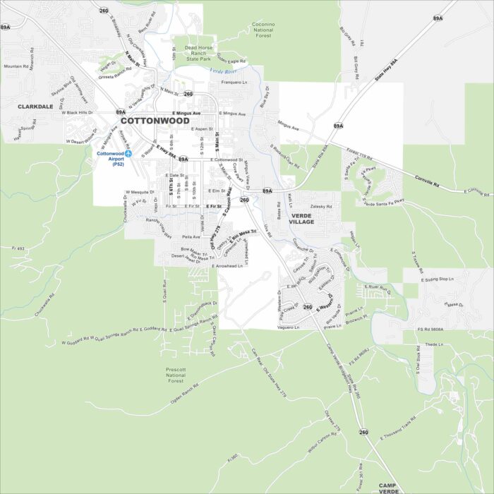
Our map of Cottonwood displays local streets, highways, and airport Set in the Verde Valley, the city is surrounded by red rock views.
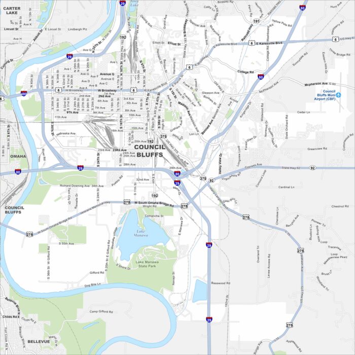
Get to know Council Bluffs with our map. It displays its streets, waterways and railways. The Loess Hills also rise nearby.
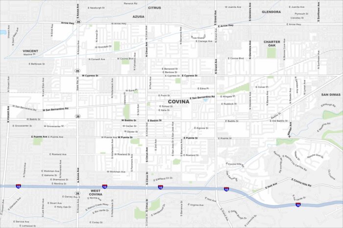
Our map of Covina shows its local roads, highways, and park areas. This city is situated east of Los Angeles, California.