Map of Alexandria, Louisiana
Alexandria sits along the Red River, with roads and bridges tying the city together. Our map shows how it truly is a crossroads of Louisiana.
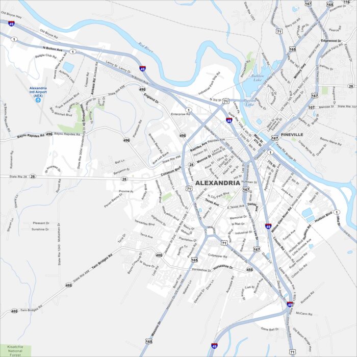
Alexandria sits along the Red River, with roads and bridges tying the city together. Our map shows how it truly is a crossroads of Louisiana.
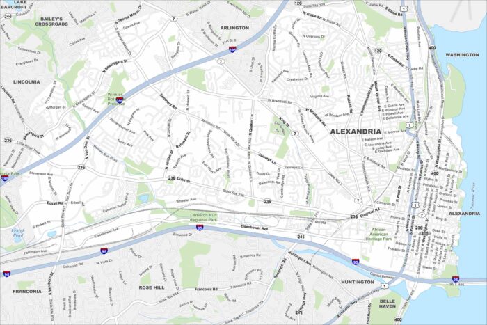
Cobblestone streets make way for a busy waterfront in Alexandria. Our map displays its neighborhoods along the Potomac.
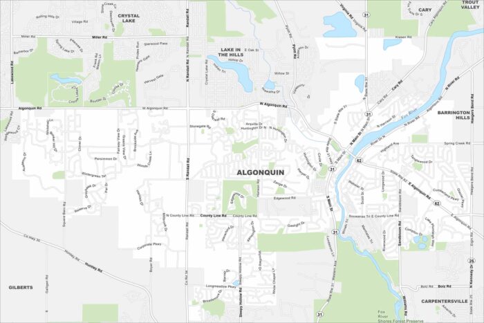
Set along the Fox River, Algonquin has tons of winding roads and open green spaces. Our map shows waterways, highways and local parks.
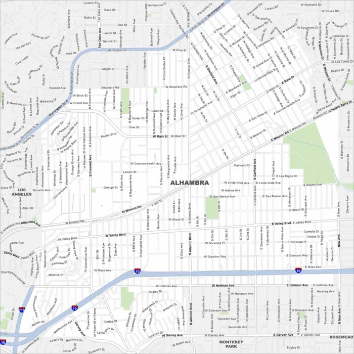
Our map of Alhambra lays out its streets and waterways. This city is next to Los Angeles and is a gateway to the San Gabriel Valley.
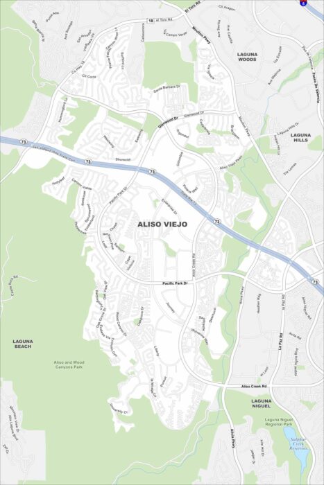
Aliso Viejo is a master-planned city in the hills of southern Orange County. Our map shows how its streets curve around canyons and parks.
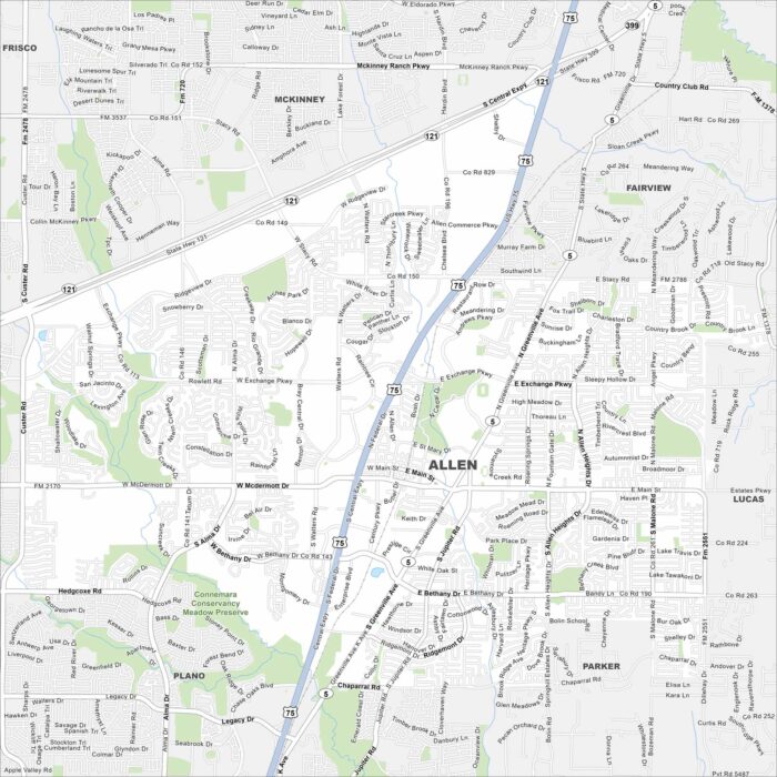
Highways, shopping centers, and wide suburban roads are important to Allen. Our map shows its position in the north Dallas metro.
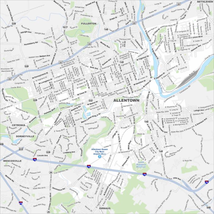
Our map of Allentown shows how the city stretches along the Lehigh River. Meanwhile, highways cut through old industrial corridors.
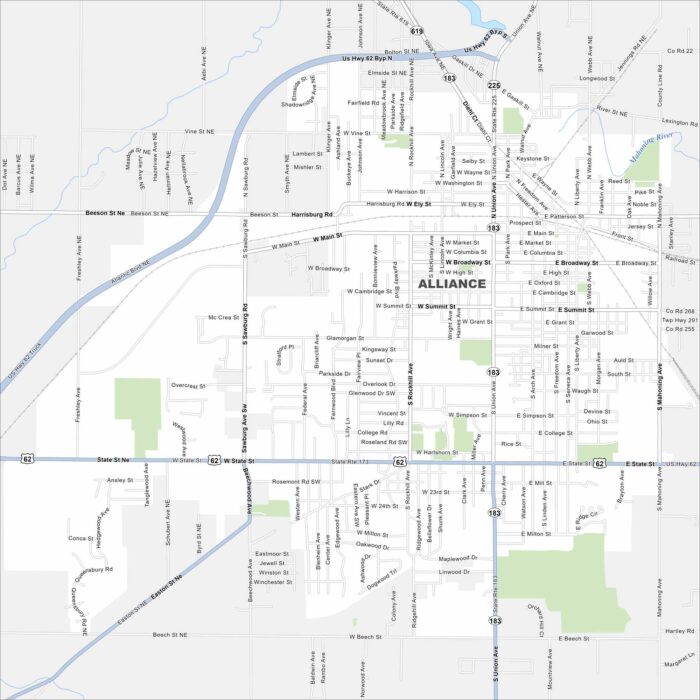
Alliance is a small city with streets that spread across Stark County farmland. Our map highlights its roads and neighborhoods.
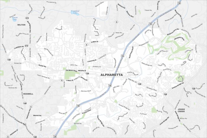
Our map of Alpharetta shows this fast-growing suburb north of Atlanta. Alpharetta has winding neighborhoods with major highways.
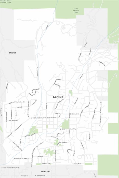
The name says it all. Alpine sits right against the Wasatch Range. This is where suburban roads meet rugged canyon trails.
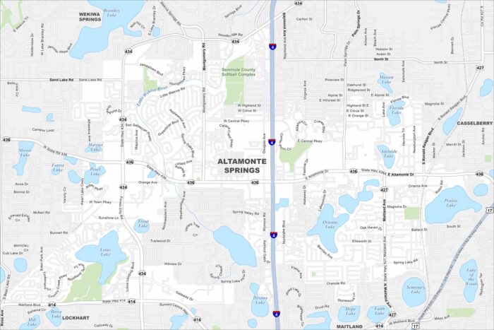
Altamonte Springs is a mix of busy highways, lakes, and well-kept parks. Cranes Roost Park is the local landmark everyone knows.
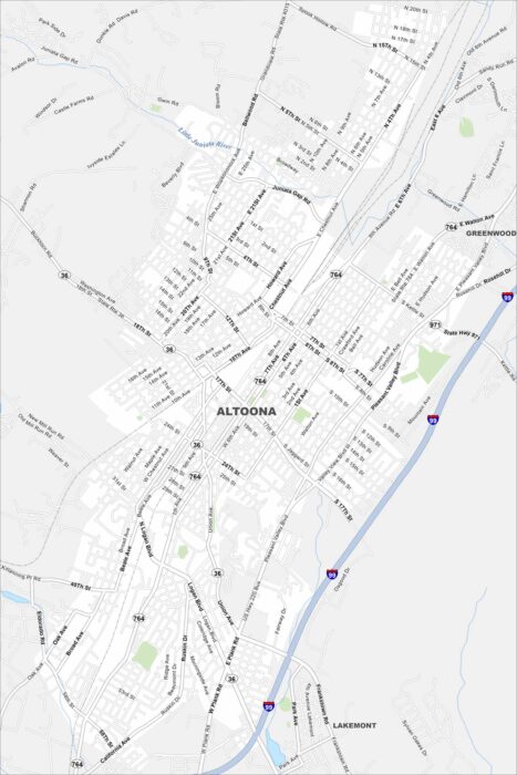
Built in the shadow of the railroad, Altoona spreads around the famous Horseshoe Curve. Streets wind through old neighborhoods on our map.
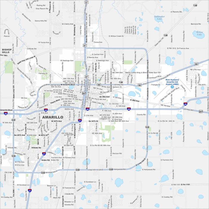
Amarillo stretches wide across the Texas Panhandle. This location is where open highways seem endless. It’s also a Route 66 stop.
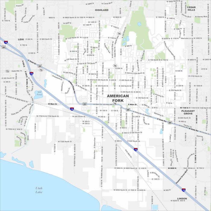
Situated near Utah Lake, American Fork sits at the mouth of a canyon that leads straight into the mountains. Our map shows its highways.
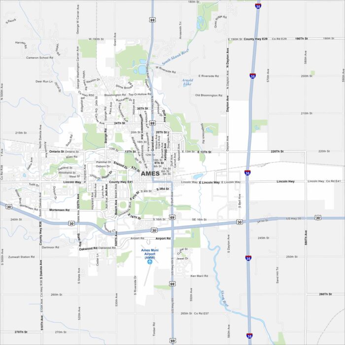
Home to Iowa State University, Ames is both a college town and a research hub. Roads wrap around the campus, as shown on our map.