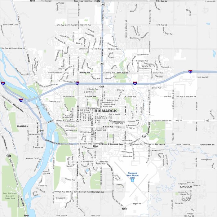
Map of Bismarck, North Dakota
See the highways, streets, and rivers shown clearly here. Our map of Bismarck follows the Missouri River. It is the capital of North Dakota.
See the highways, streets, and rivers shown clearly here. Our map of Bismarck follows the Missouri River. It is the capital of North Dakota.
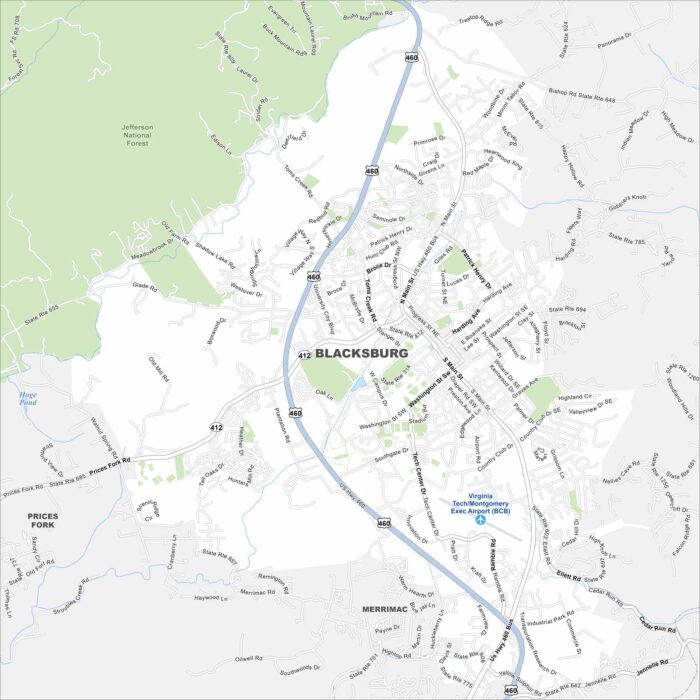
We’ve mapped Blacksburg, Virginia with its streets, highways, and parks. It’s best known as the home of Virginia Tech.
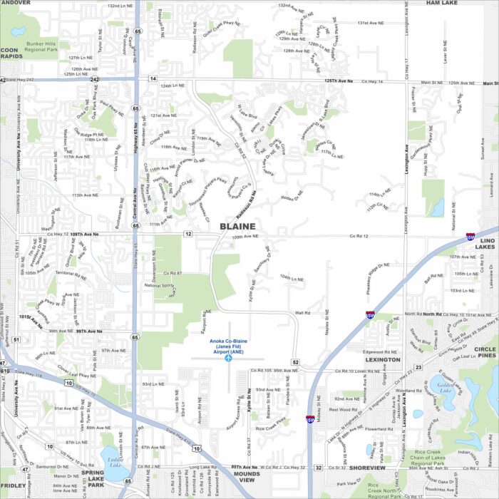
Our map of Blaine shows the highways, streets, and nearby lakes. Roads spread out here into the Twin Cities metro.
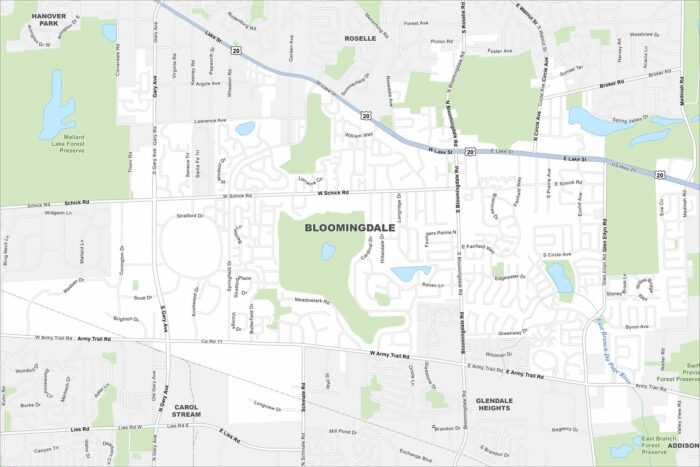
Our map of Bloomingdale highlights its highways, streets, and open park spaces. Roads link into the Chicago area.
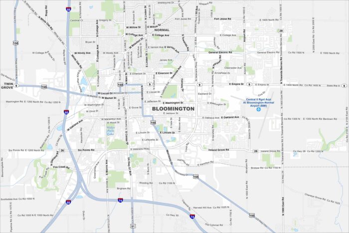
Bloomington is a central Illinois hub. Our map highlights roads, neighborhoods, and nearby parks. The city is tied to agriculture.
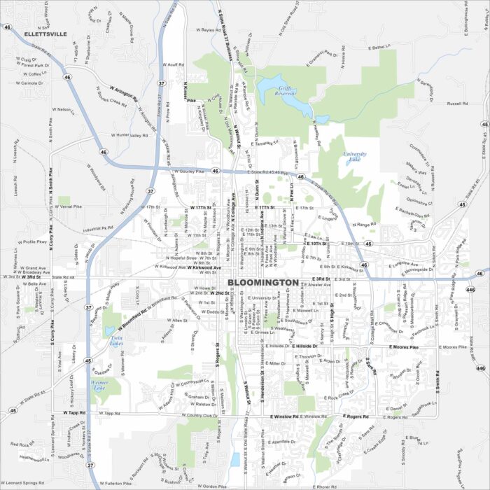
Here’s our road map of Bloomington, Indiana. It’s home to Indiana University and rolling southern Indiana hills.
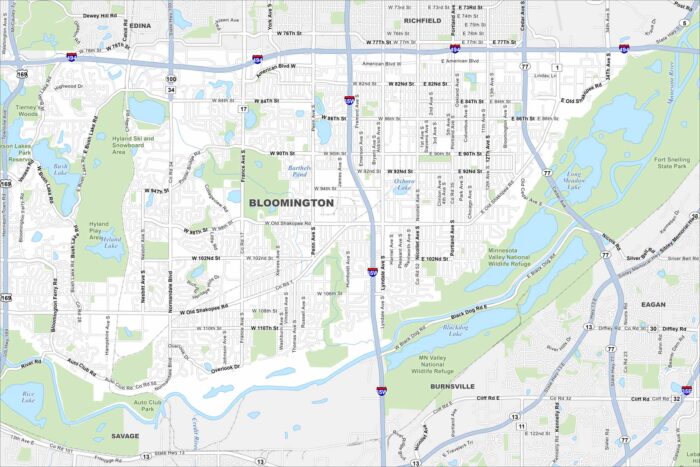
Get a snapshot of Bloomington, Minnesota. This is the home of the Mall of America. Lakes and parks spread through the community.
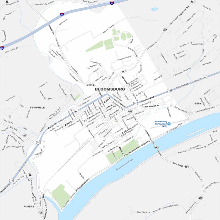
Our map of Bloomsburg shows the highways, streets, and rivers. Roads bend along the Susquehanna all the way to I-80 to the north.
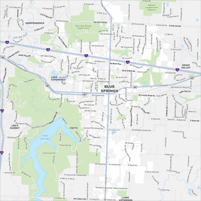
We’ve mapped out Blue Springs with its highways, streets, and nearby lakes. The roads here eventually tie into Kansas City.
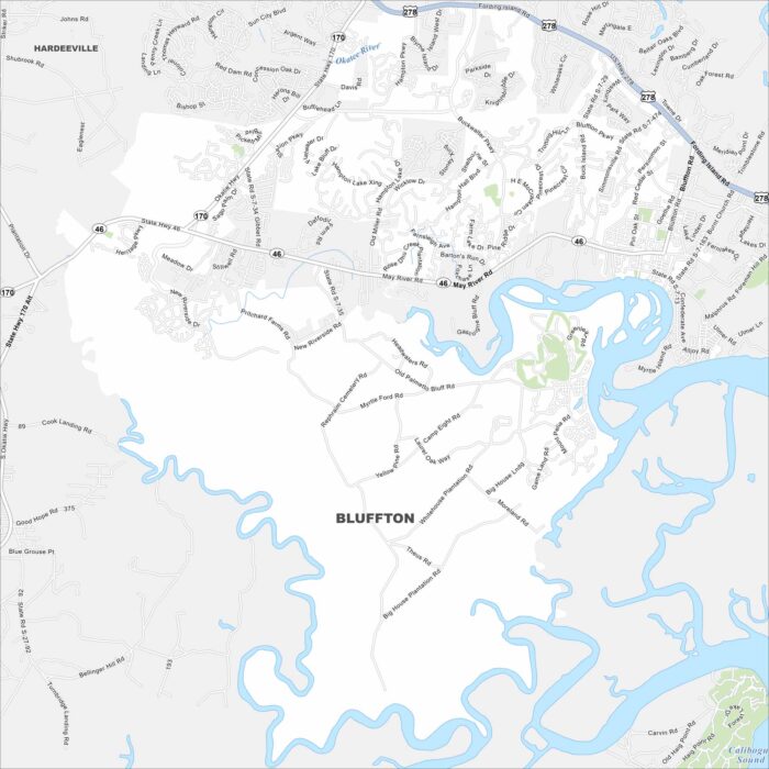
See the streets, highways, and marshland edges on this map. The city is known for its Lowcountry charm and views of the May River.
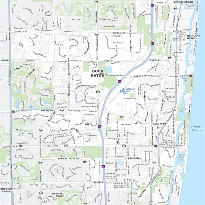
Our map of Boca Raton, Florida lays out the highways, streets, and waterways. Roads stretch along the Atlantic coast.
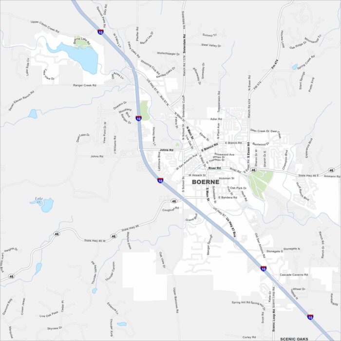
Boerne is shown with its highways, streets, and parks. Roads lead into the Texas Hill Country but still its a small town at heart.
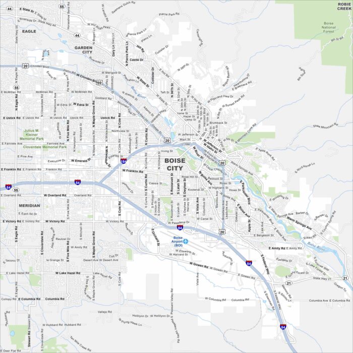
Boise is the capital of Idaho. Our map highlights its streets, parks, and of course, the Boise River. It’s often called the “City of Trees”.
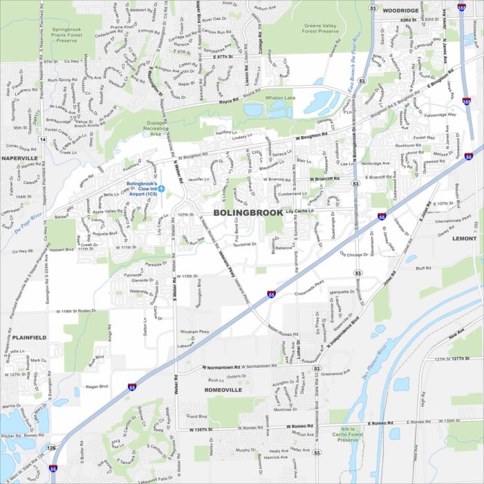
Bolingbrook is a large suburb southwest of Chicago. Our map shows its neighborhoods, parks, and waterways.
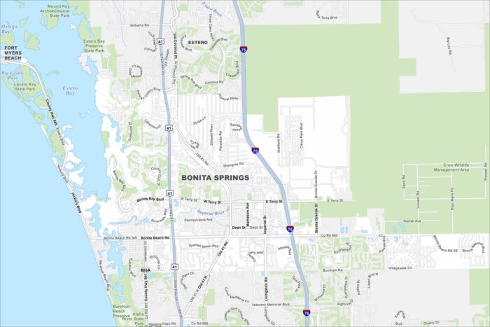
Explore Bonita Springs on our map along Florida’s Gulf Coast. Beaches and waterways are its highlights. The city has a warm climate.