Map of Cary, North Carolina
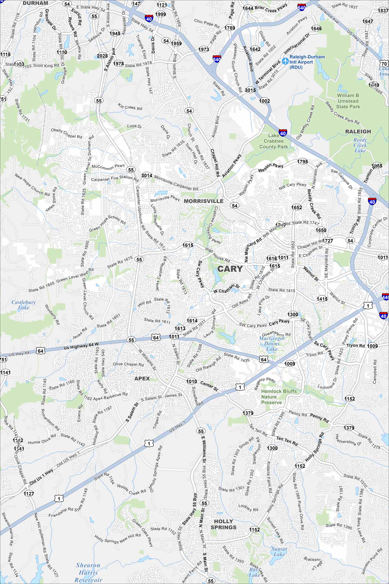
Cary is one of the fastest-growing cities in the Research Triangle. Growth has come quickly here because of its prime location. Our map shows lakes, parks, and neighborhoods that link to nearby Raleigh.
Map Information
On the Map
Interstates/Highways: I-40, State Rte 540, State Rte 54, State Rte 55, US Hwy 1, US Hwy 64 Major Roads: Cary Pkwy, Maynard Rd, Harrison Ave, Chatham St, Davis Dr, High House Rd, Kildaire Farm Rd, Tryon Rd, Penny Rd, Holly Springs Rd, Ten Ten Rd, Aviation Pkwy, Airport Blvd, Evans Rd, Morrisville Carpenter Rd, Weston Pkwy, Chapel Hill Rd, Walnut St, Piney Plains Rd, Regency Pkwy Airports: Raleigh-Durham Intl Airport (RDU) Lakes and Reservoirs: Lake Crabtree, Bond Lake, MacGregor Downs Lake, Lochmere Lake, Sunset Lake, Bass Lake, Shearon Harris Reservoir Parks and Preserves: William B Umstead State Park, Hemlock Bluffs Nature Preserve Nearby Communities: Morrisville, Raleigh, Apex, Holly SpringsNorth Carolina State Maps
Get to know the mountains and coastlines of North Carolina.


City Maps of North Carolina
Journey through North Carolina with our city maps


