Capitol Reef National Park Map
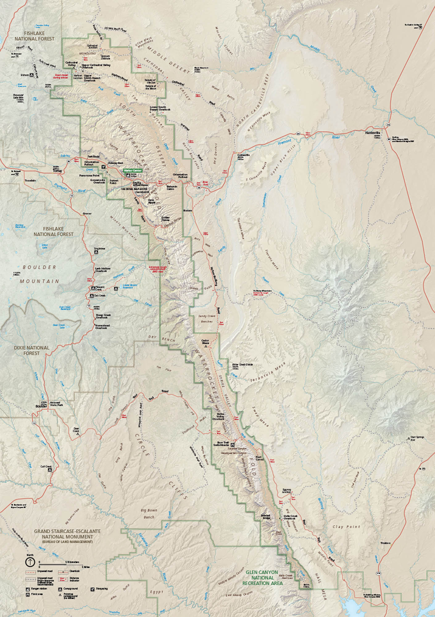
Capitol Reef National Park cuts across central Utah with canyons, domes, and orchards at the Waterpocket Fold. Our map outlines roads, trailheads, and scenic drives.
Map Information
On the Map
Highways/Roads: US Hwy 24, State Rte 12, State Rte 24, Notom-Bullfrog Rd, Burr Trail Rd, Cathedral Valley Rd, Hartnet Rd Rivers and Creeks: Fremont River, Muddy Creek, Sulphur Creek, Hall Creek, Pleasant Creek Parks: Capitol Reef National Park, Fishlake National Forest, Dixie National Forest, Grand Staircase-Escalante National Monument, Glen Canyon National Recreation Area Visitor Centers: Capitol Reef Visitor Center Cities/Towns: Torrey, Fruita, Hanksville, Caineville, Grover, Notom Campgrounds/Park Specific sites: Fruita Campground, Cedar Mesa Campground, Cathedral Valley Campground, Hickman Bridge, Cassidy Arch, Grand Wash, Capitol Gorge, Waterpocket Fold, Strike Valley Overlook, Pectols Pyramid Others: Waterpocket Fold, Cathedral Valley, Middle Desert, South Desert, North Caineville Reef, Tarantula Mesa, Swap Mesa, Big Bown BenchNational Park Maps
Find maps of green spaces and national parks near you.


