Canyonlands National Park Map
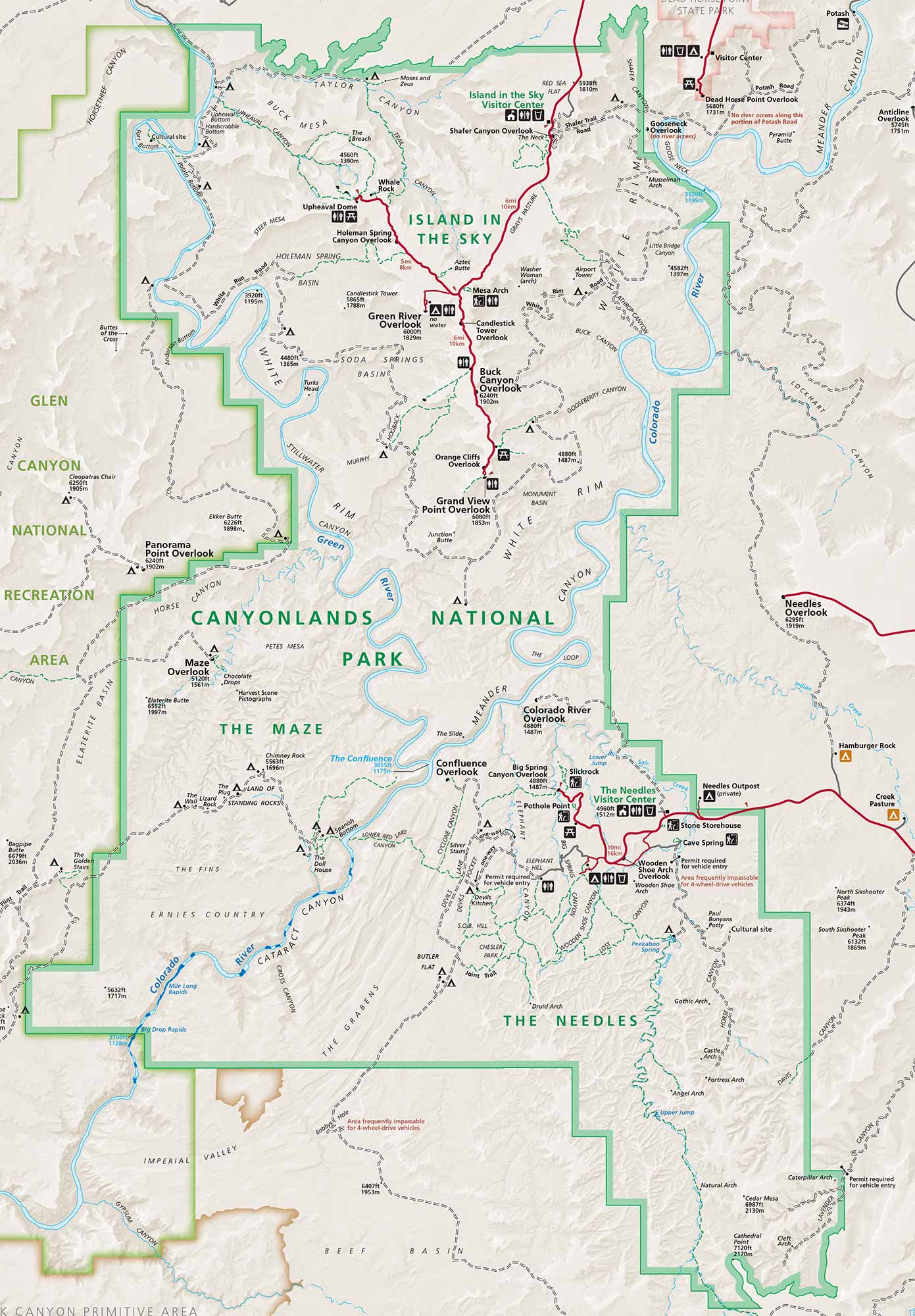
Canyonlands spreads across southeastern Utah. Our Canyonlands National Park map shows roads, overlooks, trails, backcountry routes, and topographic features.
Map Information
On the Map
Visitor Centers: Island in the Sky Visitor Center, Needles Visitor Center Parks: Canyonlands National Park, Dead Horse Point State Park, Glen Canyon National Recreation Area Rivers/Canyons: Green River, Colorado River, Stillwater Canyon, Cataract Canyon, Meander Canyon Cities/Towns: Moab, Monticello Campgrounds/Park Sites: Willow Flat Campground, Squaw Flat Campground, Upheaval Dome, Mesa Arch, Green River Overlook, Grand View Point Overlook, The Maze, The Needles, Island in the Sky, Druid Arch, Confluence Overlook, Angel Arch Other Landmarks: Upheaval Canyon, Taylor Canyon, Buck Canyon, Lathrop Canyon, Monument Basin, Horse Canyon, Chesler Park, The Grabens, Devils Kitchen, Elephant HillNational Park Maps
Find maps of green spaces and national parks near you.


