Bryce Canyon National Park Map
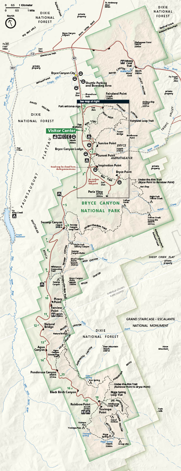
Brace yourself for a skyline of hoodoos. Bryce Canyon sits in southern Utah, carved into bright amphitheaters filled with tall sandstone spires. Our park map includes viewpoints, roads, and trails.
Map Information
On the Map
Major Roads: State Rte 12, State Rte 63 Rivers/Lakes/Bays/Reservoirs/Oceans: Paria River, Tropic Ditch, Yellow Creek, Iron Spring Parks: Bryce Canyon National Park, Dixie National Forest, Grand Staircase-Escalante National Monument Cities/Towns: Bryce Canyon City, Tropic, Cannonville Campgrounds/Park Sites: North Campground, Sunset Campground, Bryce Canyon Lodge, Sunrise Point, Sunset Point, Inspiration Point, Bryce Point, Rainbow Point, Yovimpa Point, Natural Bridge, Agua Canyon, Farview Point Other Landmarks: Paunsaugunt Plateau, Under-the-Rim Trail, Fairyland Loop TrailNational Park Maps
Find maps of green spaces and national parks near you.


