Map of Bradenton, Florida
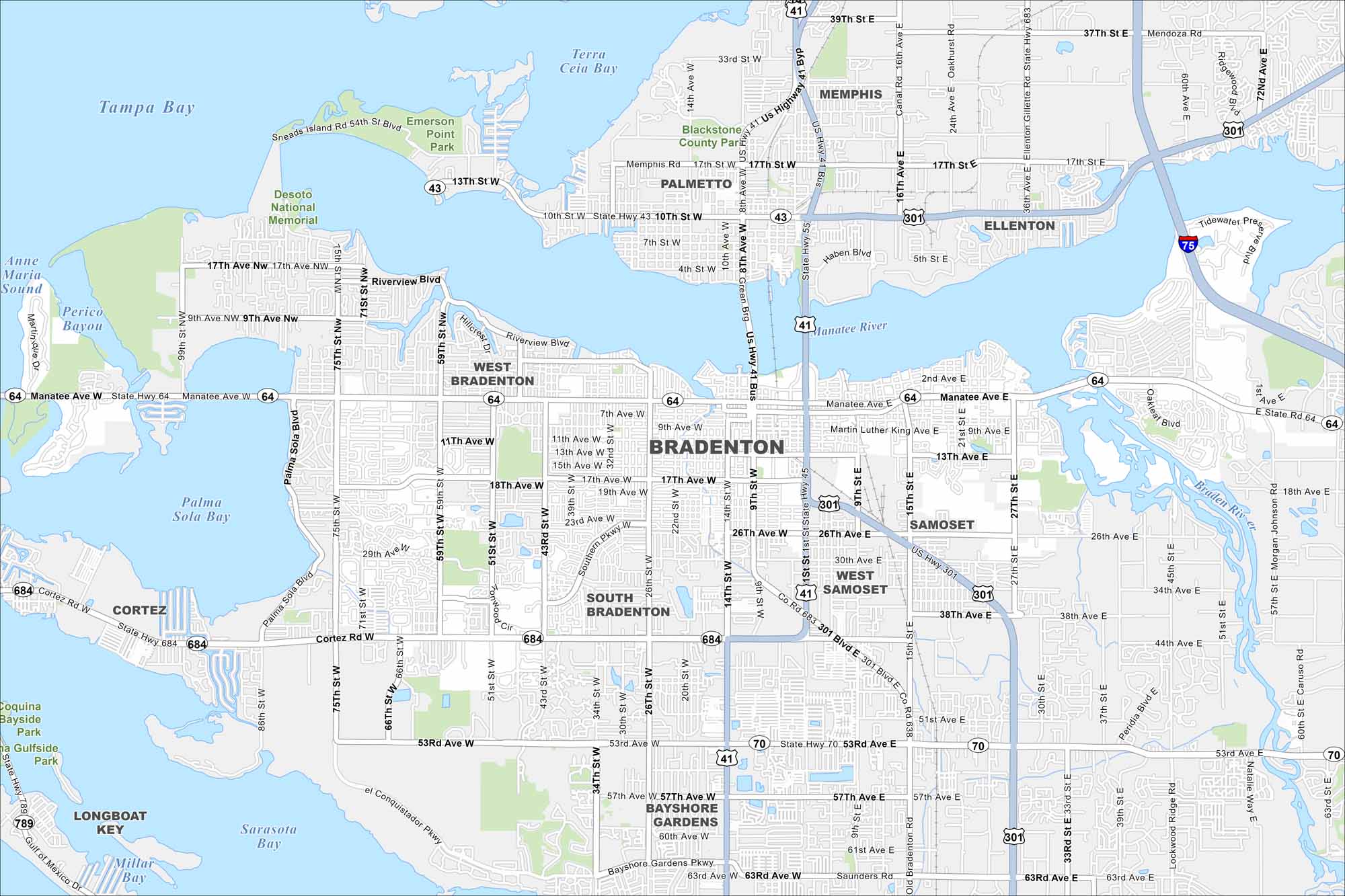
Explore Bradenton on our map where the Manatee River meets the Gulf. The waterfront is its center but beaches sit just beyond. Parks and historic areas add to its character.
Florida State Maps
Discover Florida through our state maps


Map Information
On the Map
Interstates/Highways: I-75, US Hwy 41, US Hwy 301, State Rte 64, State Rte 70, State Rte 683, State Rte 684 Major Roads: Manatee Ave W, Manatee Ave E, Cortez Rd W, 53rd Ave W, 53rd Ave E, 1st St, 9th St W, 14th St W, 26th St W, 34th St W, 43rd St W, 51st St W, 59th St W, 75th St W, Riverview Blvd, 17th Ave NW, 9th Ave NW, 63rd Ave E, Morgan Johnson Rd, 27th St E Lakes and Reservoirs: Tampa Bay, Palma Sola Bay, Sarasota Bay, Perico Bayou, Anna Maria Sound Major Rivers: Manatee River, Braden River Parks and Preserves: Emerson Point Park, De Soto National Memorial, Blackstone County Park Nearby Communities: Palmetto, West Bradenton, South Bradenton, Bayshore Gardens, Ellenton, Memphis, Samoset, West Samoset, Cortez, Longboat KeyFlorida City Maps
Chart your course through Miami and Florida’s cities


