Map of Boone, North Carolina
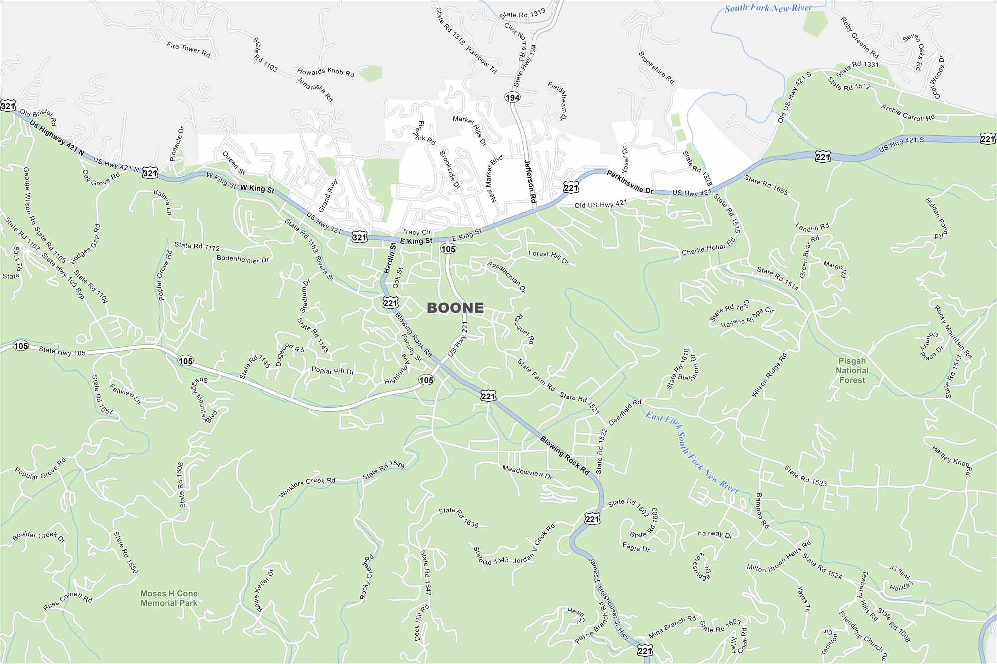
Discover Boone with our map in the Blue Ridge Mountains. It’s a college town but also a center for outdoor recreation. Scenic roads and trails define the area.
Map Information
On the Map
Interstates/Highways: US Hwy 421, US Hwy 321, US Hwy 221, State Rte 105, State Rte 194 Major Roads: King St, Blowing Rock Rd, State Farm Rd, Poplar Hill Dr, Faculty St, Highland Ave, Winklers Creek Rd, Rivers St, Bodenheimer Dr, Poplar Grove Rd, Stadium Dr, Hardin St, Junaluska Rd, Rainbow Trl, Jefferson Rd, Perkinsville Dr, Bamboo Rd, Deerfield Rd, Old US Hwy 421, Payne Branch Rd Lakes and Reservoirs: Hidden Pond Major Rivers: South Fork New River, East Fork South Fork New River Parks and Preserves: Pisgah National Forest, Moses H Cone Memorial ParkNorth Carolina State Maps
Get to know the mountains and coastlines of North Carolina.


City Maps of North Carolina
Journey through North Carolina with our city maps


