Map of Bonita Springs, Florida
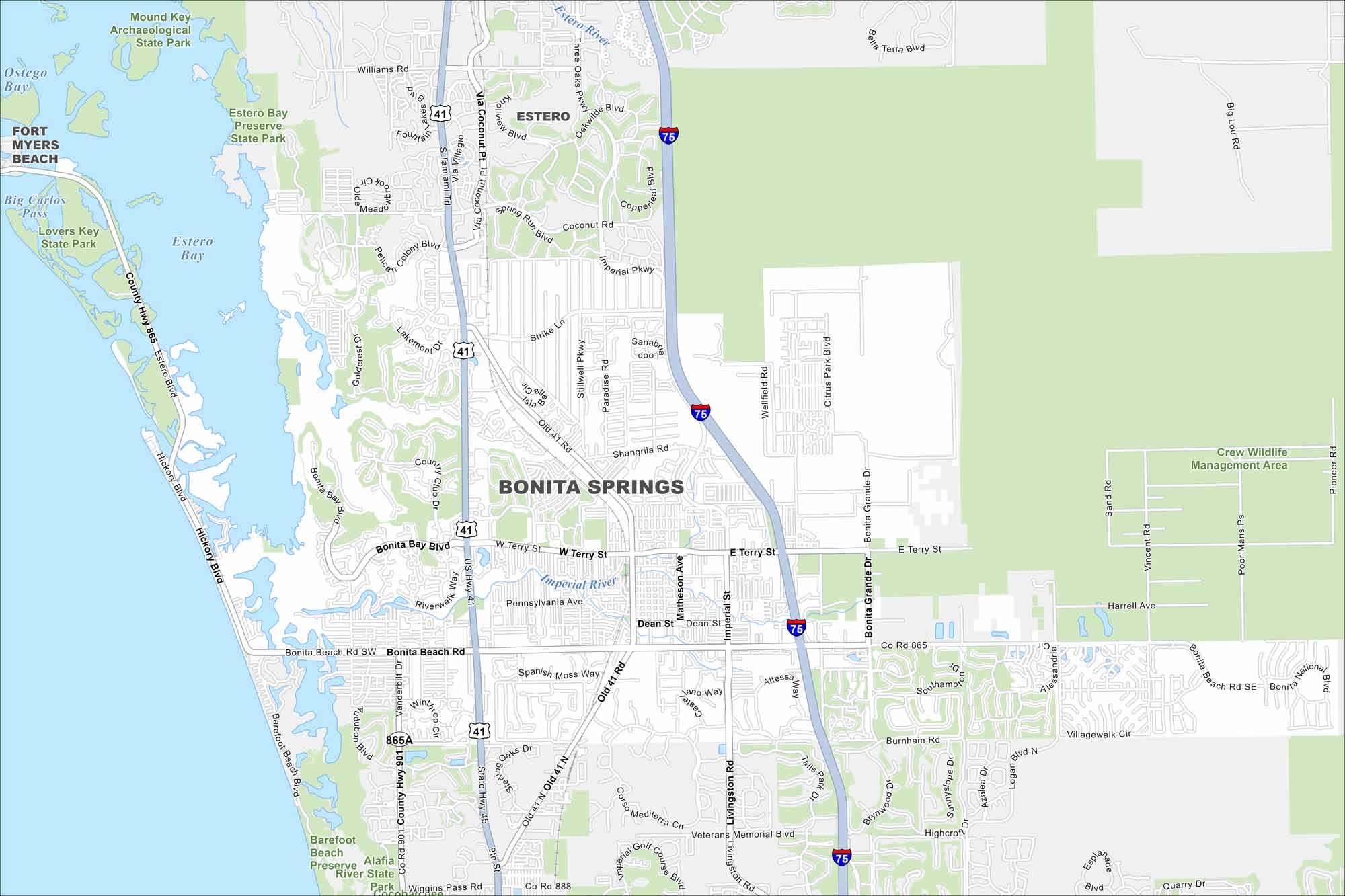
Explore Bonita Springs on our map along Florida’s Gulf Coast. Beaches and waterways are its highlights. The city is popular because of its warm climate and resort feel.
Florida State Maps
Discover Florida through our state maps


Map Information
On the Map
Interstates/Highways: I-75, US Hwy 41, Imperial Pkwy Major Roads: Tamiami Trl, Bonita Beach Rd, Terry St, Old 41 Rd, Livingston Rd, Veterans Memorial Blvd, Coconut Rd, Shangrila Rd, Pennsylvania Ave, Dean St, Strike Ln, Paradise Rd, Stillwell Pkwy, Sanabria Loop, Imperial St, Matheson Ave, Terry St Airports: Lakes and Reservoirs: Estero Bay, Big Carlos Pass Major Rivers: Estero River, Imperial River Parks and Preserves: Estero Bay Preserve State Park, Lovers Key State Park, Mound Key Archaeological State Park, Crew Wildlife Management Area, Barefoot Beach Preserve, Alafia River State Park Nearby Communities: Fort Myers Beach, EsteroFlorida City Maps
Chart your course through Miami and Florida’s cities


