Map of Boca Raton, Florida
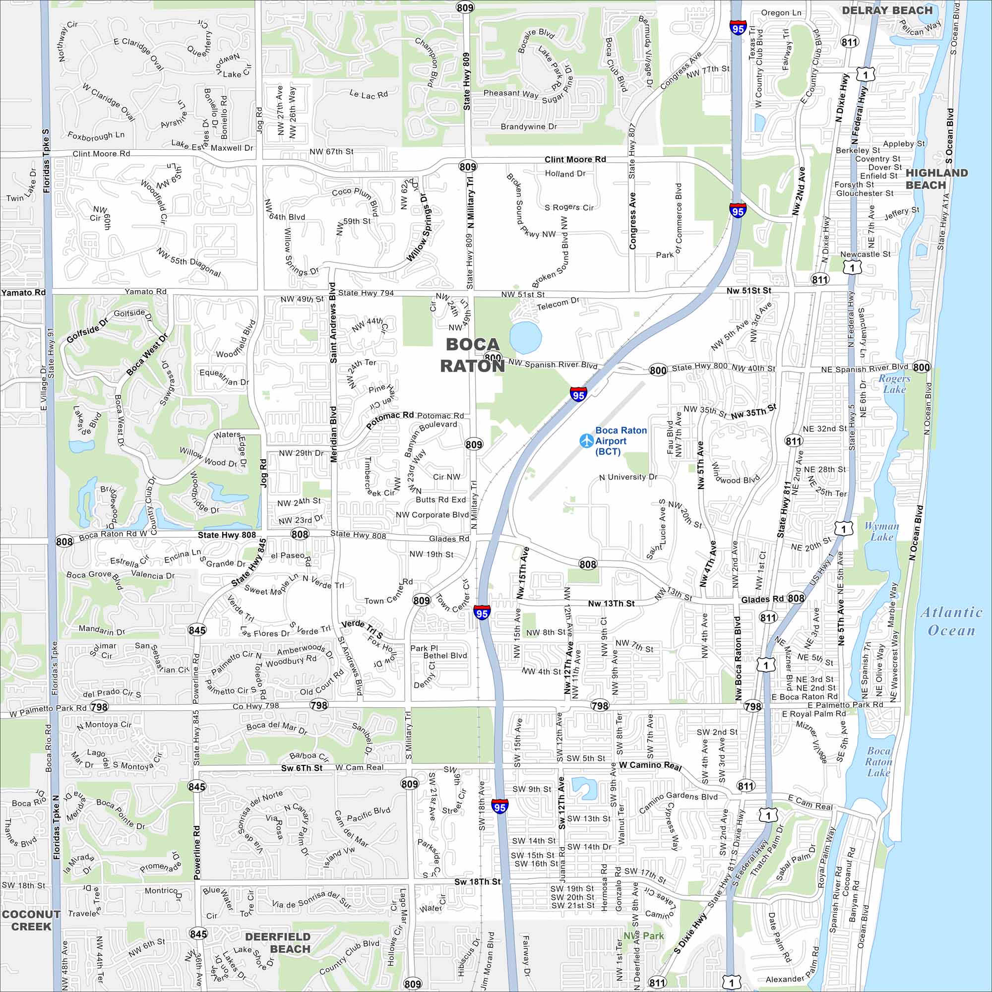
Our map of Boca Raton, Florida lays out the highways, streets, and waterways. Roads stretch along the Atlantic coast. Boca Raton is famous for its beaches and luxury living.
Florida State Maps
Discover Florida through our state maps


Map Information
On the Map
Interstates/Highways: I-95, US Hwy 1, State Hwy 808, State Hwy 809, State Hwy 794, State Hwy 811, State Hwy A1A, Federal Hwy Major Roads: Glades Rd, Military Trl, Congress Ave, Yamato Rd, Palmetto Park Rd, State Hwy 7, Dixie Hwy, Jog Rd, St. Andrews Blvd, Spanish River Blvd, Powerline Rd, Camino Real, Clint Moore Rd, Rogers Cir, NW 51st St, NW 40th St, NW 20th St Airports: Boca Raton Airport (BCT) Lakes and Reservoirs: Atlantic Ocean, Boca Raton Lake, Rogers Lake, Wyman Lake Nearby Communities: Delray Beach, Highland Beach, Deerfield Beach, Coconut CreekFlorida City Maps
Chart your course through Miami and Florida’s cities


