Map of Binghamton, New York
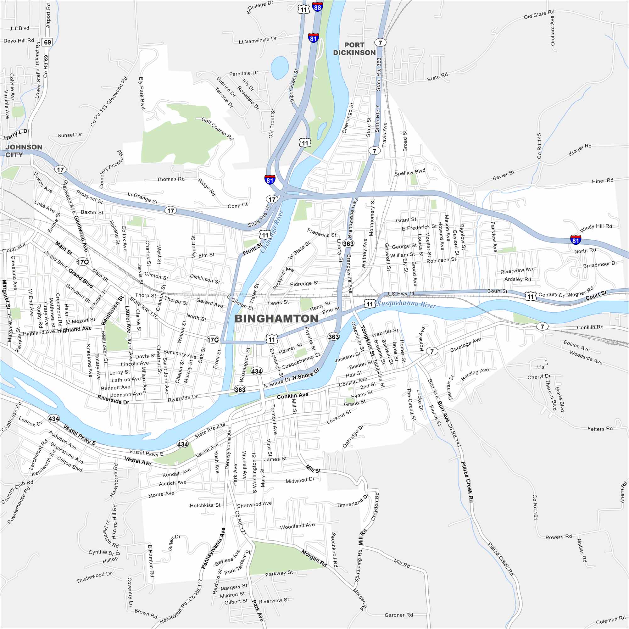
Check out Binghamton with our map in southern New York. Streets follow the Susquehanna and Chenango Rivers. It has long been called the “Carousel Capital of the World”.
Map Information
On the Map
Interstates/Highways: I-81, I-88, US Hwy 11, State Rte 17, State Rte 7, State Rte 363, State Rte 434 Major Roads: Main St, Court St, Front St, Chenango St, Riverside Dr, Vestal Pkwy, Conklin Ave, Pennsylvania Ave, Washington St, State St, Brandywine Hwy, Glenwood Ave, Airport Rd, Robinson St, Bevier St, Morgan Rd, Mill St, Clinton St, Susquehanna St, Exchange St Major Rivers: Susquehanna River, Chenango River Nearby Communities: Port Dickinson, Johnson CityNew York State Maps
Find state maps of the Empire State.


City Maps of New York
Here are the city maps that define New York


