Map of Bay City, Michigan
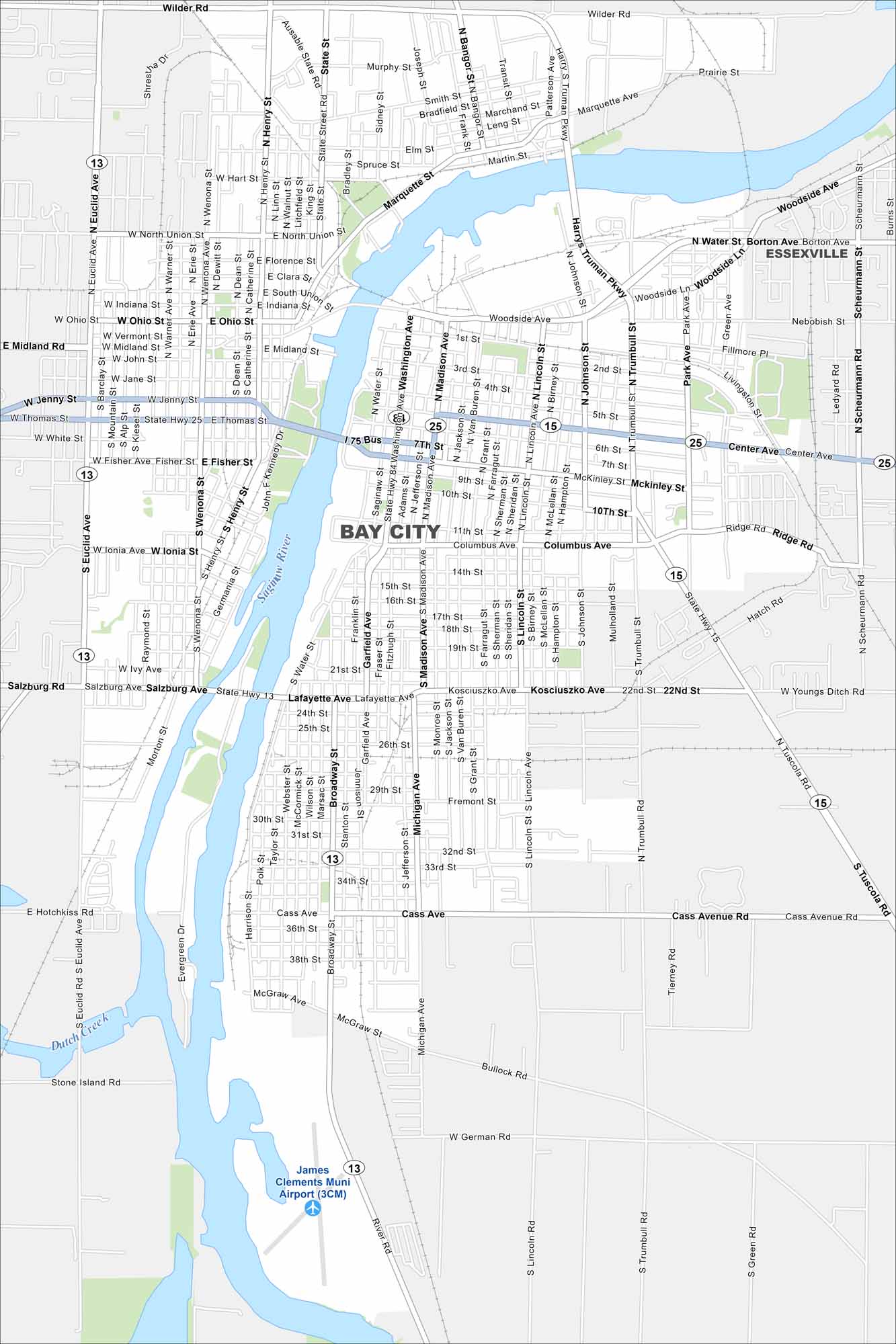
See the streets of Bay City, located on Lake Huron’s Saginaw Bay. Explore its waterfront and historic districts. Our map shows its waterfront, bridges, and streets.
Map Information
On the Map
Interstates/Highways: State Rte 13, State Rte 15, State Rte 25 Major Roads: Center Ave, Broadway St, Cass Ave, Lafayette Ave, Madison Ave, Washington Ave, Michigan Ave, Henry St, Euclid Ave, Wilder Rd, Woodside Ave, Salzburg Rd, Bullock Rd, Trumbull St, Johnson St, Lincoln St, Wenona Ave, Jenny St, Thomas St, Fisher Ave Airports: James Clements Muni Airport (3CM) Major Rivers: Saginaw River, Dutch Creek Nearby Communities: EssexvilleMichigan State Maps
Get to know Michigan with our detailed maps


City Maps of Michigan
Check out our maps of Detroit and other cities in Michigan


