Map of Battle Creek, Michigan
Get a snapshot of Battle Creek with our map. Battle Creek is in southwest Michigan where rivers and rail lines meet. The city is known as the “Cereal Capital of the World” because it’s home to Kellogg’s.
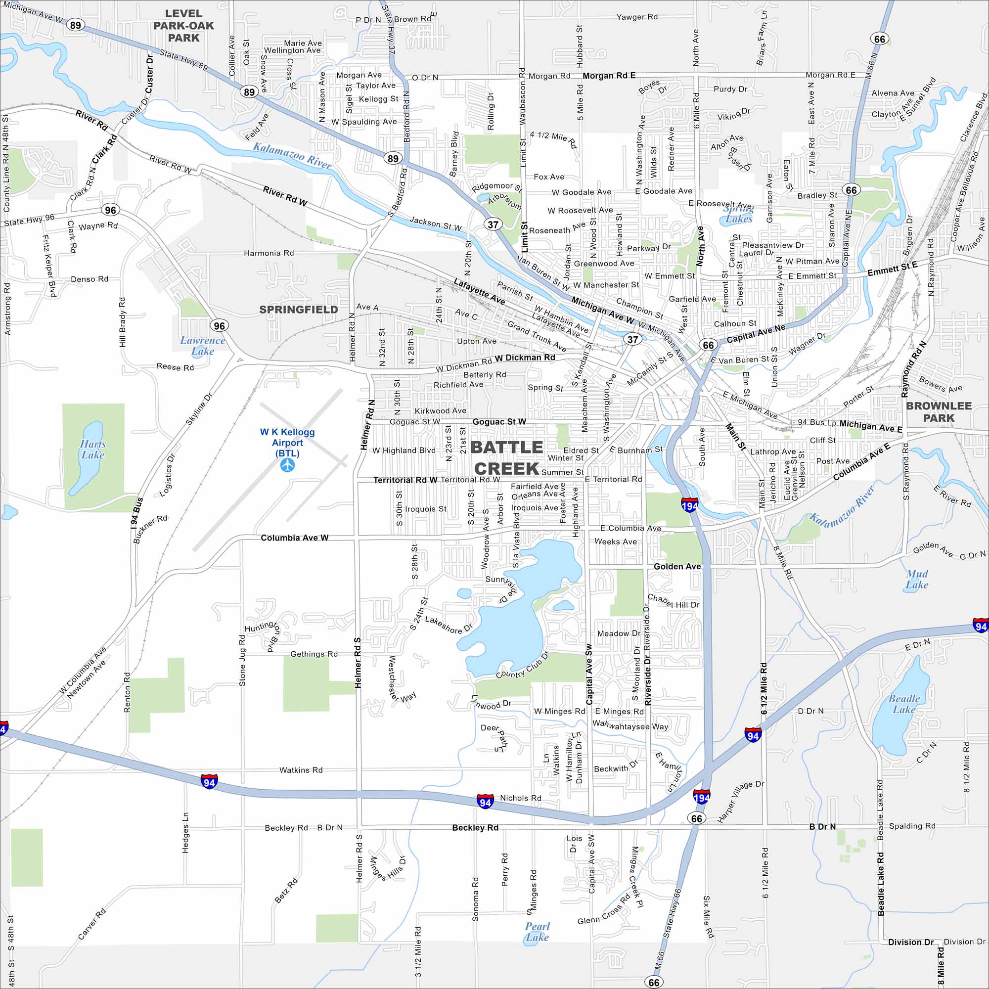
Map Information
On the Map
Interstates/Highways: I-94, I-194, State Rte 37, State Rte 66, State Rte 89, State Rte 96 Major Roads: Columbia Ave, Michigan Ave, Capital Ave, Dickman Rd, Helmer Rd, Territorial Rd, Main St, Beadle Lake Rd, Goguac St, Skyline Dr, Minges Rd, Beckley Rd, Riverside Dr, Emmett St, North Ave, Watkins Rd, Morgan Rd, Goodale Ave, North Ave, Washington Ave Airports: W K Kellogg Airport (BTL) Lakes and Reservoirs: Goguac Lake, Beadle Lake, Harts Lake, Lawrence Lake, St Marys Lake, Spring Lakes, Mud Lake, Pearl Lake Major Rivers: Kalamazoo River Nearby Communities: Springfield, Level Park-Oak Park, Brownlee ParkMichigan State Maps
Get to know Michigan with our detailed maps


City Maps of Michigan
Check out our maps of Detroit and other cities in Michigan


