Map of Asheville, North Carolina
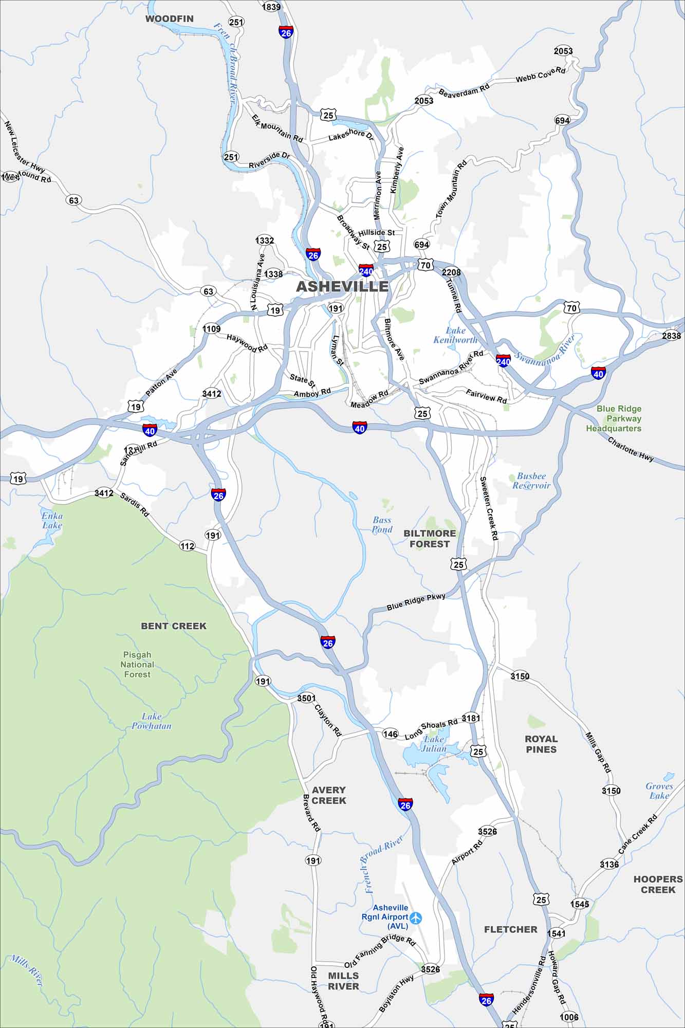
Asheville is mapped with its highways, streets, and riverside routes. Roads wind here because the city sits in the Blue Ridge Mountains. Asheville is known for the Biltmore Estate and mountain scenery.
Map Information
On the Map
Interstates/Highways: I-26, I-40, I-240, US Hwy 19, US Hwy 23, US Hwy 25, US Hwy 70 Major Roads: Patton Ave, Hendersonville Rd, Biltmore Ave, Merrimon Ave, Tunnel Rd, Airport Rd, Riverside Dr, Broadway St, Haywood Rd, Sardis Rd, Brevard Rd, Long Shoals Rd, Old Fanning Bridge Rd, Boylston Hwy, Old Haywood Rd, Charlotte Hwy, Sweeten Creek Rd, Elk Mountain Rd, Webb Cove Rd, Kimberly Ave Airports: Asheville Rgnl Airport (AVL) Lakes and Reservoirs: Lake Julian, Busbee Reservoir, Lake Kenilworth, Lake Powhatan, Bass Pond Major Rivers: French Broad River, Swannanoa River Parks and Preserves: Pisgah National Forest Nearby Communities: Woodfin, Biltmore Forest, Royal Pines, Avery Creek, Bent Creek, Fletcher, Mills River, Hoopers CreekNorth Carolina State Maps
Get to know the mountains and coastlines of North Carolina.


City Maps of North Carolina
Journey through North Carolina with our city maps


