Map of Apopka, Florida
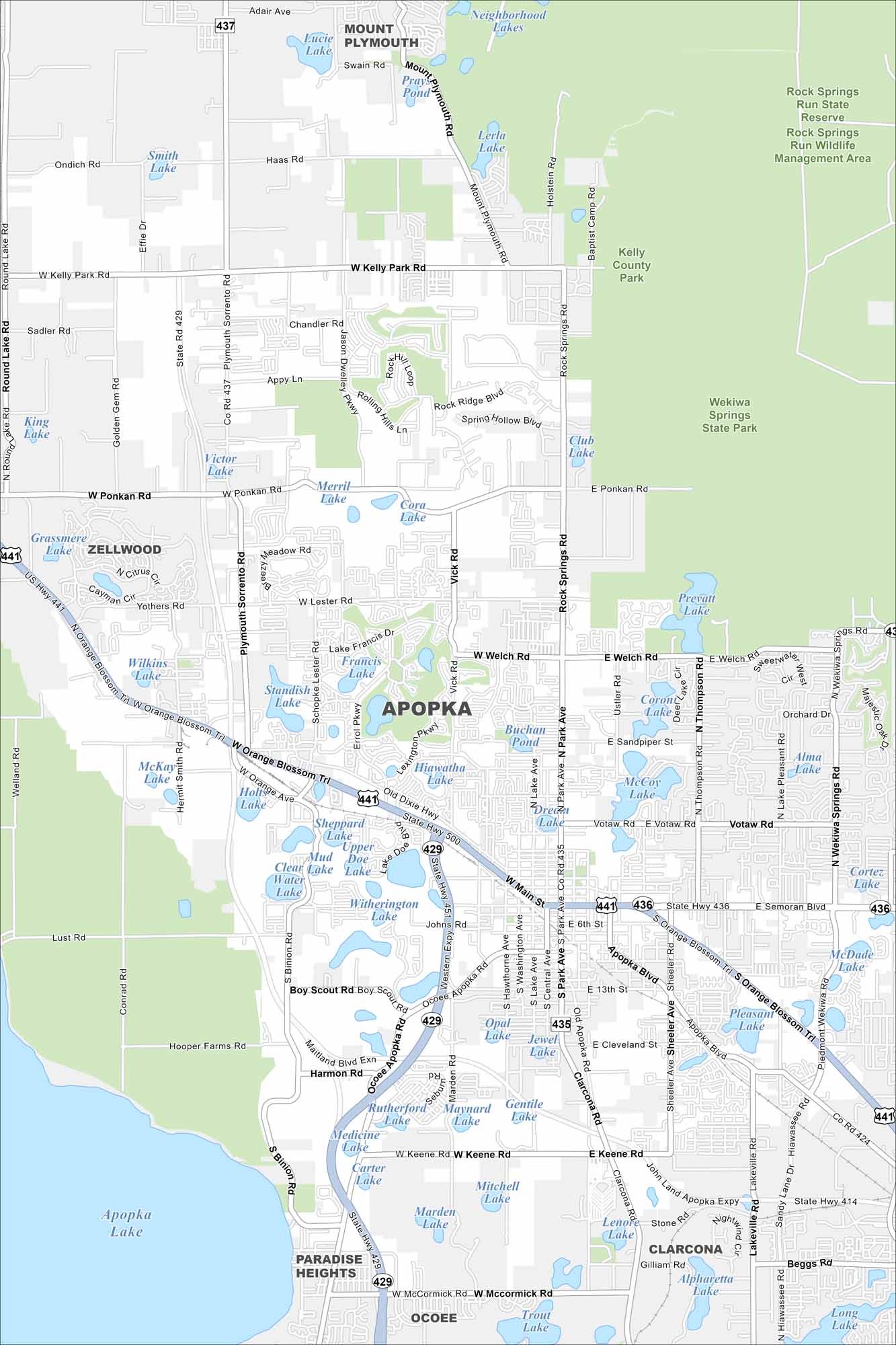
Here is a map of Apopka with its highways, state parks, and surrounding lakes. Apopka is called the “Indoor Foliage Capital of the World”. Why? Well, it’s because of its indoor greenhouses.
Florida State Maps
Discover Florida through our state maps


Map Information
On the Map
Interstates/Highways: State Hwy 429, US Hwy 441, State Hwy 414, State Hwy 451 Major Roads: Main St, Rock Springs Rd, W Kelly Park Rd, Ponkan Rd, Plymouth Sorrento Rd, Keene Rd, Ocoee Apopka Rd, Clarcona Rd, McCormick Rd, Sheeler Ave, Votaw Rd, Welch Rd, Binion Rd, Conrad Rd, Golden Gem Rd, Round Lake Rd Lakes and Reservoirs: Apopka Lake, Smith Lake, Lake Francis, Standish Lake, Hiawatha Lake, Dream Lake, McCoy Lake, Corona Lake, Prevatt Lake, Club Lake, Lerla Lake, Lake Lucie, Mud Lake, Clear Lake, Water Lake, Witherington Lake, Johns Lake, Opal Lake Parks and Preserves: Wekiwa Springs State Park, Rock Springs Run State Reserve, Rock Springs Run Wildlife Management Area, Kelly County Park, Northwest Recreation Complex Nearby Communities: Mount Plymouth, Zellwood, Paradise Heights, Ocoee, ClarconaFlorida City Maps
Chart your course through Miami and Florida’s cities


