Map of Apex, North Carolina
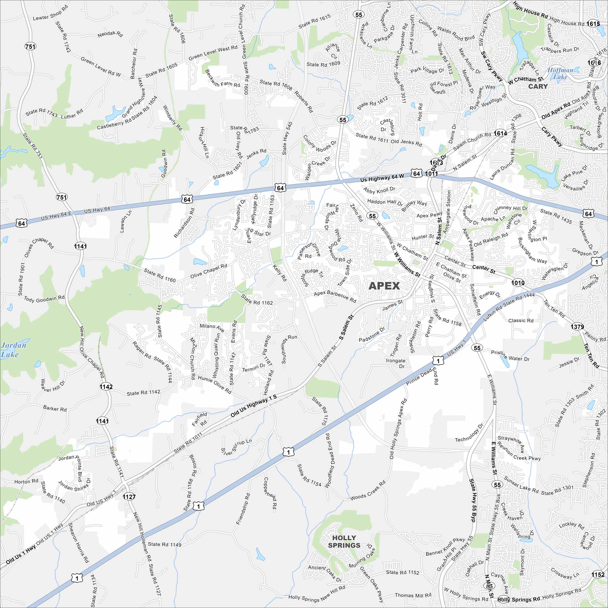
Our map of Apex shows its highways, rivers, and parks. Roads tie into Raleigh not too far away. Apex is also part of the Research Triangle.
Map Information
On the Map
Interstates/Highways: US Hwy 64, US Hwy 1, US Hwy 64 W, US Hwy 64 E, State Rte 540, State Rte 55 Major Roads: Salem St, Williams St, Davis Dr, Olive Chapel Rd, Richardson Rd, Roberts Rd, Jenks Rd, Green Level West Rd, Ten Ten Rd, Humie Olive Rd, New Hill Holleman Rd, Kelly Rd, Apex Barbecue Rd, Tingen Rd, Schieffelin Rd, James St, Hunter St, Center St, Old Raleigh Rd, Laura Duncan Rd Lakes and Reservoirs: Jordan Lake, Castlebury Lake Nearby Communities: Apex, Cary, Holly SpringsNorth Carolina State Maps
Get to know the mountains and coastlines of North Carolina.


City Maps of North Carolina
Journey through North Carolina with our city maps


