Map of Ann Arbor, Michigan
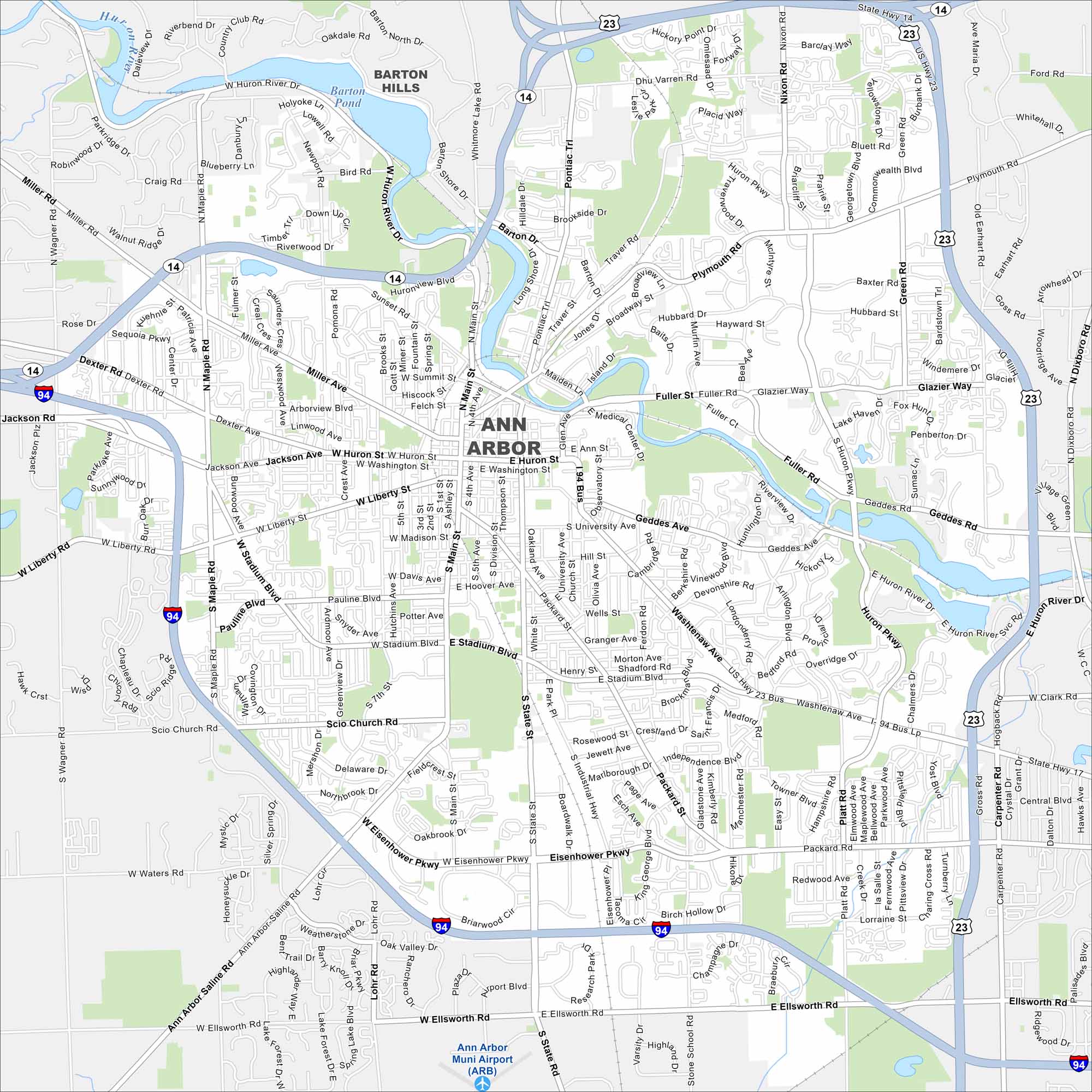
Get to know Ann Arbor with our road map. The Huron River winds through with residential development along its banks. Ann Arbor is also home to the University of Michigan.
Map Information
On the Map
Interstates/Highways: I-94, US Hwy 23, State Rte 14 Major Roads: Washtenaw Ave, Main St, State St, Stadium Blvd, Huron St, Eisenhower Pkwy, Jackson Rd, Packard Rd, Plymouth Rd, Geddes Ave, Fuller St, Miller Ave, Liberty St, Scio Church Rd, Ellsworth Rd, Broadway St, Ann Arbor-Saline Rd, Nixon Rd, Green Rd, Newport Rd Airports: Ann Arbor Muni Airport (ARB) Lakes and Reservoirs: Barton Pond Major Rivers: Huron River Nearby Communities: Barton HillsMichigan State Maps
Get to know Michigan with our detailed maps


City Maps of Michigan
Check out our maps of Detroit and other cities in Michigan


