Map of Wake Forest, North Carolina
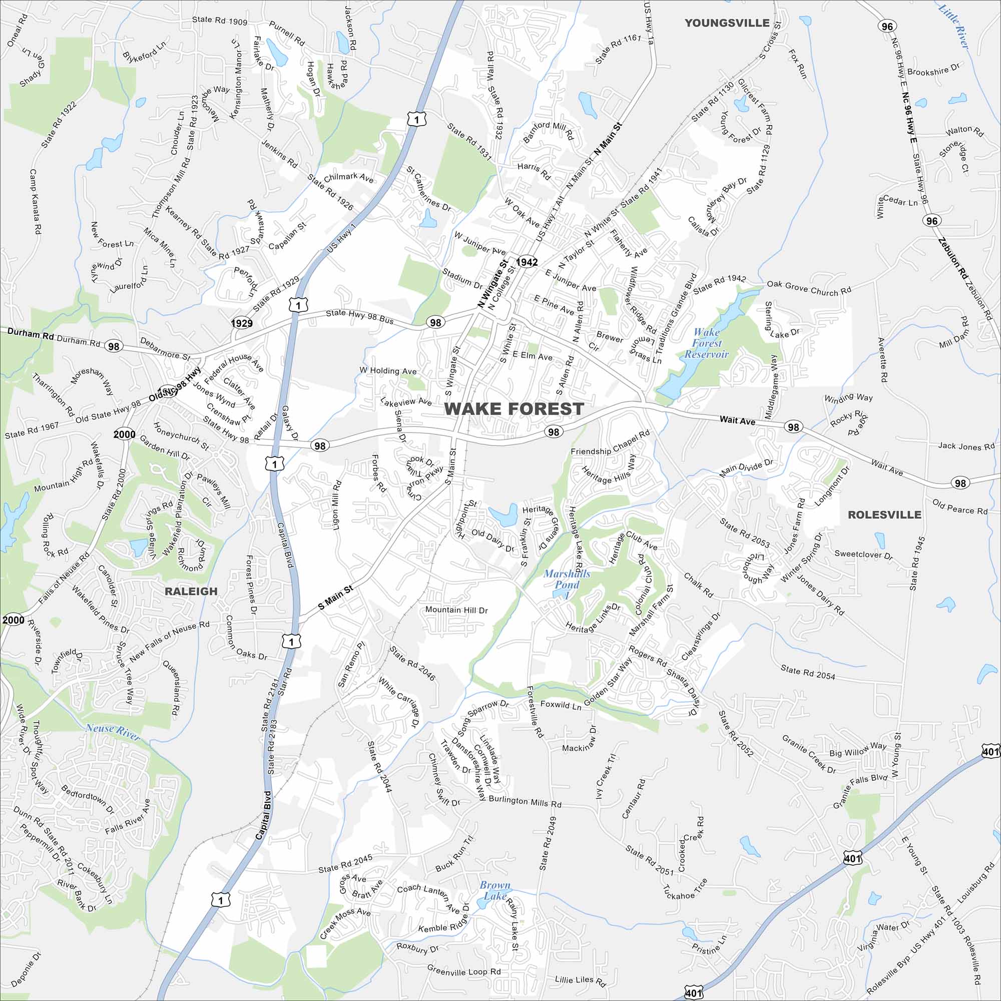
Check out Wake Forest, a fast-growing town north of Raleigh. Our map highlights historic streets, neighborhoods, and nearby greenways.
Map Information
On the Map
Interstates/Highways: US Hwy 1, US Hwy 401, State Hwy 98, State Hwy 98 Bus, State Rte 96 Major Roads: Capital Blvd, Main St, Wait Ave, Durham Rd, White St, Holding Ave, Stadium Dr, Rogers Rd, Heritage Lake Rd, Forestville Rd, Burlington Mills Rd, Purnell Rd, Jenkins Rd, Falls River Ave, Falls of Neuse Rd, Ligon Mill Rd, South Main St, Chalk Rd, Jones Dairy Rd, Zebulon Rd Lakes and Reservoirs: Wake Forest Reservoir, Marshalls Pond, Brown Lake, Rainy Lake Major Rivers: Neuse River, Little River Nearby Communities: Youngsville, Rolesville, RaleighNorth Carolina State Maps
Get to know the mountains and coastlines of North Carolina.


City Maps of North Carolina
Journey through North Carolina with our city maps


