Map of Albany, New York
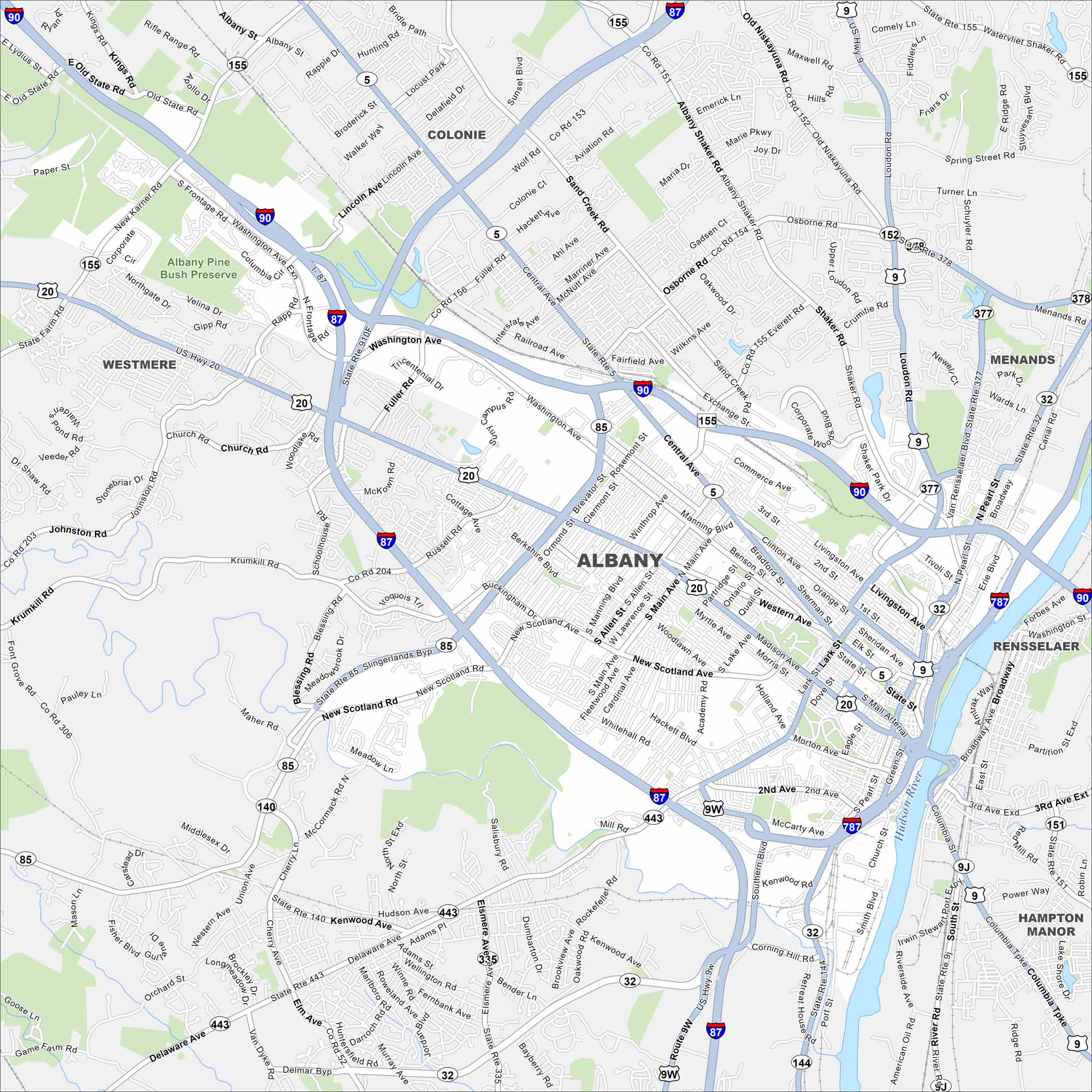
Our map of Albany lays out this historic city on the Hudson River. As New York’s capital, it’s known for its government buildings, old neighborhoods, and riverfront views.
Map Information
On the Map
Interstates/Highways: I-87, I-90, I-787, US Hwy 20, US Hwy 9W, State Rte 5, State Rte 32, State Rte 85, State Rte 443, State Rte 155, State Rte 377, State Rte 378, State Rte 140 Major Roads: Central Ave, Washington Ave, Western Ave, New Scotland Ave, Delaware Ave, Madison Ave, Broadway, Clinton Ave, Northern Blvd, Lark St, Manning Blvd, Henry Johnson Blvd, Rapp Rd, Fuller Rd, Wolf Rd, Everett Rd, Watervliet Shaker Rd, Osborne Rd, Loudon Rd, Northern Blvd Major Rivers: Hudson River Parks and Preserves: Albany Pine Bush Preserve Nearby Communities: Colonie, Westmere, Menands, Rensselaer, Hampton ManorNew York State Maps
Find state maps of the Empire State.


City Maps of New York
Here are the city maps that define New York


