Map of Apache Junction, Arizona
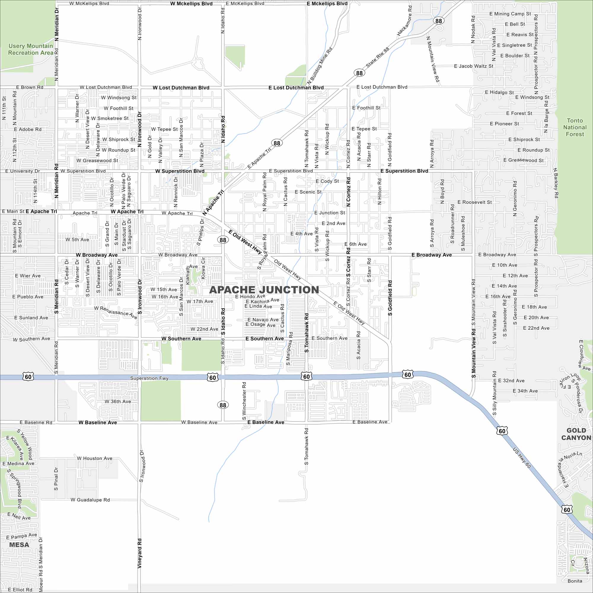
See the highways, forests, and desert surroundings. Our map of Apache Junction displays its road and locations near the Superstition Mountains. The city has rugged scenery and Old West feel.
Arizona State Maps
Check out our Arizona state maps we’ve put together


Map Information
On the Map
Interstates/Highways: US Route 60 (Superstition Freeway), State Route 88 (Apache Trail), Old West Highway Major Roads: Ironwood Dr, Idaho Rd, Tomahawk Rd, Goldfield Rd, Meridian Rd, Superstition Blvd, Broadway Ave, Southern Ave, Baseline Ave, Guadalupe Rd, Elliot Rd, McKellips Blvd, Brown Rd, Lost Dutchman Blvd, University Dr, Main St, Apache Trl, Vineyard Rd, Houston Ave, Signal Butte Rd Parks/Preserves/Forests: Usery Mountain Recreation Area, Tonto National Forest Nearby Communities: Mesa, Gold CanyonArizona City Maps
Here’s our full batch of Arizona city maps


