Map of Auburn Hills, Michigan
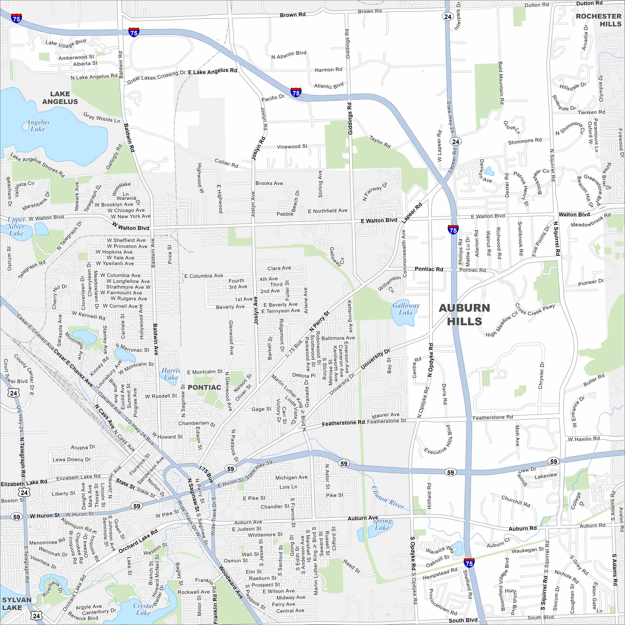
Our map of Auburn Hills shows the highways, streets, and open park spaces. Roads stretch toward the Detroit area. Auburn Hills is home to automakers and the Great Lakes Crossing mall.
Map Information
On the Map
Interstates/Highways: I-75, State Rte 24, State Rte 59 Major Roads: Walton Blvd, University Dr, Lapeer Rd, Opdyke Rd, Pontiac Rd, Featherstone Rd, Auburn Ave, Squirrel Rd, Joslyn Rd, Giddings Rd, Baldwin Rd, Perry St, MLK Jr Blvd, Montcalm St, Columbia Ave, Pike St, Cass Ave, Orchard Lake Rd, Woodward Ave, Brown Rd Lakes and Reservoirs: Angelus Lake, Silver Lake, Galloway Lake, Harris Lake, Crystal Lake, Spring Lake Major Rivers: Clinton River Nearby Communities: Lake Angelus, Pontiac, Rochester Hills, Sylvan LakeMichigan State Maps
Get to know Michigan with our detailed maps


City Maps of Michigan
Check out our maps of Detroit and other cities in Michigan


