Map of Bartow, Florida
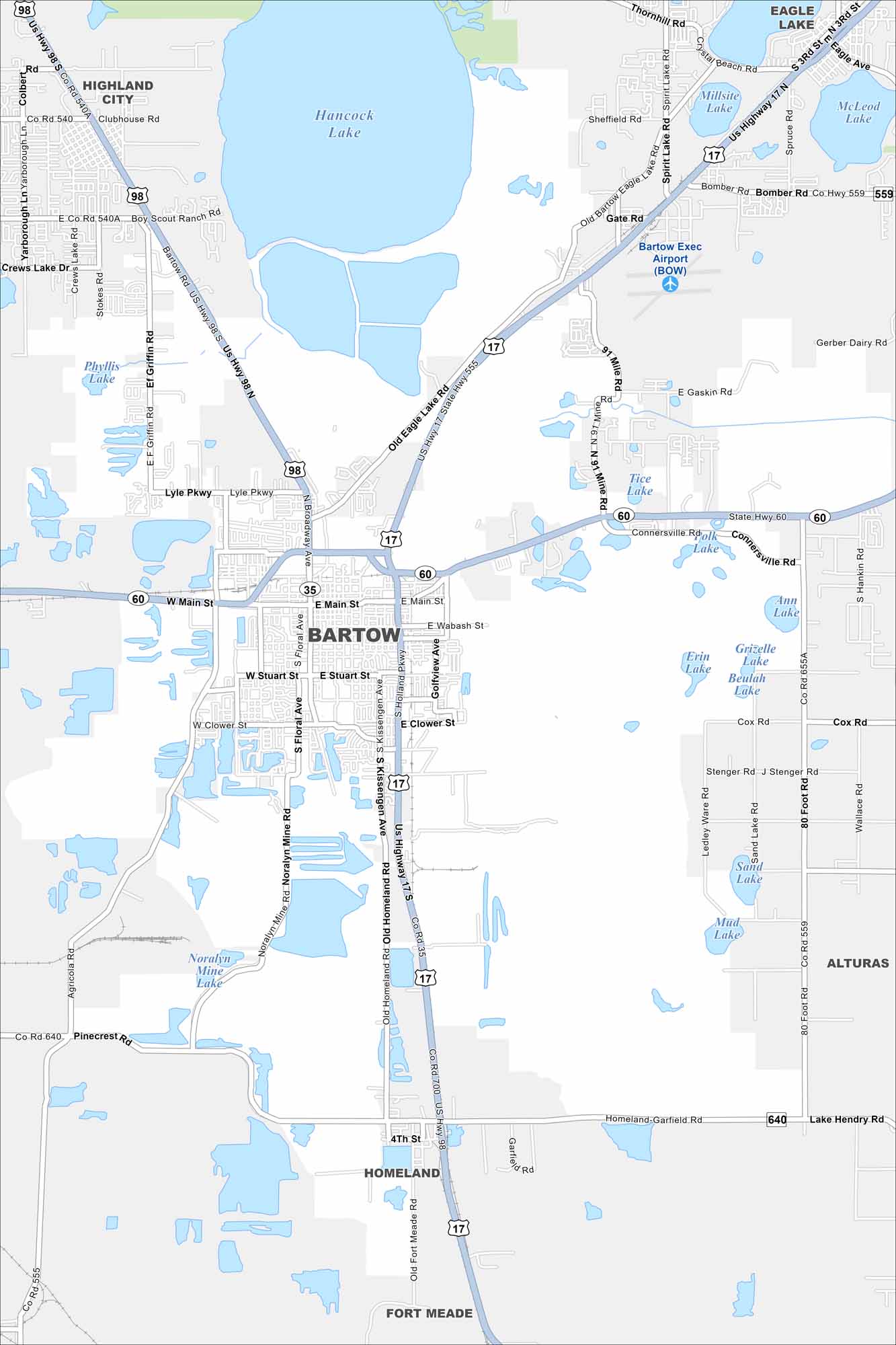
See it here on our map of Bartow, known as the “City of Oaks and Azaleas”. Explore its historic downtown and everything special about this Florida community. Our map of Bartow highlights its streets, lakes, and surroundings.
Florida State Maps
Discover Florida through our state maps


Map Information
On the Map
Interstates/Highways: US Hwy 98, US Hwy 17, State Hwy 60 Major Roads: Main St, Broadway Ave, Floral Ave, Holland Pkwy, Golfview Ave, Van Fleet Dr, Old Eagle Lake Rd, Bomber Rd, E Gaskin Rd, Spirit Lake Rd, Lyle Pkwy, Clower St, Stuart St, Wabash St, Pinecrest Rd, Lake Hendry Rd Airports: Bartow Exec Airport (BOW) Lakes and Reservoirs: Hancock Lake, Phyllis Lake, Tice Lake, Ann Lake, Grizelle Lake, Beulah Lake, Erin Lake, Sand Lake, Mud Lake, Noralyn Mine Lake, Millsite Lake, McLeod Lake Nearby Communities: Highland City, Alturas, Homeland, Fort Meade, Eagle LakeFlorida City Maps
Chart your course through Miami and Florida’s cities


