Map of Buckeye, Arizona
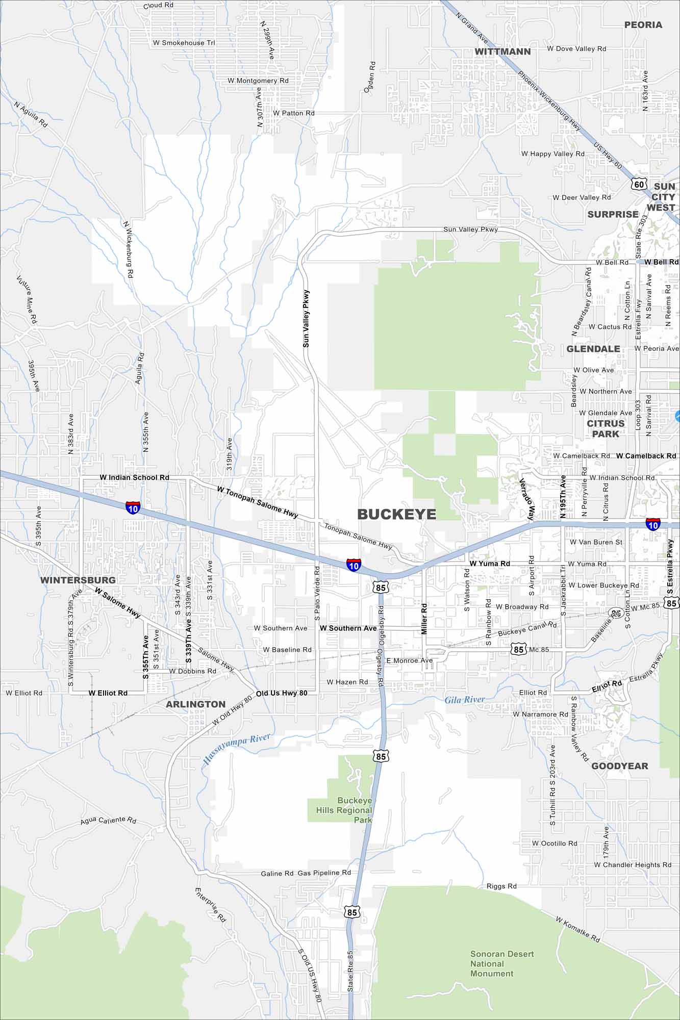
Check out our map of Buckeye, where desert neighborhoods spread west of Phoenix. The White Tank Mountains rise along the edge. It’s a fast-growing city in Arizona because of its open land.
Arizona State Maps
Check out our Arizona state maps we’ve put together


Map Information
On the Map
Interstates/Highways: I-10, State Rte 303 (Loop 303), SR-85, US Hwy 60, Tonopah Salome Hwy, Old Us Hwy 80 Major Roads: Indian School Rd, Sun Valley Pkwy, Watson Rd, Miller Rd, Jackrabbit Trl, Southern Ave, Baseline Rd, Elliot Rd, Yuma Rd, Broadway Rd, Lower Buckeye Rd, MC 85, Rainbow Rd, Airport Rd, Verrado Way, Palo Verde Rd, Oglesby Rd, Hazen Rd, Monroe Ave, Riggs Rd Airports: Buckeye Municipal Airport Rivers and Creeks: Gila River, Hassayampa River Parks/Preserves/Forests: Buckeye Hills Regional Park, Sonoran Desert National Monument Nearby Communities: Wintersburg, Arlington, Goodyear, Glendale, Surprise, WittmannArizona City Maps
Here’s our full batch of Arizona city maps


