Map of Buffalo, New York
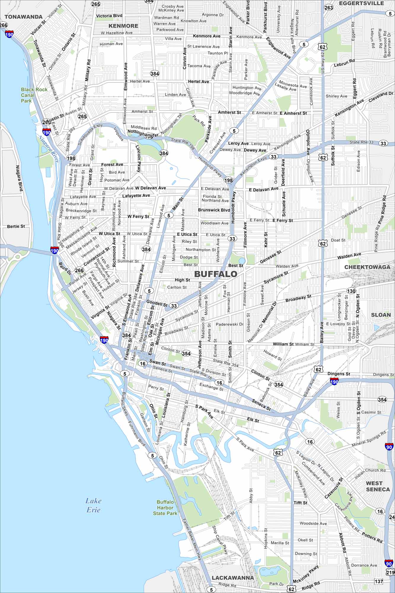
Buffalo sits on Lake Erie at the head of the Niagara River. Our map shows the waterfront, highways/streets, and green parkways. Buffalo is home to the Bills and Sabres. It’s also nicknamed the “Queen City”.
Map Information
On the Map
Interstates/Highways: I-190, I-90, US Hwy 62, State Rte 5, State Rte 33, State Rte 198, State Rte 354, State Rte 266 Major Roads: Main St, Delaware Ave, Broadway, Genesee St, Kensington Ave, Seneca St, Abbott Rd, Clinton St, William St, Fillmore Ave, Elmwood Ave, Richmond Ave, Bailey Ave, South Park Ave, Jefferson Ave, Michigan Ave, Niagara St, Military Rd, Hertel Ave, Amherst St Lakes and Reservoirs: Lake Erie Major Rivers: Niagara River Parks and Preserves: Buffalo Harbor State Park, Black Rock Canal Park Nearby Communities: Tonawanda, Kenmore, Eggertsville, Cheektowaga, Sloan, West Seneca, LackawannaNew York State Maps
Find state maps of the Empire State.


City Maps of New York
Here are the city maps that define New York


