Map of Bullhead City, Arizona
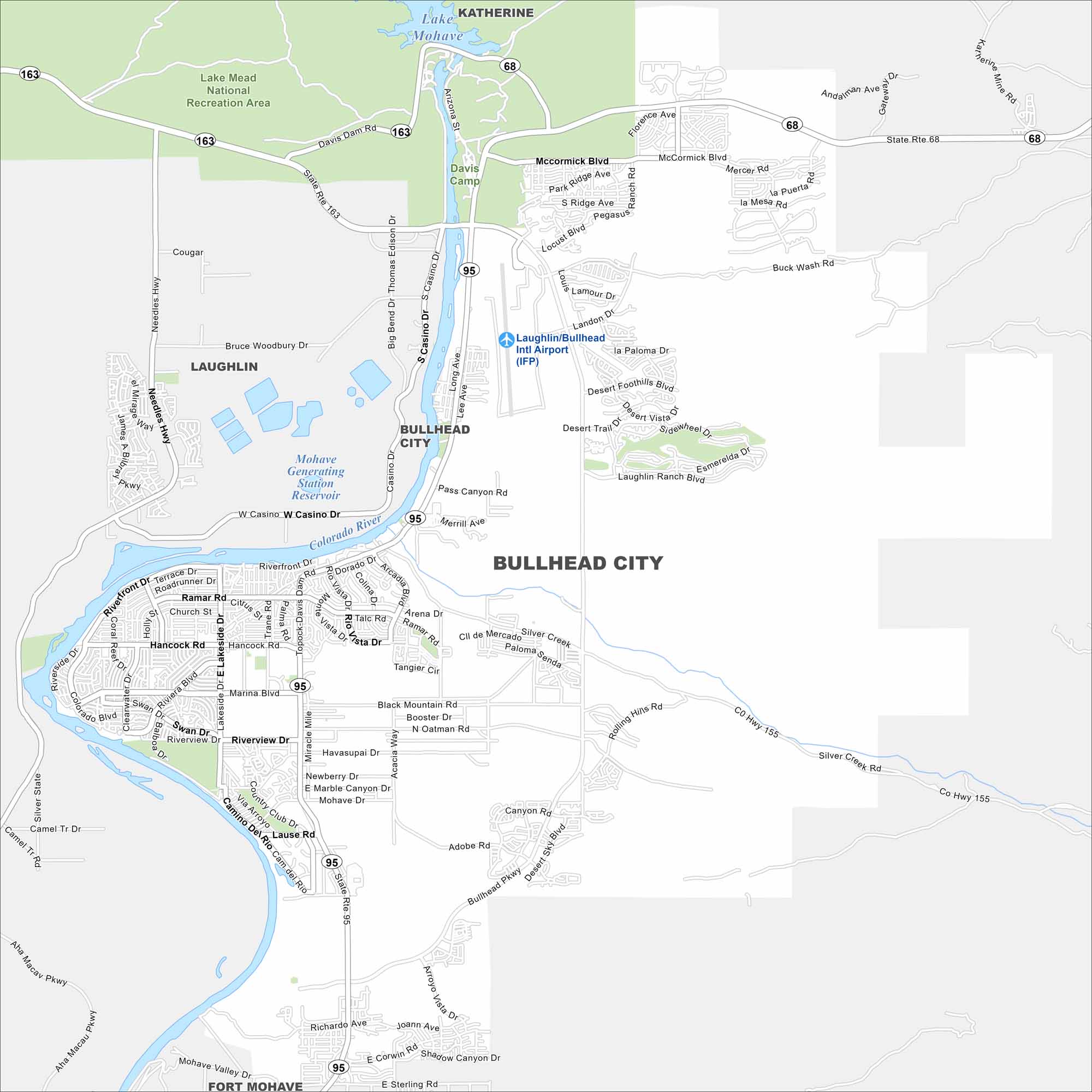
Our map of Bullhead City highlights its position on the Colorado River. Roads follows the riverbanks across from Laughlin, Nevada. The city thrives due to its great access to water and recreation.
Arizona State Maps
Check out our Arizona state maps we’ve put together


Map Information
On the Map
Interstates/Highways: State Rte 95, State Rte 68, State Rte 163, US Hwy 95 Major Roads: Bullhead Pkwy, McCormick Blvd, Hancock Rd, Riverview Dr, Silver Creek Rd, Marina Blvd, Ramar Rd, Landon Dr, Desert Foothills Blvd, Laughlin Ranch Blvd, Coria Dr, Miracle Mile, Lakeside Dr, Riverfront Dr, Casina Dr, Big Bend Dr, Thomas Edison Dr, Bruce Woodbury Dr, Needles Hwy, Mohave Valley Dr Airports: Laughlin/Bullhead Intl Airport (IFP) Lakes and Reservoirs: Lake Mohave, Mohave Generating Station Reservoir Rivers and Creeks: Colorado River Parks/Preserves/Forests: Lake Mead National Recreation Area, Davis Camp Nearby Communities: Laughlin, Fort Mohave, KatherineArizona City Maps
Here’s our full batch of Arizona city maps


