Map of Burlington, North Carolina
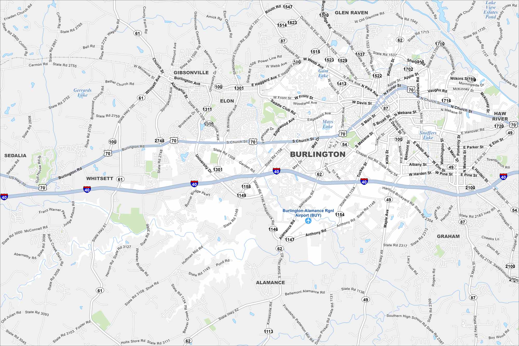
Burlington is between Greensboro and Durham in central North Carolina. Our map highlights its streets, rail lines, and nearby lakes. It’s often linked to textiles because of its long industrial history.
Map Information
On the Map
Interstates/Highways: I-40, US Hwy 70, State Rte 49, State Rte 54, State Rte 61, State Rte 62, State Rte 87, State Rte 100 Major Roads: Church St, Alamance Rd, Front St, Main St, Webb Ave, Mebane St, University Dr, Huffman Mill Rd, Anthony Rd, Chapel Hill Rd, Harden Ave, Graham Hopedale Rd, Vaughn Rd, Williamson Ave, Springwood Ave, Manning Ave, Gibsonville Ossipee Rd, Shallowford Church Rd, Power Line Rd, Ossipee Rd Airports: Burlington-Alamance Rgnl Airport (BUY) Lakes and Reservoirs: Gerrards Lake, Mays Lake, Snofers Lake, Lake View Estates Pond Nearby Communities: Graham, Elon, Gibsonville, Whitsett, Sedalia, Glen Raven, Alamance, Haw RiverNorth Carolina State Maps
Get to know the mountains and coastlines of North Carolina.


City Maps of North Carolina
Journey through North Carolina with our city maps


