Map of Cape Coral, Florida
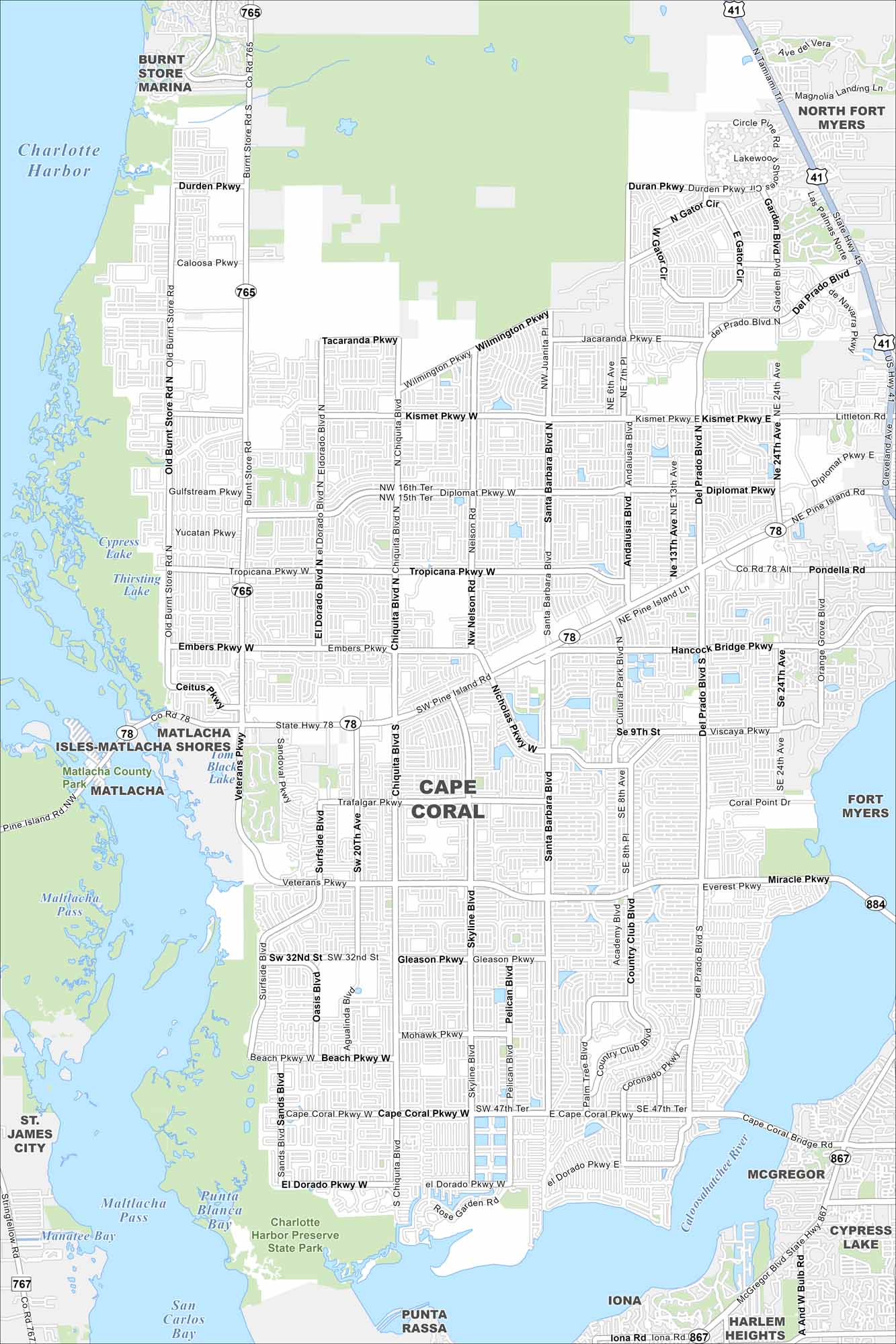
Explore Cape Coral with our map, where canals cut through nearly every neighborhood. The city is laid out on a grid but shaped by water. The waterways are truly unique with 400+ miles of canals.
Florida State Maps
Discover Florida through our state maps


Map Information
On the Map
Interstates/Highways: US Hwy 41, State Rte 78, State Rte 765, State Rte 767, State Rte 867, State Rte 884 Major Roads: Veterans Pkwy, Cape Coral Pkwy W, Cape Coral Pkwy E, Pine Island Rd, Hancock Bridge Pkwy, Santa Barbara Blvd, Del Prado Blvd S, Del Prado Blvd N, Chiquita Blvd S, Chiquita Blvd N, Skyline Blvd, Nelson Rd, Sands Blvd, Surfside Blvd, Oasis Blvd, Country Club Blvd, Coronado Pkwy, Kismet Pkwy W, Kismet Pkwy E, Diplomat Pkwy Lakes and Reservoirs: Charlotte Harbor, Matlacha Pass, San Carlos Bay, Punta Blanca Bay, Thirsting Lake, Cypress Lake, Tom Black Lake, Sandoval Lake Major Rivers: Caloosahatchee River Parks and Preserves: Charlotte Harbor Preserve State Park, Matlacha County Park, Sirenia Vista Park Nearby Communities: Matlacha, Isles-Matlacha Shores, Fort Myers, North Fort Myers, McGregor, Iona, Punta Rassa, Harlem Heights, St. James City, Burnt Store MarinaFlorida City Maps
Chart your course through Miami and Florida’s cities


