Map of Wellington, Florida
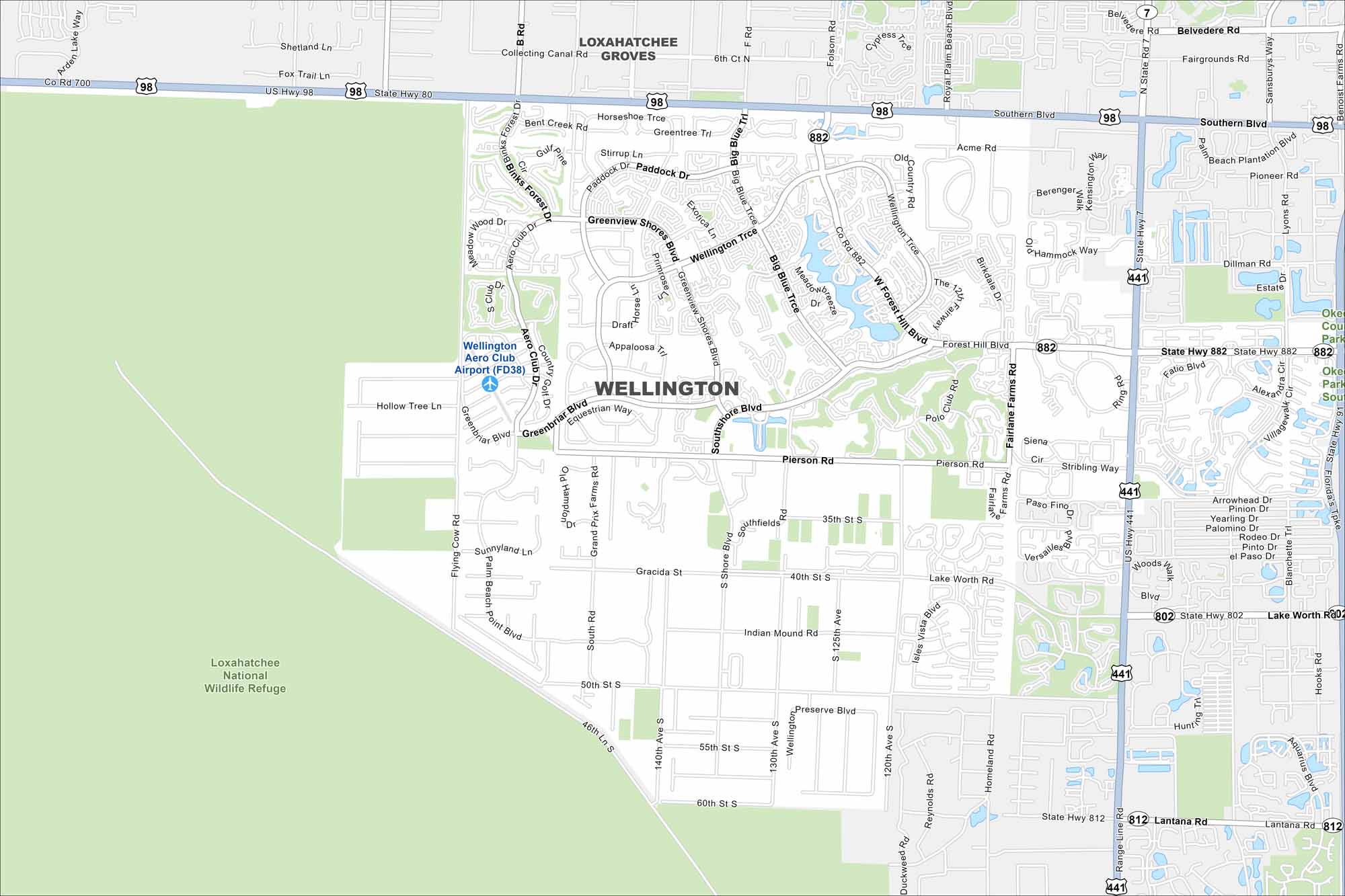
We’ve mapped out every major road in Wellington. The city is famous for equestrian events, sprawling neighborhoods, and lush green spaces. It actually sits next to the Loxahatchee National Wildlife Refuge.
Florida State Maps
Discover Florida through our state maps


Map Information
On the Map
Interstates/Highways: US Hwy 98, US Hwy 441, State Hwy 7, State Hwy 80, State Hwy 802, State Hwy 882, State Hwy 812 Major Roads: Southern Blvd, Lake Worth Rd, Forest Hill Blvd, Pierson Rd, Lantana Rd, Wellington Trce, Greenview Shores Blvd, Binks Forest Dr, Aero Club Dr, Southshore Blvd, Lyons Rd, Sansburys Way, Benoist Farms Rd, Pike Rd, Fairlane Farms Rd, Stribling Way, Fortune Way, Acme Rd, Belvedere Rd, Big Blue Trce Airports: Wellington Aero Club Airport (FD38) Parks and Preserves: Loxahatchee National Wildlife Refuge, Okeeheelee Park South Nearby Communities: Loxahatchee Groves, Royal Palm BeachFlorida City Maps
Chart your course through Miami and Florida’s cities


