Map of Casa Grande, Arizona
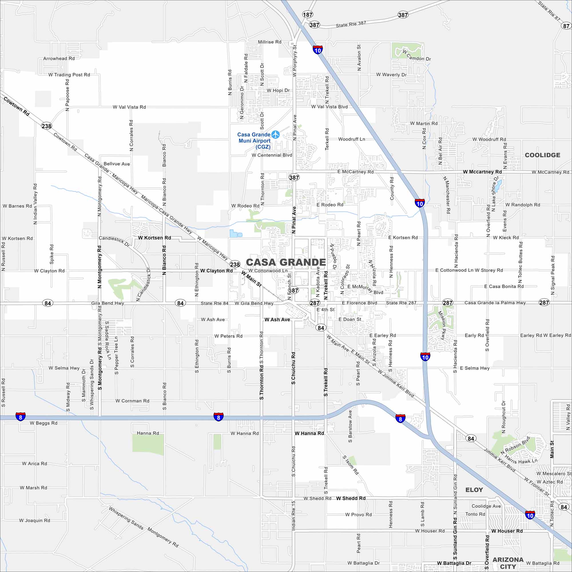
Our map of Casa Grande shows a desert city between Phoenix and Tucson. The city spreads across flat desert with mountain views in the distance. It’s especially known for the historic Casa Grande Ruins.
Arizona State Maps
Check out our Arizona state maps we’ve put together


Map Information
On the Map
Interstates/Highways: I-10, I-8, State Rte 84 (Gila Bend Hwy), State Rte 287 (Florence Blvd), State Rte 387, State Rte 187, Maricopa-Casa Grande Hwy (SR-238) Major Roads: Pinal Ave, McCartney Rd, Kortsen Rd, Clayton Rd, Main St, Cottonwood Ln, Jimmie Kerr Blvd, Hanna Rd, Shedd Rd, Chuichu Rd, Thornton Rd, Montgomery Rd, Bianco Rd, Trekell Rd, Peart Rd, Henness Rd, Hacienda Rd, Overfield Rd, Toltec Rd, Sunland Gin Rd Airports: Casa Grande Muni Airport (CGZ) Nearby Communities: Coolidge, Eloy, Arizona CityArizona City Maps
Here’s our full batch of Arizona city maps


