Map of Clearwater, Florida
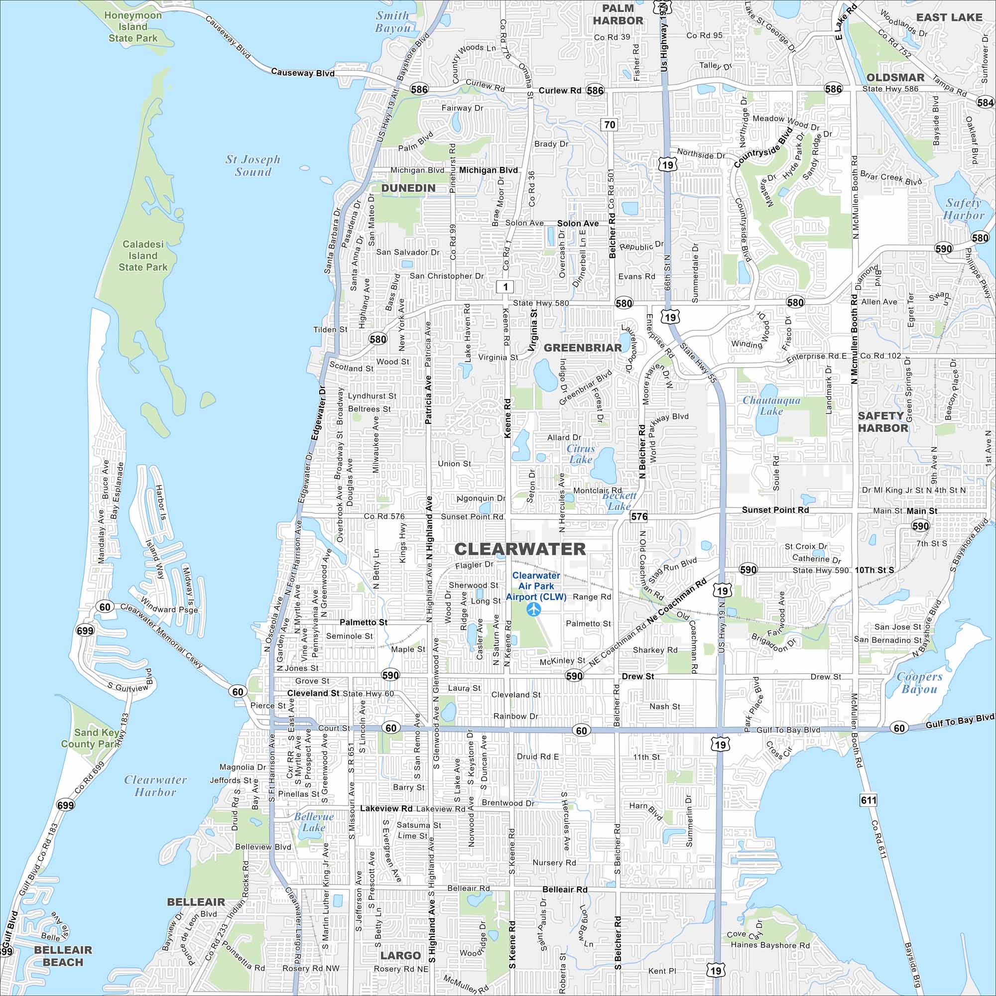
Our map of Clearwater shows streets, highways, and coastal routes. The city is known for its Gulf beaches and barrier islands. Situated west of Tampa, the Intracoastal Waterway divides the shoreline.
Florida State Maps
Discover Florida through our state maps


Map Information
On the Map
Interstates/Highways: US Hwy 19, State Rte 60, State Rte 576, State Rte 580, State Rte 584, State Rte 586, State Rte 590, State Rte 611, State Rte 699 Major Roads: Gulf to Bay Blvd, Courtenay Pkwy, Drew St, Cleveland St, Lakeview Rd, Belleair Rd, Rosery Rd NW, Main St, Curlew Rd, Causeway Blvd, Belcher Rd, Keene Rd, Hercules Ave, Highland Ave N, Highland Ave S, Missouri Ave, Ft Harrison Ave, Myrtle Ave, Greenwood Ave, Douglas Ave Airports: Clearwater Air Park Airport (CLW) Lakes and Reservoirs: Clearwater Harbor, St Joseph Sound, Safety Harbor, Old Tampa Bay, Chautauqua Lake, Smith Bayou, Beckett Lake, Bellevue Lake, Coopers Bayou Parks and Preserves: Honeymoon Island State Park, Caladesi Island State Park, Sand Key County Park Nearby Communities: Dunedin, Largo, Belleair, Belleair Beach, Safety Harbor, Palm Harbor, Oldsmar, East Lake, GreenbriarFlorida City Maps
Chart your course through Miami and Florida’s cities


