Map of Concord, North Carolina
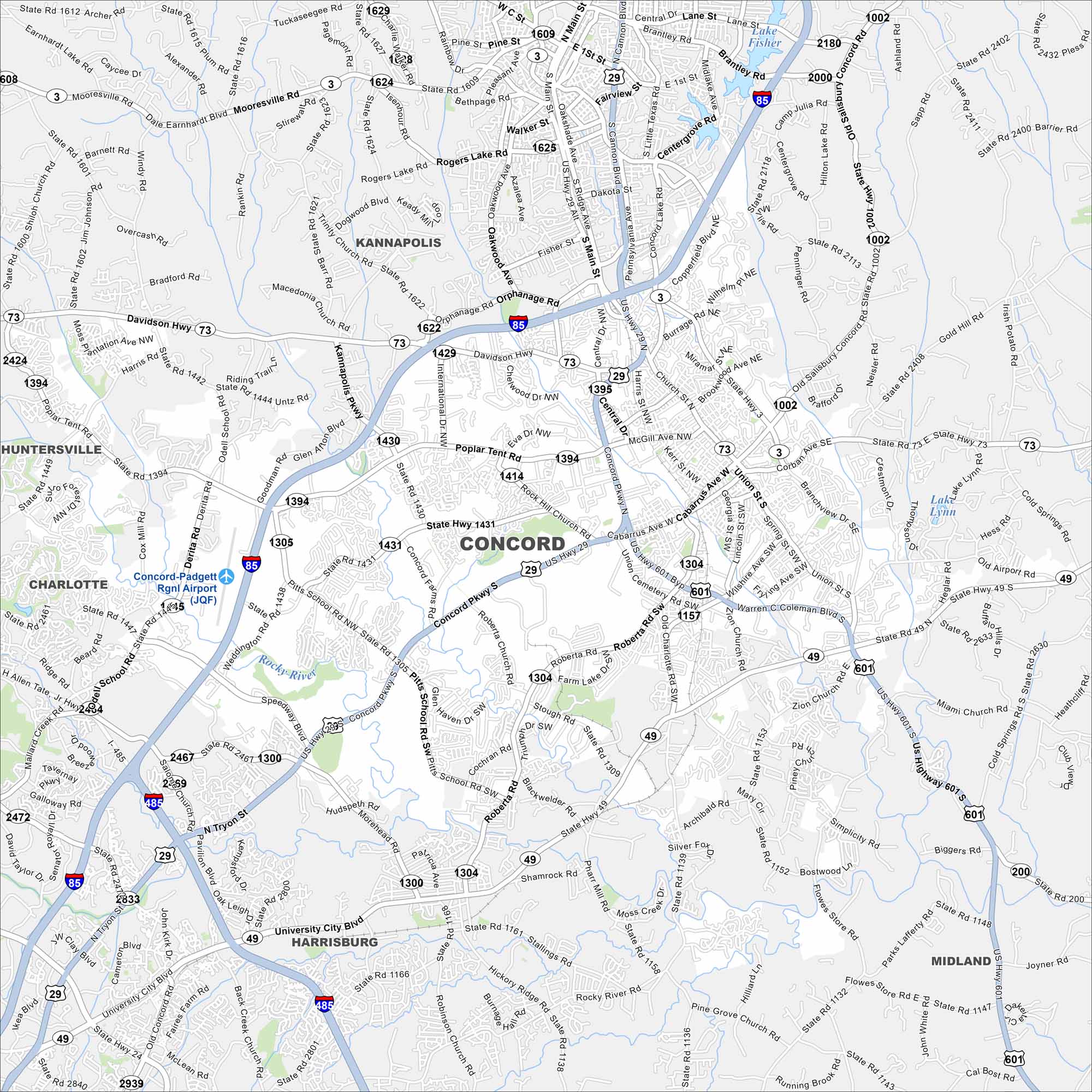
Our map of Concord shows streets, highways, and nearby green space. Located northeast of Charlotte, the city is home to Charlotte Motor Speedway. It lies in the rolling Piedmont region.
Map Information
On the Map
Interstates/Highways: I-85, I-485, US Hwy 29, US Hwy 601, State Rte 73, State Rte 49, State Rte 3, State Rte 24, Davidson Hwy Major Roads: Concord Pkwy, Warren Coleman Blvd, Union St, Cabarrus Ave, Church St, Poplar Tent Rd, Weddington Rd, Pitts School Rd, George Liles Pkwy, Roberta Rd, Central Ave, Branchview Dr, Main St, University City Blvd, Harris Blvd, Copperfield Blvd, Derita Rd, Odell School Rd, Zion Church Rd Airports: Concord-Padgett Rgnl Airport Lakes and Reservoirs: Lake Fisher, Lake Lynn Major Rivers: Rocky River Nearby Communities: Kannapolis, Harrisburg, Midland, Charlotte, HuntersvilleNorth Carolina State Maps
Get to know the mountains and coastlines of North Carolina.


City Maps of North Carolina
Journey through North Carolina with our city maps


