Map of Coral Gables, Florida
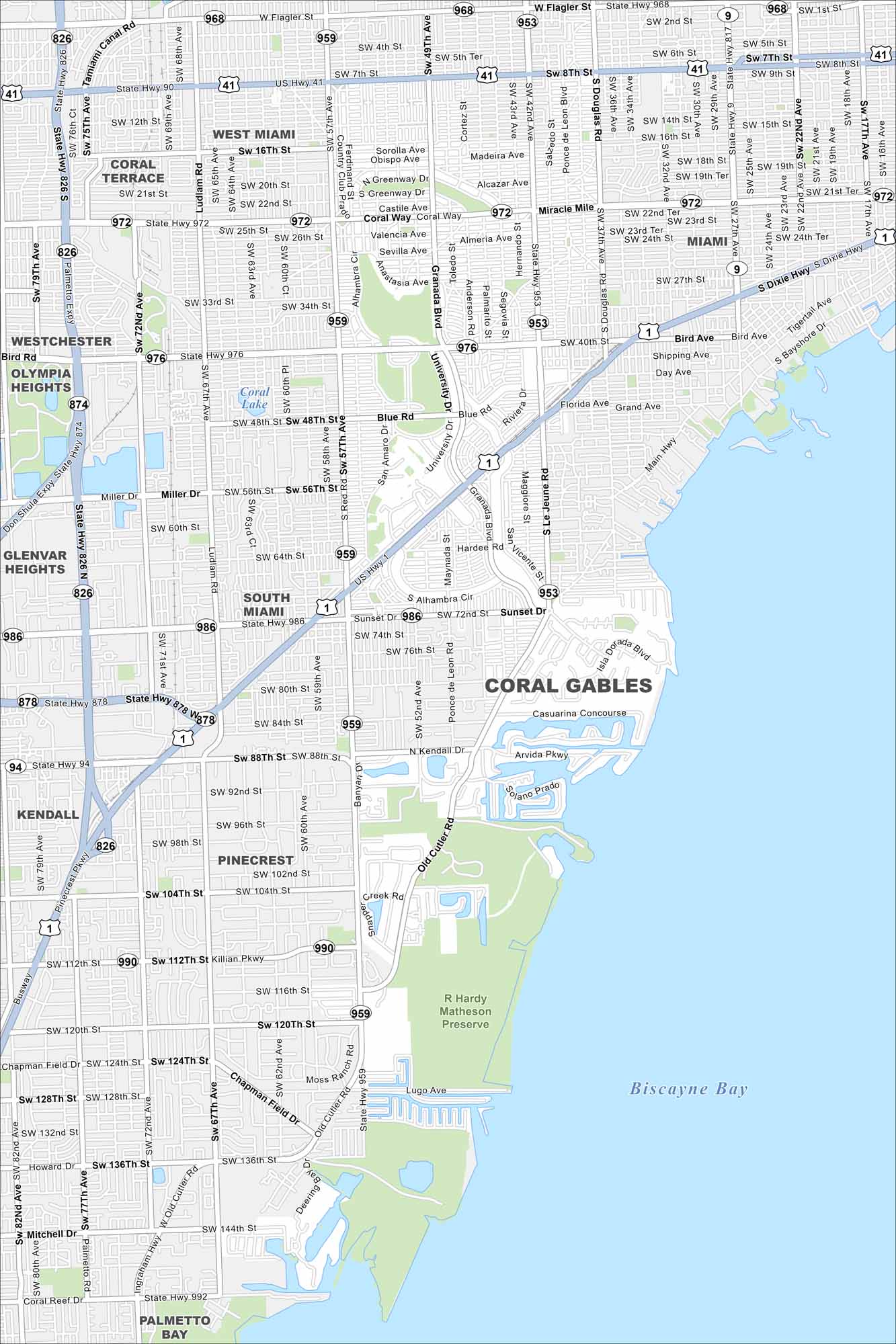
Coral Gables appears with its streets, waterways, and boulevards. Nicknamed “The City Beautiful”, it sits just southwest of Miami. You’ll find it next to Biscayne Bay to the right.
Florida State Maps
Discover Florida through our state maps


Map Information
On the Map
Interstates/Highways: US Hwy 1, State Rte 9, State Rte 826, State Rte 874, State Rte 878, State Rte 953, State Rte 959, State Rte 968, State Rte 972, State Rte 976, State Rte 986, Dixie Hwy Major Roads: Bird Ave, Le Jeune Rd, Douglas Rd, Ponce de Leon Blvd, Old Cutler Rd, Miracle Mile, Coral Way, Bird Rd, Miller Dr, Sunset Dr, N Kendall Dr, Killian Pkwy, Chapman Field Dr, Red Rd, Ludlam Rd, Galloway Rd, Flagler St, SW 8th St, SW 24th St Lakes and Reservoirs: Biscayne Bay, Coral Lake Parks and Preserves: R Hardy Matheson Preserve Nearby Communities: Miami, West Miami, South Miami, Coral Terrace, Westchester, Olympia Heights, Glenvar Heights, Kendall, Pinecrest, Palmetto BayFlorida City Maps
Chart your course through Miami and Florida’s cities


