Map of Coral Springs, Florida
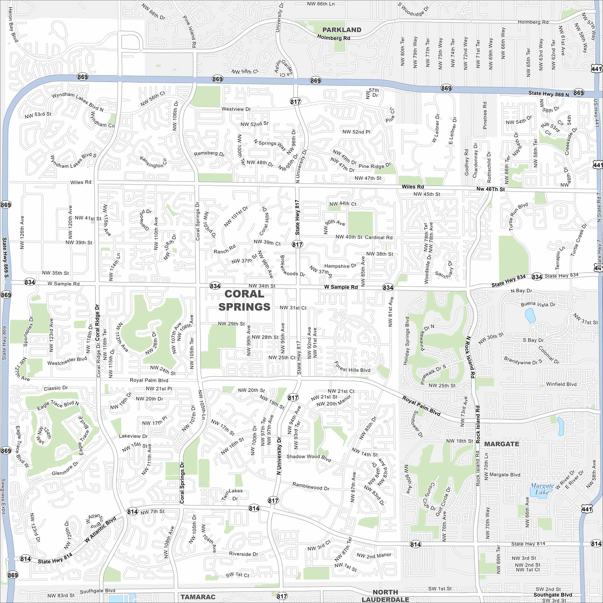
Our map of Coral Springs shows its roads, highways, and canals. Planned with wide boulevards and parks, the city is part of Broward County. The Everglades stretch out just to the west.
Florida State Maps
Discover Florida through our state maps


Map Information
On the Map
Interstates/Highways: State Hwy 869, Sawgrass Expy Major Roads: University Dr, Sample Rd, Wiles Rd, Coral Springs Dr, Royal Palm Blvd, Atlantic Blvd, Riverside Dr, Ramblewood Dr, Coral Ridge Dr, Lakeview Dr, Westview Dr, Pine Island Rd Lakes and Reservoirs: Lake Margate Nearby Communities: Parkland, Margate, Tamarac, North LauderdaleFlorida City Maps
Chart your course through Miami and Florida’s cities


