Map of Cortland, New York
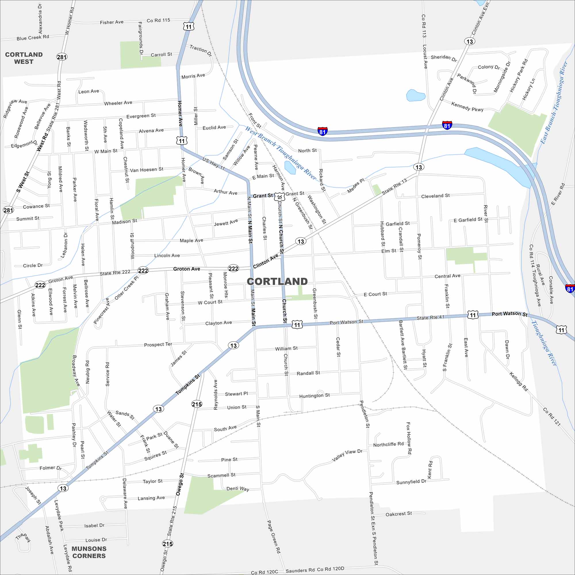
Cortland is sandwiched between Syracuse and Binghamton in the state of New York. It’s nicknamed the “Crown City” because it sits on a plateau. Our map includes its roads, highways, and waterways.
Map Information
On the Map
Interstates/Highways: I-81, US Hwy 11, State Rte 13, State Rte 281, State Rte 222, State Rte 41, State Rte 215 Major Roads: Main St, Church St, Clinton Ave, Tompkins St, Port Watson St, Groton Ave, Homer Ave, Owego St, Pendelton St, West Main St, Grant St, Madison St, Central Ave, River St, Court St, William St, Randall St, Huntington St, South Ave, Pine St Major Rivers: West Branch Tioughnioga River, East Branch Tioughnioga River, Tioughnioga River Nearby Communities: Cortland West, Munsons CornersNew York State Maps
Find state maps of the Empire State.


City Maps of New York
Here are the city maps that define New York


