Map of Cottonwood, Arizona
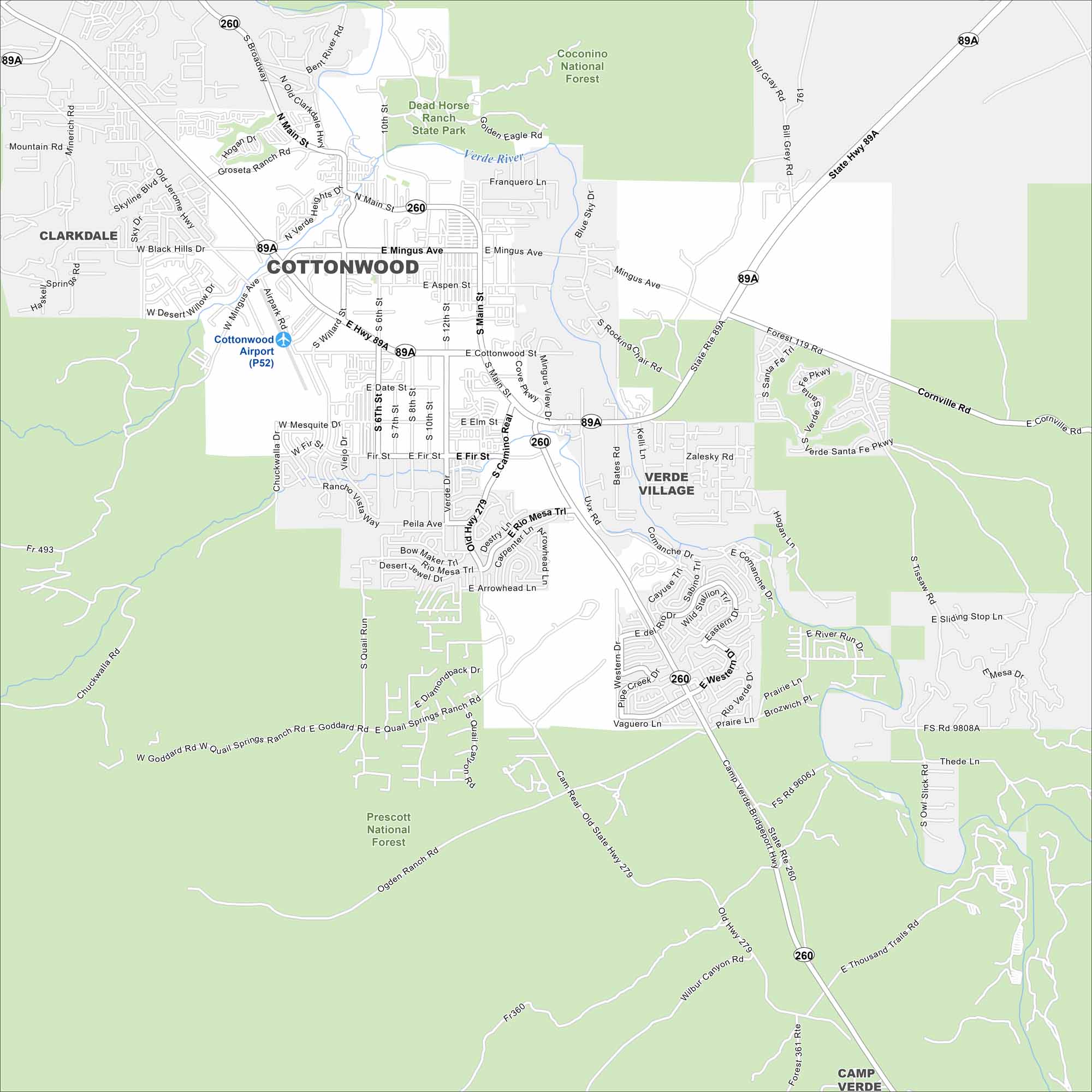
Our map of Cottonwood displays local streets, highways, and airport. Set in the Verde Valley, the city is surrounded by red rock views. The Verde River is the main watercourse here.
Arizona State Maps
Check out our Arizona state maps we’ve put together


Map Information
On the Map
Interstates/Highways: State Hwy 89A, State Rte 260, State Rte 279 (Old Hwy 279), Camp Verde-Bridgeport Hwy Major Roads: Main St, Mingus Ave, Cottonwood St, Willard St, 6th St, 10th St, 12th St, Airpark Rd, Camino Real, Cornville Rd, Zalesky Rd, Western Dr, Eastern Dr, Quail Springs Ranch Rd, Goddard Rd, Chuckwalla Rd, Skyline Blvd, Black Hills Dr, Old Jerome Hwy, Bent River Rd Airports: Cottonwood Airport (P52) Rivers and Creeks: Verde River Parks/Preserves/Forests: Coconino National Forest, Prescott National Forest, Dead Horse Ranch State Park Nearby Communities: Clarkdale, Verde Village, Camp Verde, CornvilleArizona City Maps
Here’s our full batch of Arizona city maps


