Map of Dade City, Florida
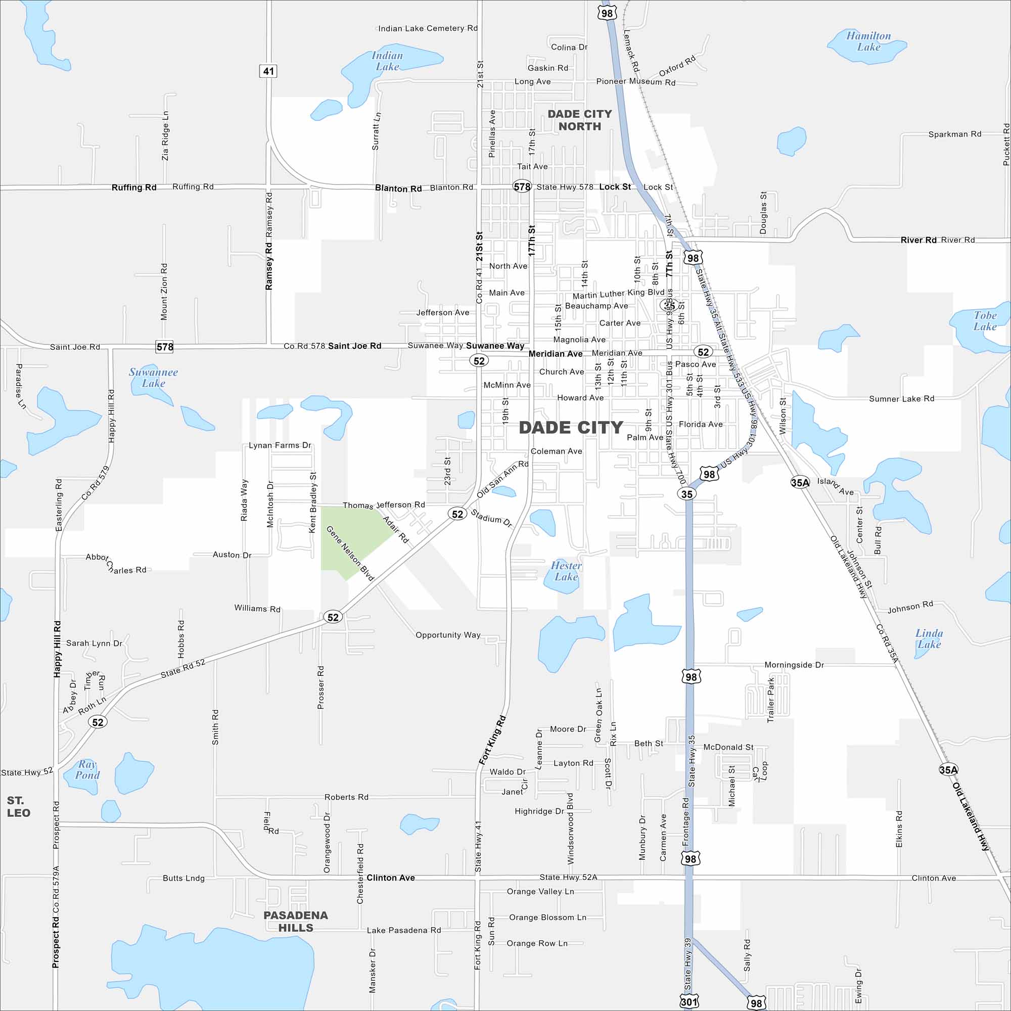
Check out Dade City with its mapped roads, highways, and rolling hills. Situated northeast of Tampa, it’s known for its historic downtown. Orange groves spread through the surrounding countryside.
Florida State Maps
Discover Florida through our state maps


Map Information
On the Map
Interstates/Highways: US Hwy 98, US Hwy 301, State Hwy 52, State Hwy 578, State Hwy 35A, State Hwy 52A, State Hwy 39 Major Roads: Meridian Ave, Fort King Rd, Clinton Ave, Blanton Rd, Lock St, 21st St, 17th St, 10th St, 7th St, Main Ave, Church Ave, Howard Ave, Florida Ave, Palm Ave, Coleman Ave, Suwannee Way, Saint Joe Rd, Happy Hill Rd, Prospect Rd, Old Lakeland Hwy Lakes and Reservoirs: Hamilton Lake, Tobe Lake, Linda Lake, Sparkman Rd Lake, Hester Lake, Ray Pond, Suwannee Lake, Indian Lake Nearby Communities: Dade City North, Pasadena Hills, Saint LeoFlorida City Maps
Chart your course through Miami and Florida’s cities


