Map of Davie, Florida
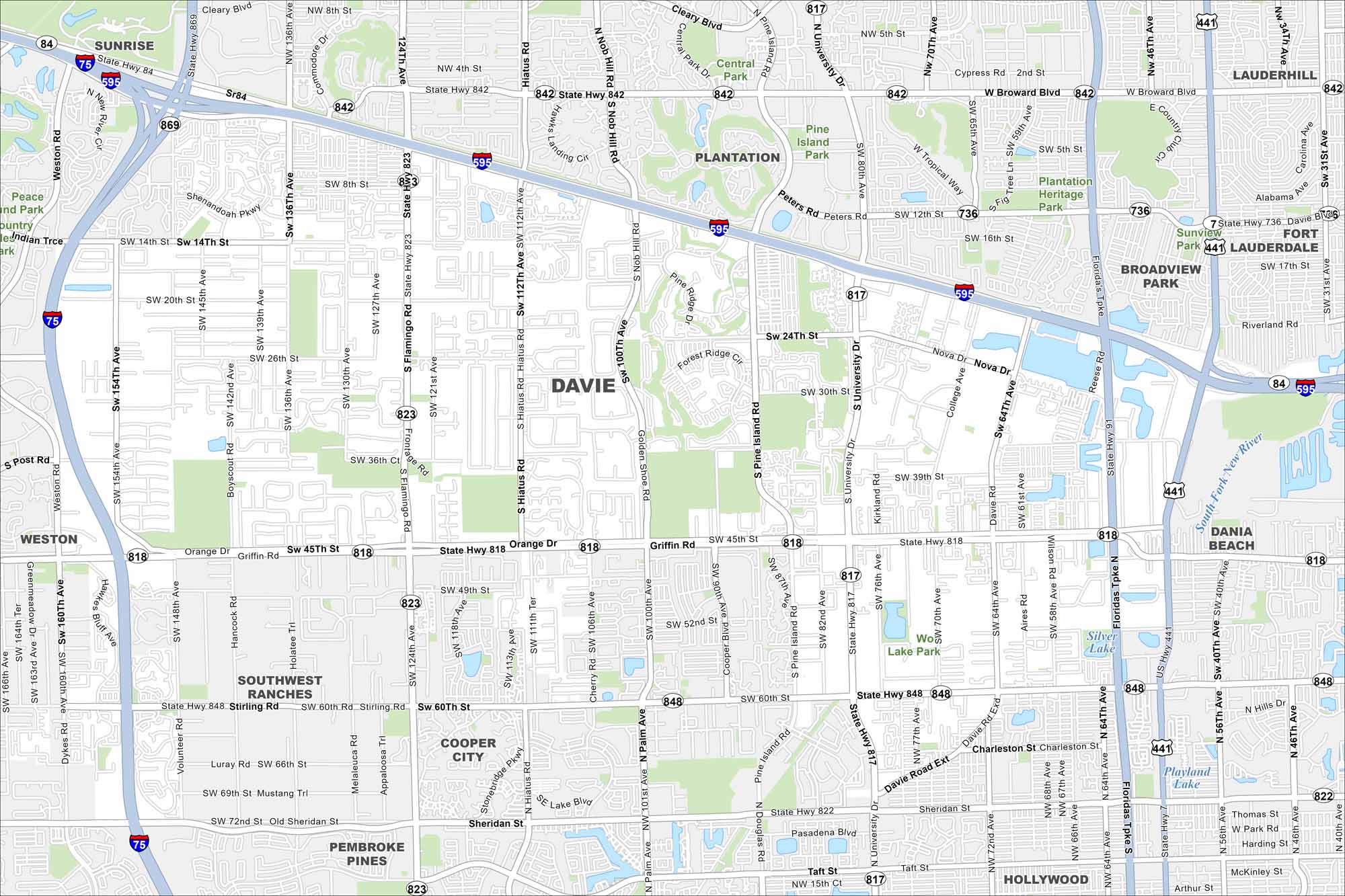
Our map of Davie highlights local roads, highways, and green space. It sits inland from Fort Lauderdale with the Everglades spread out to the west. The area is known for its equestrian trails.
Florida State Maps
Discover Florida through our state maps


Map Information
On the Map
Interstates/Highways: I-75, I-595, State Hwy 869, State Hwy 842, State Hwy 84, State Hwy 818, State Hwy 848, State Hwy 822, State Hwy 823, State Hwy 817 Major Roads: University Dr, Flamingo Rd, Griffin Rd, Stirling Rd, Pine Island Rd, Hiatus Rd, Nob Hill Rd, Weston Rd, Broward Blvd, Peters Rd, Nova Dr, Davie Rd, College Ave, SW 136th Ave, SW 100th Ave, Orange Dr, Sheridan St, Southview Blvd Lakes and Reservoirs: Playland Lake Major Rivers: South Fork New River Parks and Preserves: Plantation Heritage Park, Sunview Park, Central Park, Pine Island Park Nearby Communities: Sunrise, Plantation, Fort Lauderdale, Cooper City, Southwest Ranches, Weston, Pembroke Pines, Dania Beach, HollywoodFlorida City Maps
Chart your course through Miami and Florida’s cities


