Map of DeLand, Florida
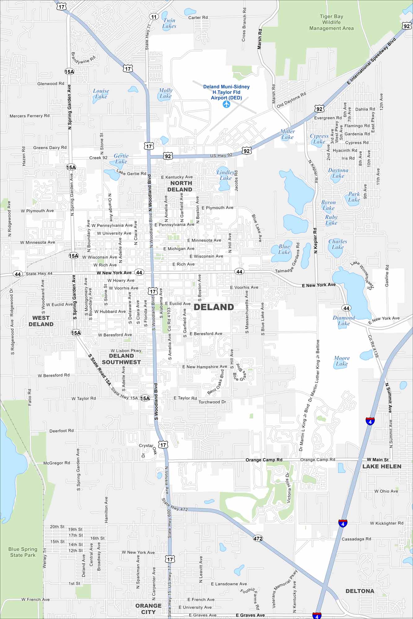
DeLand is mapped with its streets, highways, and surrounding lakes. It’s located between Orlando and Daytona Beach with a historic downtown. The city is nicknamed “The Athens of Florida”.
Florida State Maps
Discover Florida through our state maps


Map Information
On the Map
Interstates/Highways: US Hwy 92, US Hwy 17, State Rte 44, State Rte 15A, State Rte 11, State Rte 472 Major Roads: Woodland Blvd, New York Ave, Spring Garden Ave, Orange Camp Rd, Kepler Rd, International Speedway Blvd, Taylor Rd, Beresford Ave, Plymouth Ave, Minnesota Ave, Wisconsin Ave, Voorhis Ave, Euclid Ave, Michigan Ave, Rich Ave, University Ave, Pennsylvania Ave, French Ave, Kentucky Ave, Old Daytona Rd Airports: Deland Muni-Sidney H Taylor Fld Airport (DED) Lakes and Reservoirs: Miller Lake, Cypress Lake, Daytona Lake, Park Lake, Byron Lake, Ruby Lake, Charles Lake, Blue Lake, Diamond Lake, Moore Lake, Molly Lake, Louise Lake, Gertie Lake, Lake Gertie, Twin Lakes Parks and Preserves: Tiger Bay Wildlife Management Area, Blue Spring State Park Nearby Communities: North Deland, West Deland, Deland Southwest, Lake Helen, Orange City, DeltonaFlorida City Maps
Chart your course through Miami and Florida’s cities


