Map of Deltona, Florida
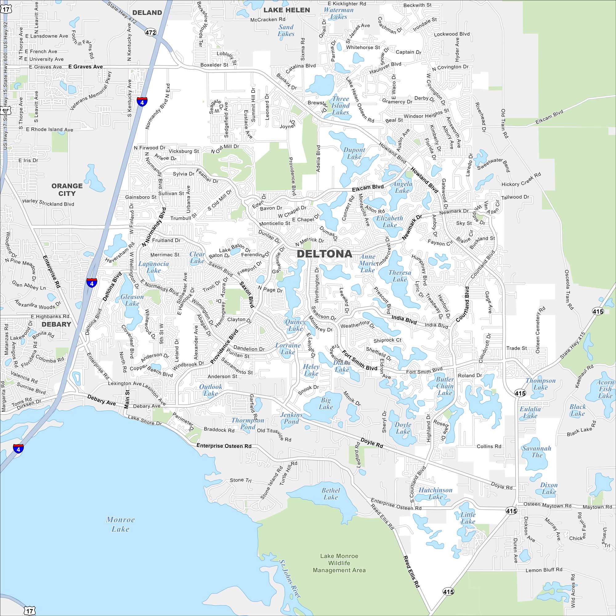
Deltona is set between Orlando and Daytona Beach. On the map, you’ll notice it’s covered with small lakes and spread-out suburban streets. Its location makes it a commuter hub in central Florida.
Florida State Maps
Discover Florida through our state maps


Map Information
On the Map
Interstates/Highways: I-4, US Hwy 17, State Rte 472, State Rte 415 Major Roads: Deltona Blvd, Howland Blvd, Enterprise Osteen Rd, Providence Blvd, Normandy Blvd, Saxon Blvd, Courtland Blvd, Fort Smith Blvd, Doyle Rd, Elkcam Blvd, Debary Ave, Eustace Ave, Tivoli Dr, Lakeshore Dr, Main St, New York Ave, Graves Ave, University Ave, French Ave, Lansdowne Ave Lakes and Reservoirs: Monroe Lake, Butler Chain Lake, Theresa Lake, Anne Marie Lake, Elizabeth Lake, Angela Lake, Dupont Lake, Three Island Lakes, Waterman Lakes, Sand Lakes, Clear Lake, Lapanocia Lake, Gleason Lake, Outlook Lake, Saxon Lake, Lorraine Lake, Quincy Lake, Heley Lake, Big Lake, Doyle Lake Parks and Preserves: Lake Monroe Wildlife Management Area Nearby Communities: Deland, Lake Helen, Orange City, DebaryFlorida City Maps
Chart your course through Miami and Florida’s cities


