Map of Detroit, Michigan
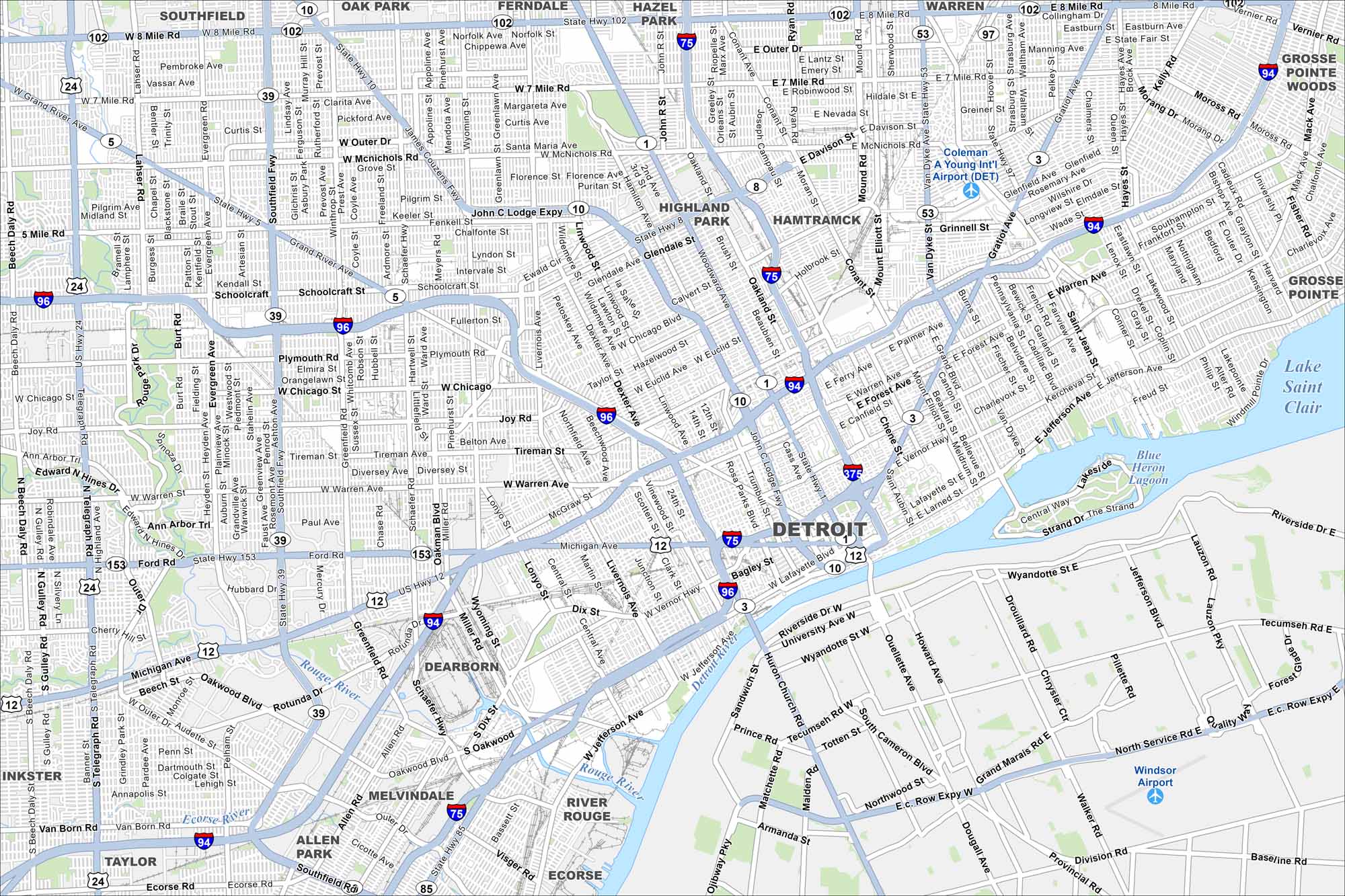
Detroit is located along the Detroit River on the border with Canada. Our map highlights its downtown grid, riverfront, and major roadways. It’s long known as the “Motor City”.
Map Information
On the Map
Interstates/Highways: I-75, I-94, I-96, I-275, I-375, I-696, US Hwy 10, US Hwy 12, State Rte 1, State Rte 3, State Rte 5, State Rte 8, State Rte 10, State Rte 14, State Rte 39, State Rte 53, State Rte 97, State Rte 102 Major Roads: Woodward Ave, Michigan Ave, Gratiot Ave, Grand River Ave, Jefferson Ave, Fort St, Eight Mile Rd, Seven Mile Rd, McNichols Rd, Southfield Fwy, Lodge Fwy, Chrysler Fwy, Fisher Fwy, Edsel Ford Fwy, Jeffries Fwy, Davison Fwy, Vernor Hwy, Warren Ave, Livernois Ave, Mack Ave Airports: Coleman A Young Int’l Airport (DET), Windsor Airport Lakes and Reservoirs: Lake Saint Clair, Blue Heron Lagoon Major Rivers: Detroit River, Rouge River Nearby Communities: Dearborn, Highland Park, Hamtramck, Grosse Pointe, Grosse Pointe Woods, River Rouge, Ecorse, Allen Park, Melvindale, Southfield, Oak Park, Ferndale, Hazel Park, Warren Neighborhoods: Downtown DetroitMichigan State Maps
Get to know Michigan with our detailed maps


City Maps of Michigan
Check out our maps of Detroit and other cities in Michigan


